

Hello friends,
Halloween has come and gone, which means the evening’s daylight has done the same. I try to think positively about the upcoming dark days. When long winter nights arrive, it’s the perfect time to get cozy with a book. It’s also a time for bonding with friends over potlucks, board games, movie nights, and craft parties. And my favorite, it’s the time to catch up on video games that you’ve set aside, such as Zelda: A Link Between Worlds.
Well, enough about Halloween and dark nights, let’s talk about hiking in Minnesota! In my last post, I finished off my road trip series; I wrote about Monterey, CA and hiking at Big Sur National Sea Shore. In this post, I’ll catch you up with some of the hiking I’ve done while back in Minnesota. The first of my hiking adventures was exploring Jay Cooke State Park with my friend Lisa!
 Jay Cooke State Park: Rugged River Trails and a Swinging Bridge
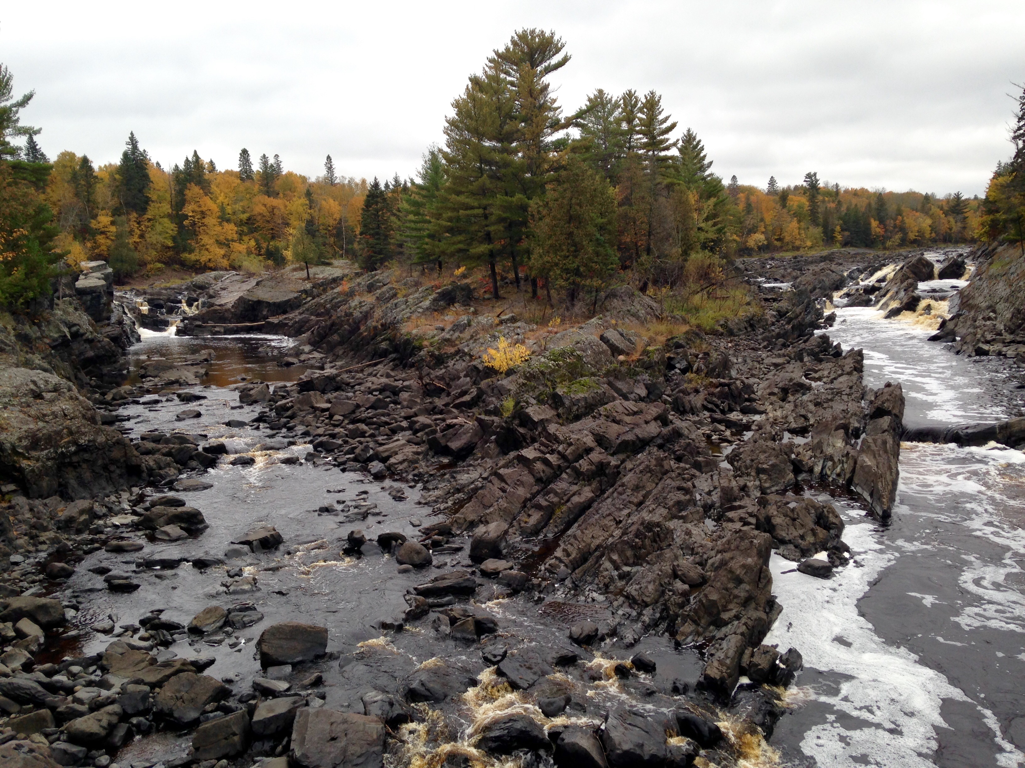
Two hours north of the Twin Cities and housing the official start of the Superior Hiking Trail (SHT) is Minnesota’s Jay Cooke State Park. The park is bisected by the roaring St. Louis River, which results in rugged river trails and north woods vibes. If you want to go to the Boundary Waters, but don’t have the time to take a long weekend, I’d recommend going to Jay Cooke. The trails are rugged and sometimes hard to follow, just like the trails I remember up north. Also, the thick mixed hardwood-confier forest is a welcome reminder that you can get a north woods feel only two hours away from the city.
After a two-hour drive, Lisa and I arrived at the visitor center. We retrieved a map and got great trail advice from a local park ranger. We told him we wanted to be on trail for the whole day, so he gave us a 6-7 mile loop trail to check out. From the visitor center, we headed towards the iconic swinging suspension bridge. The wind cradled us back and forth as we walked to the middle. From there, we peered down and got a good look of the glacially-etched rock formations below. Oddly enough, the large boulders and bedrock were slanted, at least by 45 degrees or higher. I’d never seen something like that before. It’s amazing how diverse the geology can be from state park to state park.
We crossed the bridge and I saw the familiar SHT symbol on a trail marker. I didn’t realize that we were on the SHT when we had first started walking. Knowing this made me smile as we walked along the wide dirt path. Soon enough though, our planned loop veered us right, off the SHT, towards the river. In my mind, I said “see you later,” because I knew I’d be back hopefully when doing a thru-hike.

We followed the trail till it took us down to the river itself. We went off trail and climbed up one of the large slanted slate boulders. It was tricky because it was slick and there weren’t many footholds. It was well worth it though, the view of the river was fantastic. (photo taken by Lisa)
As I mentioned before, Jay Cooke’s trails really reminded me of the national forest way up in Northern Minnesota. This is because there were century’s old white oak, the trail was rugged and sometimes a little dangerous, especially due to the muddy patches and scrambling rock sections, and there were no other people on the trail. Though we were not far from a town and a bustling road, when on trail we felt secluded and alone; now that was my favorite part.
We had learned from informational signs that there was a flood within the last 5 years, which resulted in closed off hiking trails and roads. I could see the destruction while we walked on the river’s edge. There was a definite line where the river had been flowing when the water was really high. There were uprooted trees, exposed roots, and uneven ground. It’s obvious to see that the park staff have been working hard to get the trails back to tip-top shape because there was fresh wood chip trails from time to time. It will be cool to come back to this section of the trail to see if instead of North Woods forest, maybe a floodplain forest will take root.

The trail took us inland (Photo taken by Lisa)
The serpentine River Trail (Carlton Trail) wound us inland and dropped us off in a birch forest. The leaves were at peak color, resulting in a yellow glow that engulfed our view of the sky. From above, we could appreciate the yellows, reds, and oranges of the falling leaves, while below we could appreciate the sounds of crunching leaf-liter and the feeling of ferns caressing our pant legs. It is these sounds and feelings that reaffirm my love for hiking. After about two hours, we reached the halfway point of our hike, which was a bridge that crossed Otter Creek. Before crossing, we climbed to the top of a slanted rock way up above the riverbed. From there we got a breathtaking view of the park.
On the North side of the St. Louis River, we followed a paved bike trail, wide ski trails, and even the side of the road at certain sections. Though the rest of the hike was less secluded, it still had some great things to offer. The Thomson Cemetery welcomed you with a century old hand drawn sign, there were patches of large white oak, which is always a treat to see (since almost all of the Minnesota white oak was cut down in the 1800’s), and there were river trails that hugged the river’s cliff edge. Our hike back to the visitor center was full of good conversation and laughter and was accompanied by stellar fall colors and the sound of the roaring river.
Overall, I really liked Jay Cooke State Park. I plan on coming back again and exploring all the different trail sections. And, hopefully, I’ll be back in Jay Cooke soon with my backpacking backpack, prepared to walk 296-miles through Minnesota’s diverse landscapes.
Till next time. Much love,
-Molly

Lisa saying goodbye to the St. Louis River

Hello friends,
In the Twin Cities, Fall is almost of its way out and winter is just around the corner. The sugar and silver maples are still holding onto their leaves, gifting Twin Citizens with their bright hues of yellow and red-orange. But, most other trees have lost their leaves and are preparing for this upcoming winter. As always, I have kept myself busy. I went to Jay Cooke State Park with a friend a couple weeks ago and just this last weekend I went camping at Great River Bluffs State park with a gaggle of friends. I’ll write blog posts about both trips in the next coming weeks. I’ve also been volunteering for BareBones Productions, which is a Halloween/Day of the Dead inspired puppet show. It’s one of my most favorite things to go to in the Twin Cities. Their first show is this Saturday October 24 starting at 7pm. There’s also shows starting at 7pm on October 25, 29th, 30th, and the 31st.
Well, for now, let me finish up my Road Trip Series and end it with a fun short film summarizing the whole thing.
Cannery Row
In my last post, I wrote about the Grand Canyon, Sedona, and camping in Sequoia National Forest. After that, my brother and I drove west toward Monterey, CA. Why Monterey? Well, when we first started out trip, Monterey Bay wasn’t on our radar. It wasn’t until we bumped into our father in Jackson, WY that we even considered it as a destination. He told us about Monterey and told us to try and fit it into our trip, since it is one of his favorite towns. The reasoning behind liking Monterey is because one of his favorite authors is John Steinbeck and Steinbeck spent a lot of time there. I have read a few of my dad’s favorite books, such as The Crow Road by Iain Banks and The Lives of a Cell by Lewis Thomas. One of his all time favorites is Cannery Row by John Steinbeck. He let me borrow his beat-up copy a few years back and I remember enjoying it immensely, I especially liked my dad’s notes which were found on every page. Cannery Row is set during the Great Depression and follows characters (who are probably real people Steinbeck met while living in Monterey back in the canning days) working and living on Cannery Row, a street lined with sardine canneries. It’s a really good read, I’d recommend checking it out.
Thanks to my father, we ended up spending three nights in Monterey, which ended up being the perfect place to unwind after two weeks of driving and camping across the southwest. On the first night, my brother and I explored Fishermen’s Wharf and ate clam chowder for dinner; yum.
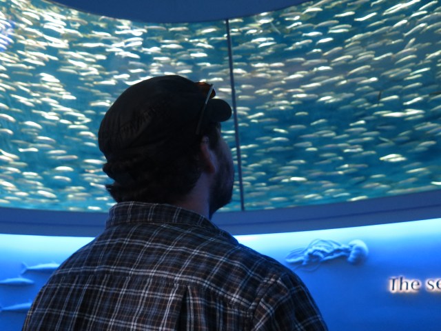
Watching the mackerel circle around an exhibit at the Monterey Bay Aquarium
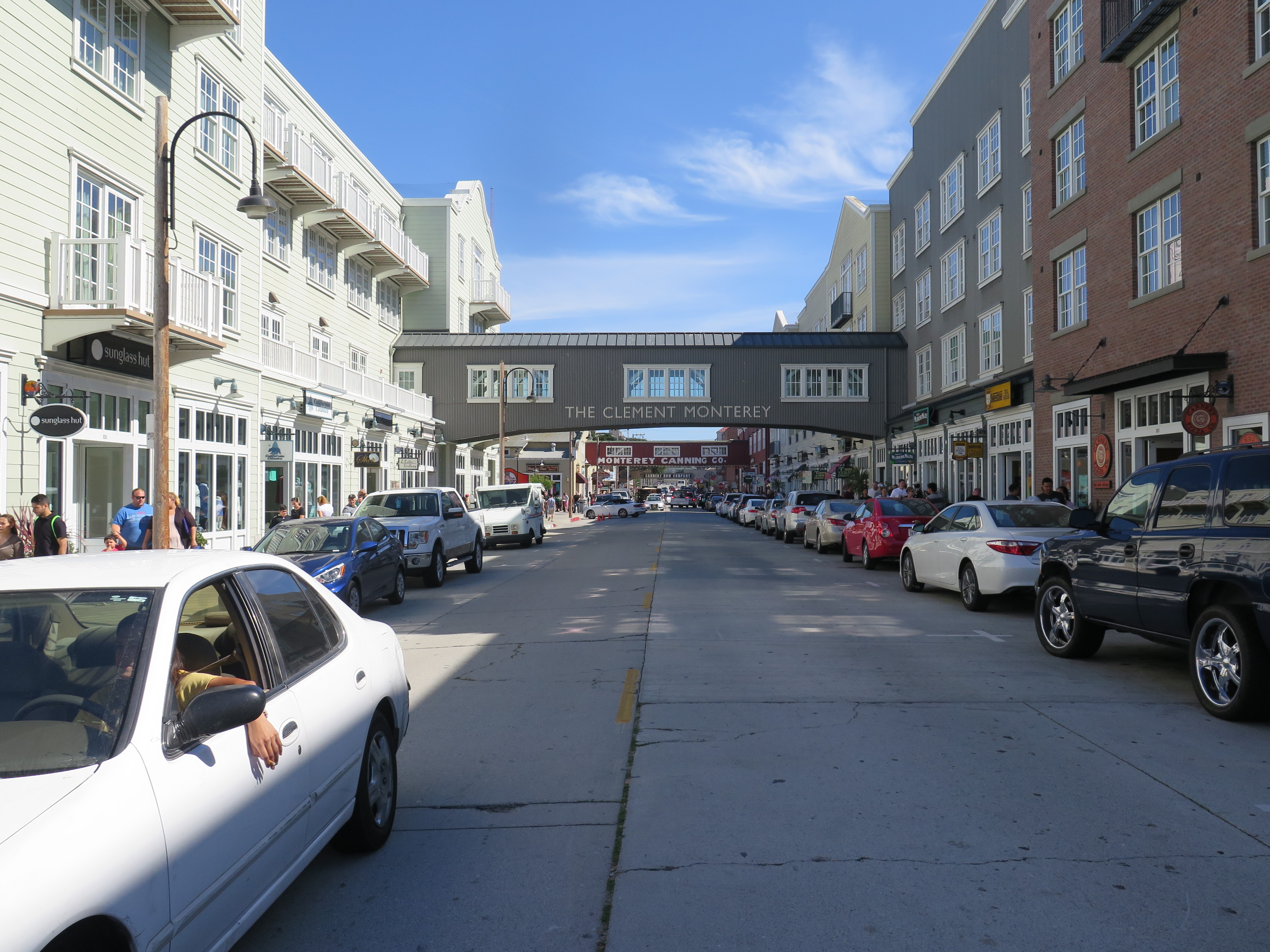
On Saturday, we relaxed in the morning and then walked along the famous Cannery Row. Though it has been rebuilt mostly for tourism, the road still has a nice charm. The road borders the bay and you can still see the old buildings that once housed canneries. If you squint your eyes, you can almost imagine what the road was like back in its heyday (let’s not forget that you also have to imagine the pungent smell of sardines). At the end of the road, is the world famous Monterey Bay Aquarium. Jamie and I had tried to be frugal while on our trip, so we decided to indulge by spending a day at the aquarium. I’m so glad we did because we saw some amazing exhibits.
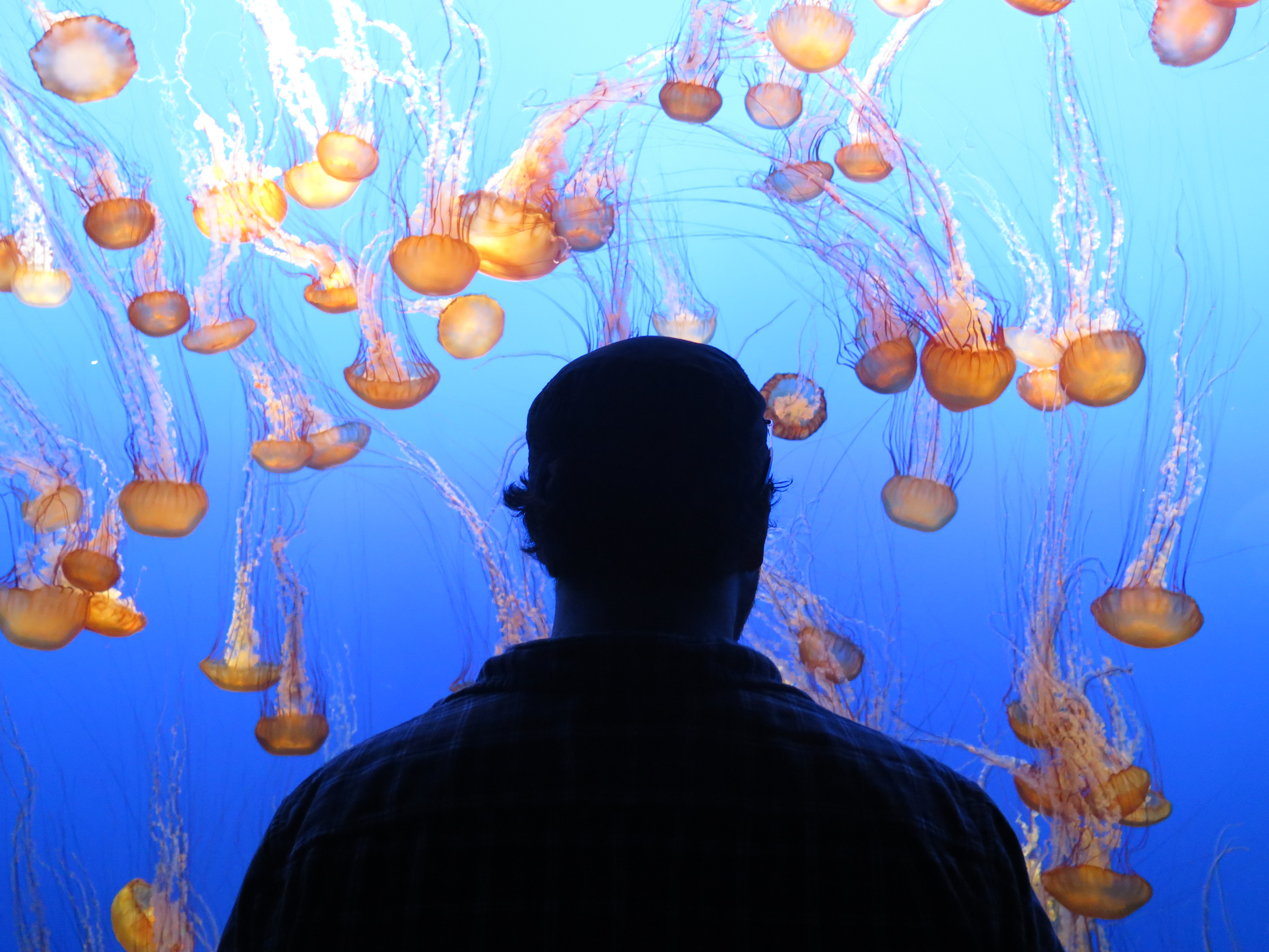 My brother watching the squid
My favorite was the squid and octopus room, though the bird exhibit was fun as well (the birds were all pre-identified, so I added a bunch onto my bird app! Nerdy, I know.) We spent most of the day walking from exhibit to exhibit and we enjoyed every second of it. In the evening, I met up with an old friend named Hanna Muegge. We met in middle school (right?) and became closer through taking the same A.P. classes and hanging out during Track and Field tournaments in high school. Even since I’ve known her, she’s always been an athlete. She was on varsity basketball, she even played for the German national basketball team, she got a few track and field high school records (which I believe haven’t been beat yet?), and now she is trying out Pro-Cycling. She’s a very talented and determined lady and I look forward to seeing where she goes next. Here’s her website and profile.
 Big Sur National Seashore
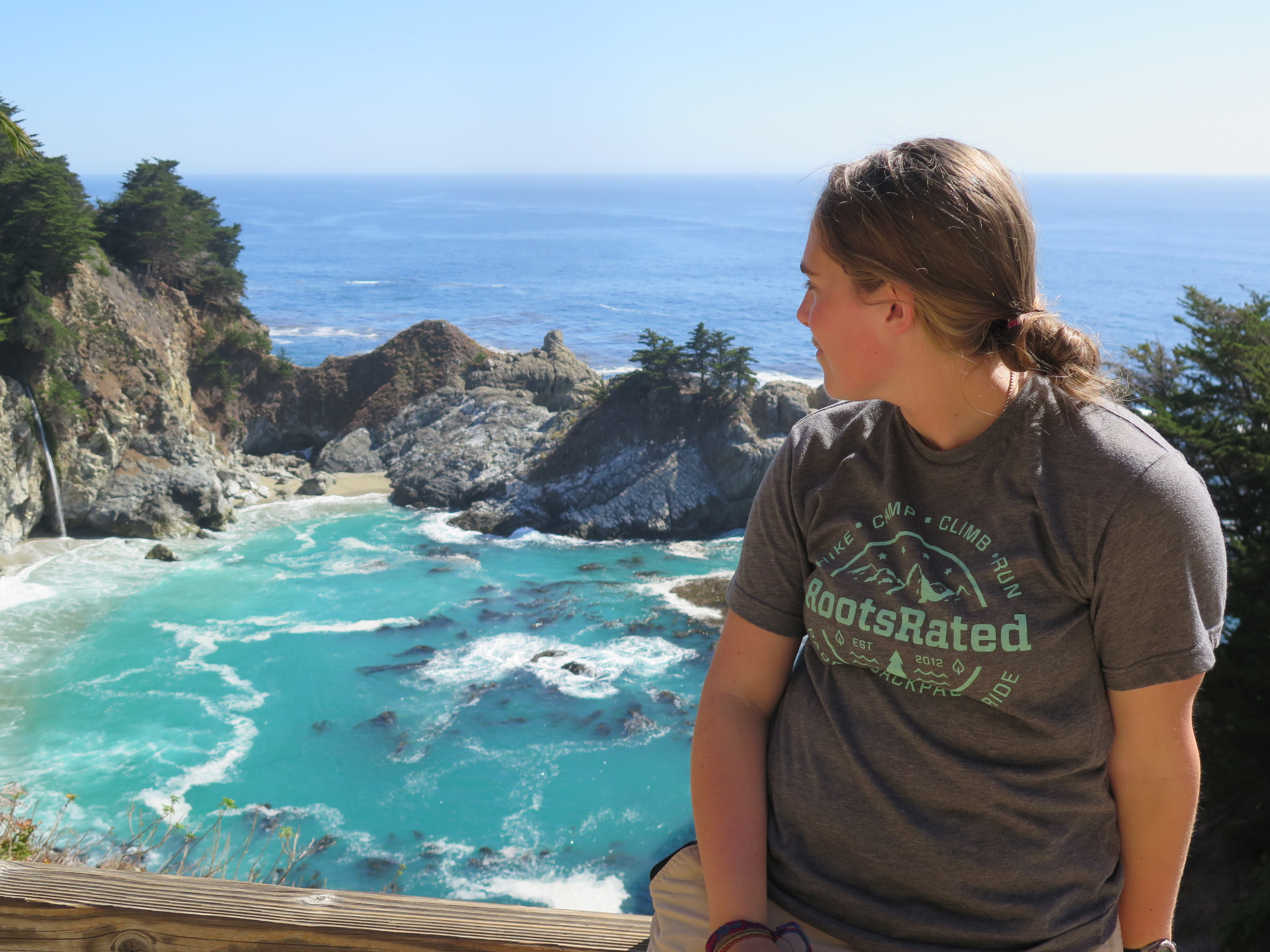
Jamie and I decided to spend our last full day of our road trip hiking at Big Sur National Seashore. We drove south for about an hour and found our way to Pfieffer Big Sur State Park. Jamie had never been on Highway 1, so I made sure to drive on the way down so he could completely enjoy the ride. We were fortunate to have great weather. We made it to the park and spent a few hours walking beneath towering coastal redwoods and hiking high up into the coastal mountain range. I totally understand why people love living in California. There’s only so few places where you can get perfect, sunny weather, while also being able to climb into some low elevation mountains and end the day at the beach. That’s what my brother and I did that day. Though I still love my good ole Minnesota, it’s hard to beat mountain to ocean hikes.
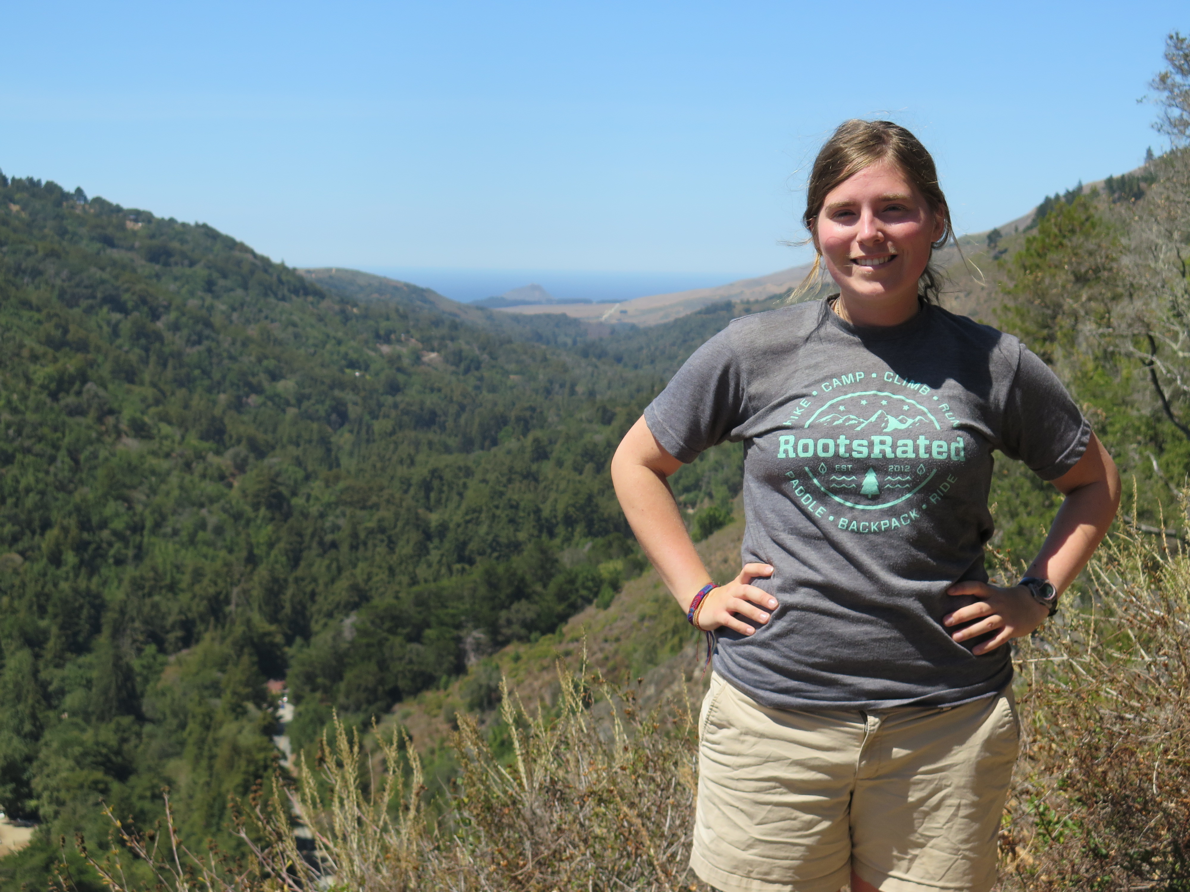 Me posing at the end of the trail at Pfieffer Big Sur State Park. We got some great views of the Pacific Coast.
After hiking at Pfieffer, we considered driving back to Monterey, but I decided to continue driving south for another short while, just to take advantage of the beautiful scenery. I mean, who knows when my brother or I will be back here, you know? Well, I’m glad we drove south because we found ourselves at a very tourist-heavy section on the road. There were tons of cars parked and people were all walking towards the same direction. Jamie and I looked at each other and thought that whatever is around here must be pretty cool, so we found a parking spot and joined the crowd.
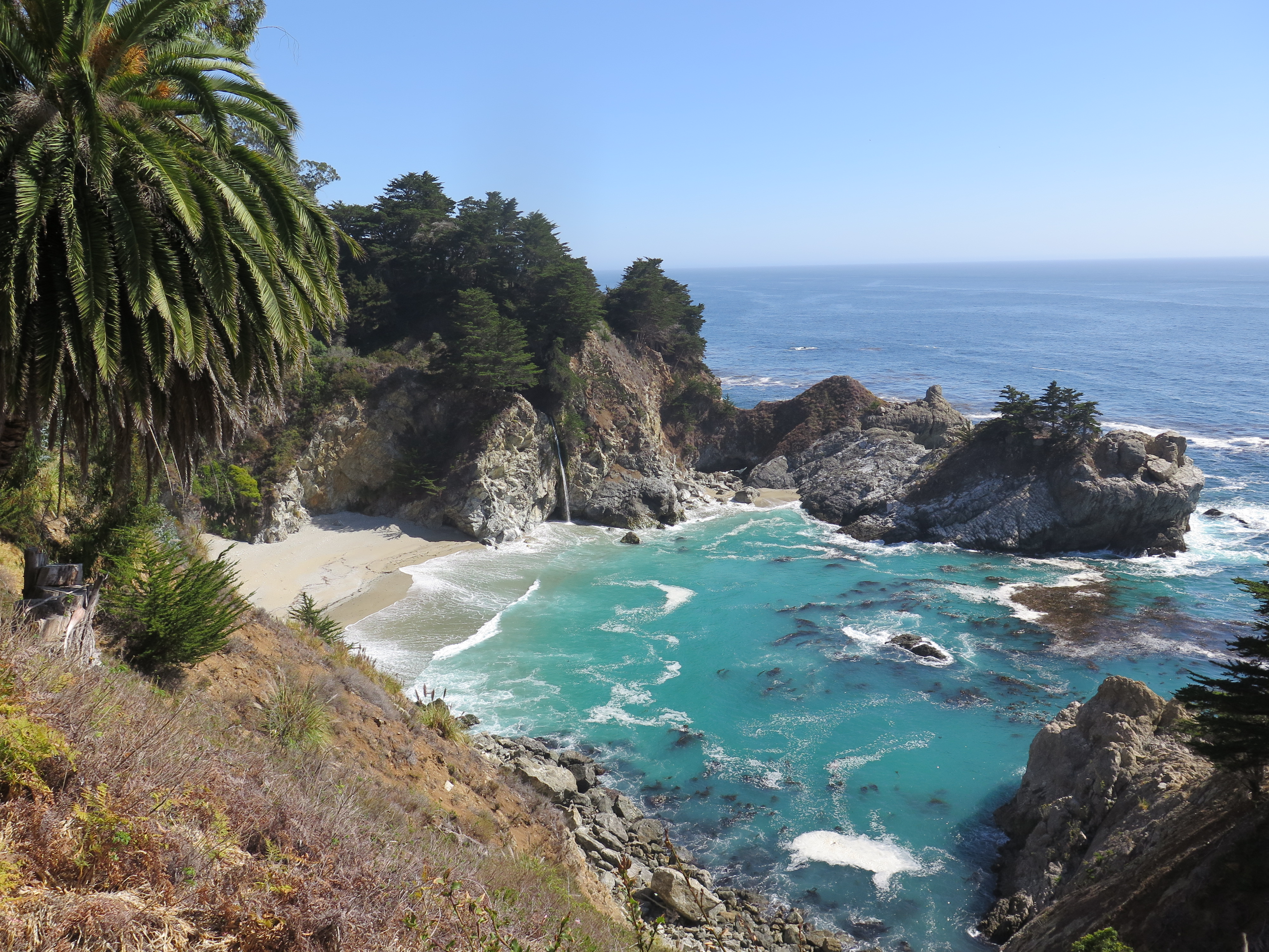 Doesn’t this look like a postcard? Well, it pretty much is. This is McWay Falls, one of the most photographed waterfalls in California
Jamie and I found Big Sur’s famous McWay Falls. I’m glad we followed the crowds because this section of Big Sur had stellar views. One viewpoint had the waterfall and a spotless beach and the other viewpoint had jaw-dropping views of the cliff-lined coast. Just, wow. What a way to end our final day on the road. The next day, Jamie and I packed up our bags, said goodbye to Cannery Row, and drove back to San Francisco. We took Highway 1 for most of the way, soaking up our last views of California’s gorgeous coastline.
Thanks for reading and now for the best part: a fun short film documenting my brother and I’s road trip! It’s called Road Trip 2015: National Parks, Hiking Trails, and Sista-Bro Bonding. Enjoy!

Hello friends,
Fall has arrived in Minneapolis once again. The extremities of the sugar maples are starting to turn red and the oaks are finally losing their dark green luster. The weather has cooled down considerably, thus resulting in the exponential increase of cardigans and cute scarves. It’s a good problem to have while living in Minneapolis. I’ve kept myself busy with applying for jobs, visiting with friends, and hiking at nearby state parks. I recently visited Interstate State Park with a bunch of counchsurfers and got great views of the fall colors, while also making new friends. Before then, I visited the Minnesota Landscape Arboretum with my mother, which is a must-do before the leaves fall!
Well, in my last post, I wrote about my experiences hiking in Zion National Park and finding dinosaur footprints at the Warner Valley Dinosaur track site. Goodness, it’s been over a month since I got back home, but it only feels like last week that I was in that Nissan Versa with my brother, traversing the southwestern states.
 Hiking nearby our Aunt and Uncle’s House
Well, after getting our pictures taken with the dinosaur tracks, Jamie and I found our way south to Sedona. We have an aunt and uncle there and decided to recuperate for a couple evenings with them. I had never been to Sedona and was very surprised by how green it was. Also, it is very scenic; the whole city is surrounded by beautiful red rock formations, creating this beautiful juxtaposition of lush green plant life and bright red/orange rock. If you find yourself in the area, I’d recommend stopping by and experiencing it for yourself.
After a couple days, Jamie and I said goodbye to our family and headed back north towards the famous Grand Canyon National Park. We only had a couple hours to spend there, but we thought it would be worth it to visit. Friends and family who had been there before told Jamie and I that it is like standing in front of a green screen, and they were right. When we got to the edge, it really did look unreal.
 One of the many viewpoints from our trip to the Grand Canyon
We followed the path that paralleled the edge of the cliff and couldn’t keep our eyes away. We followed the crowds to the several viewing stations and got a few photos of us posing, looking towards the Colorado River below. We couldn’t stay long because we were hoping to make it to Sequoia National Forest by the following afternoon, so we did a quick tour of the main area and then had to say goodbye to the Grand Canyon. Though I could only be there for a couple hours, I look forward to camping overnight and backpacking into the canyon someday.
Jamie and I got back on the road, our goal being to drive as far west as we possibly could. By the time we were reaching Barstow, CA we had almost reached our driving limit (I could barely keep my eyes open). I did a quick search of hotel/motels in the local area and found Historic Route 66 Motel. It had good reviews, so I made the executive decision to sleep there that evening and I’m glad we did. It had clean beds, a warm shower, and a helluva a lot of character. The customer service desk was covered in trinkets and the parking lot was full of antique cars, some were even filled with retro dolls and clothing.

Route 66 Motel
We slept like babies that night and woke up bright and early to start the long incline up the mountain pass towards Sequoia National Forest. We didn’t make any camping reservations, but I looked up a few campgrounds that had good reviews and saw that there was a trail called the Trail of 100 Giants. It seemed right up our alley, so Jamie and I drove towards there. After a few hours of winding roads, we found the trailhead and saw that there was a campground just across from it call Redwood Campground. We decided to stay there that evening and then picked our campsite and unpacked our gear. We were so antsy from being in the car all day that we immediately got on trail. It was so fun to walk beneath the Sequoia trees. Whenever I walk in a forest, I always feel so humbled. Well, in this forest, I felt even more humbled.

Just for some comparison
If you haven’t experienced a Sequoia, then maybe it would be hard to comprehend the sheer immensity of how big one is. On average, they can be 20-26 feet wide, but they can get as big as 56 feet in diameter. On average, they reach heights of 164-290 feet, but the tallest one reaches to 311 feet tall. I don’t think Jamie and I witnessed any record setting trees while on trail, but we got to see some exceptional ones, even one that had fallen pretty recently. I climbed on top of it and spent a long while appreciating the moment. It’s not everyday that you get to climb onto a fallen sequoia.
I knew I would be back on trail tomorrow, so we walked back to our camp and saw another tent. We soon realized we wouldn’t be alone that evening, which came to a surprise; a good surprise. Then a whole carload of young people got out of a car and introduced themselves. They all looked college aged (maybe a few were graduated) and seemed ready to party. Little did Jamie and I know, but we would relive our college days in the middle of Sequoia National Forest, beer pong and all!
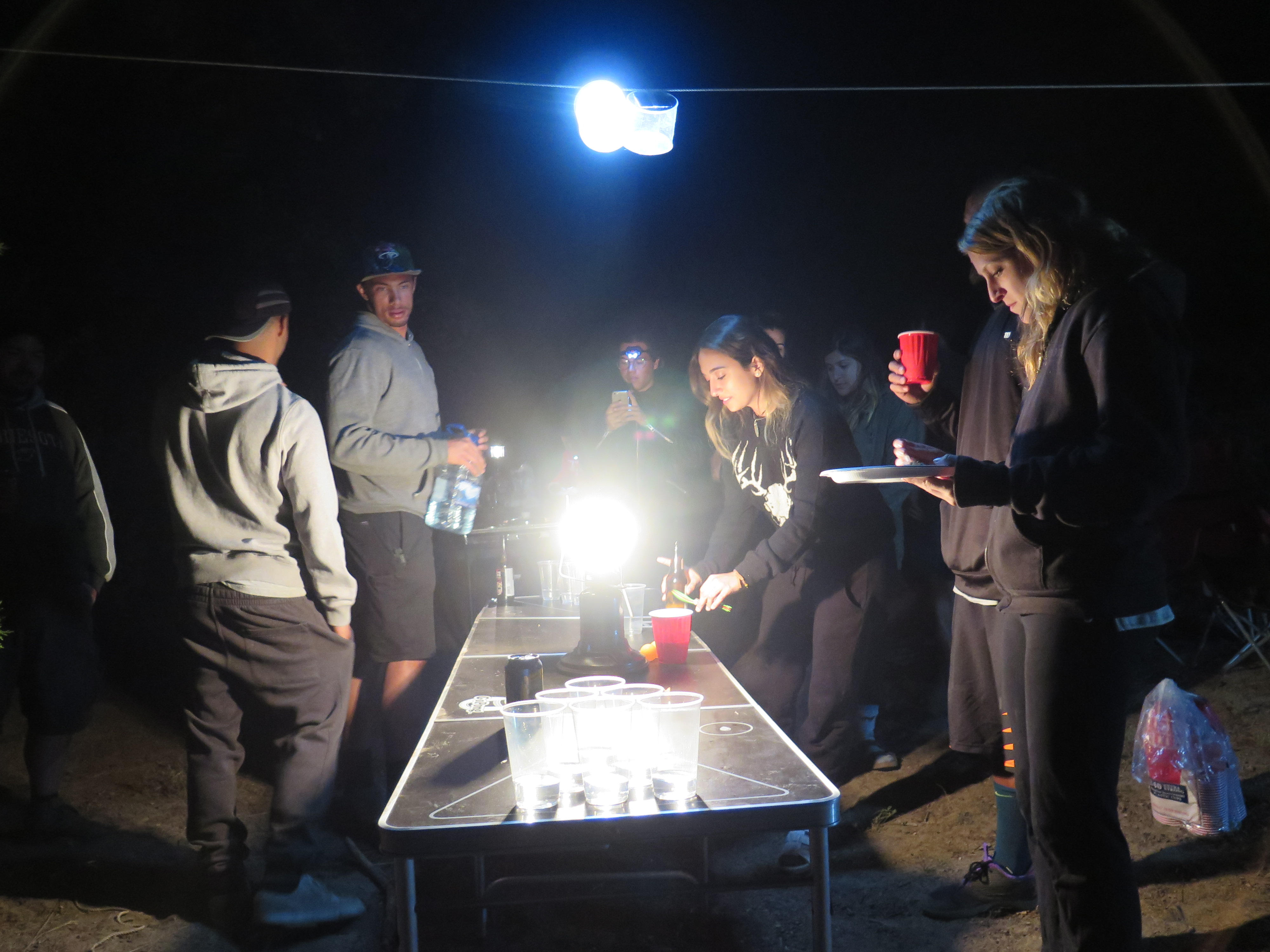
Playing beer pong with new friends
I would’ve never thought I’d ever play beer pong while out in the middle of the woods, but when the opportunity arose, I couldn’t say no. Though I didn’t go hard like the youngsters, I did enjoy almost “crushing” a gentleman with a large ego at beer pong. My brother and I were so close to beating the self-proclaimed beer pong masters. Alas, we did lose, but luckily we were avenged by a lovely couple from Santa Barbara. I’m glad Jamie and I got at least one good experience hanging out with strangers while camping. The last few times we camped while on the road, we didn’t see anyone, so it was refreshing to have so many people to chat with.

Chilling in the hammock, playing an epic round of Monster Hunter
The following day, Jamie and I split and did our own things. I walked the 100 Giant trail again, appreciating the beautiful sequoias. I also wrote in my journal and read my book while in my hammock. Then, Jamie and I decided to drive down the road to the local town. We found a bar/store and bought some stuff, and realized there was a horseshoe field in the back. I hadn’t played in years, so Jamie and I tried our best to get a ringer. Sadly, neither of us succeeded, but I got really close. That evening, the youngsters were pretty pooped, so there wasn’t a party like the night before, so Jamie and I relaxed at our campsite and looked up at the stars. We chatted till the early evening and then retreated to our respective beds; for me, my hammock and for Jamie, my tent.
While swinging in the hammock, I tried to be intentional with my thoughts and senses. I wanted to remember the smells, the sights, and everything in between about that very moment. I could smell the dry air, full of dust and dry detritus; I could see the milky way through the pine trees that supported my hammock; and I could feel the crisp air cool my exposed cheeks. At that very moment, I was very happy.
Thanks for reading! In my next post, I’ll finish off my road trip series and show you guys the video I made documenting the whole thing.
All the best,
-Molly
 Aw, aren’t we so cute?

Hello friends,
Though I’m writing about my adventures in Utah, in actuality, I’m home in Minnesota. I got home last week after 2 months of traveling around the western USA. It feels good to be home. Well, let me refresh your memory real fast. In my last post, I wrote about my experiences hiking in Arches National Park and Canyonlands National Park. After spending time there, I camped at White House Campground (If you search for it, you’ll see that I wrote a google review for the campground. It’s my first review ever! I decided to write one because it didn’t have a review and I think travelers should know there’s a well-maintained, cheap campground near so many national parks).
 Zion National Park: A Park Built Between Petrified Sand Dunes and Narrow Canyons
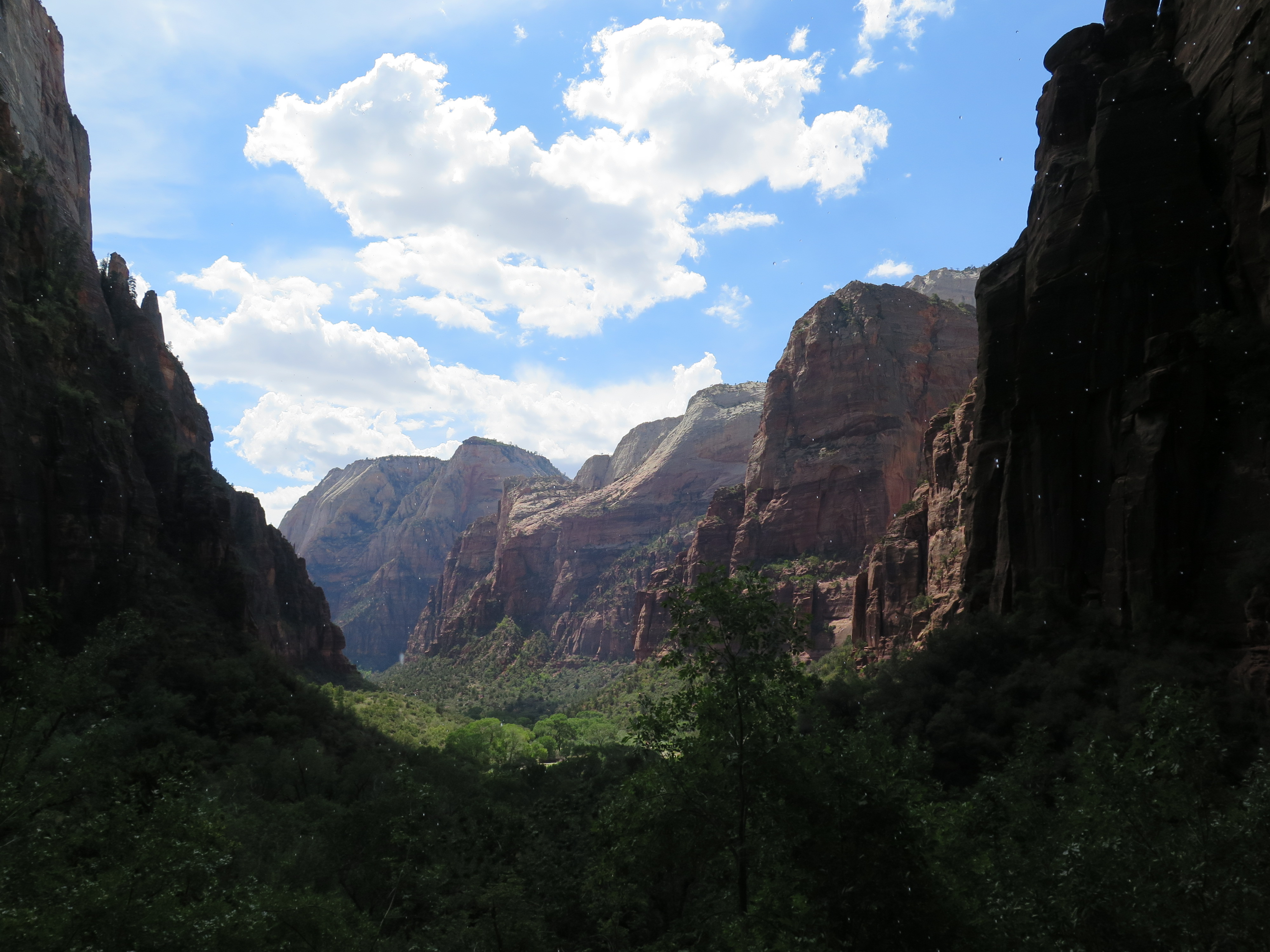
If you have never been to Zion, then you must go. Make it the next on your list of places to see. There is something so stunning and so magical about Zion. Maybe it’s the sheer size of the cliffs that you’re hiking beside or maybe it’s the pristine mountains that flank you on both sides or maybe it’s because every view looks like a priceless painting. My brother and I couldn’t keep our mouths shut because we were gawking everywhere we looked; from the shuttle bus to the Narrows, our jaws were ajar, awed by the surrounding scenery.
When we got past the eastern entry point, we stopped at a few lookout points. Each one had their own unique history to share and horizon to see. This is where I learned that many of the mountains I saw were gigantic petrified sand dunes. Woah.
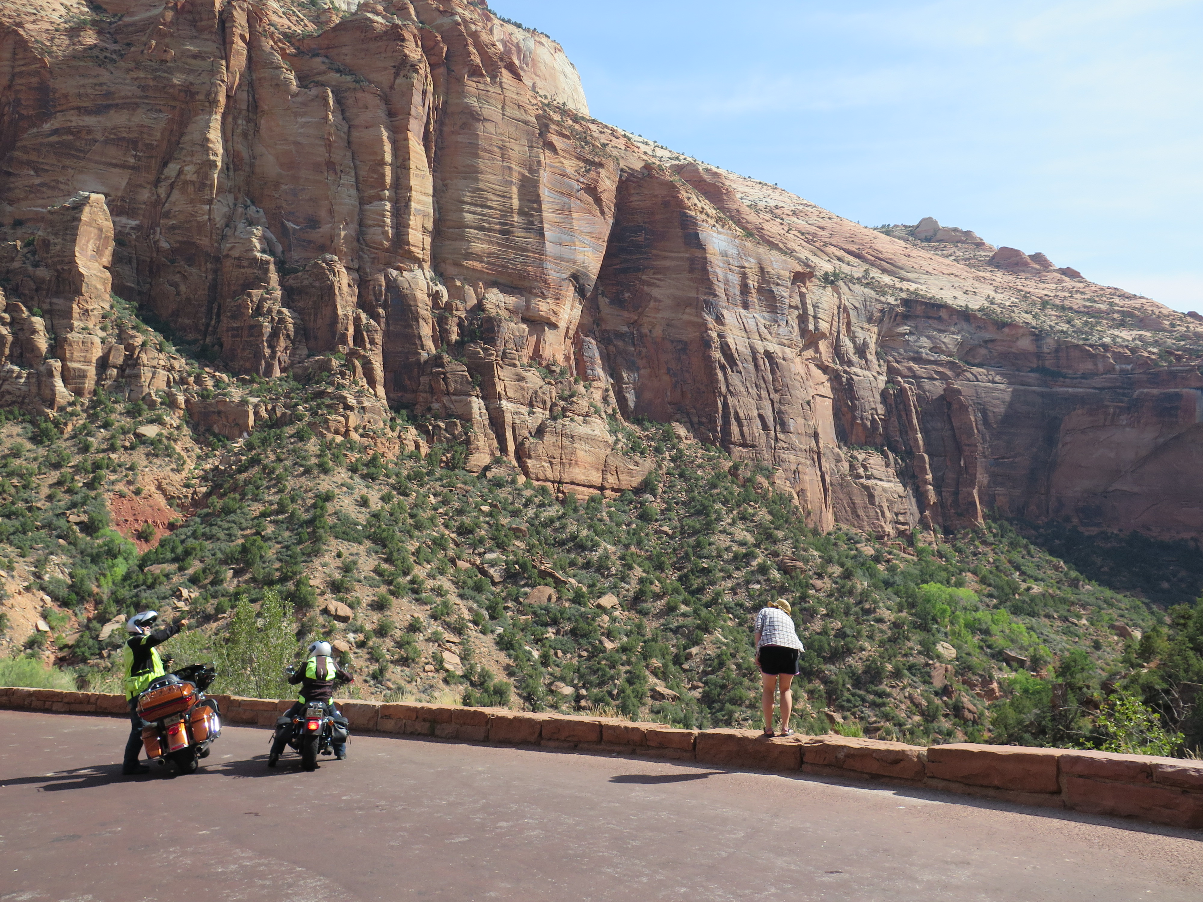
The landscapes were so massive. Our cameras couldn’t do them justice.
We learned that there is parking available in the park, but it is very limited. We ended up driving out of the park from the southern entrance and finding a parking spot about a quarter mile away. There’s a free shuttle that goes from Springdale to Zion, which is a great alternative if you happen to be coming from the south. Once you’ve parked and have entered Zion, then follow signs for the park shuttle. It’s the best way to get around while in the park.
My brother and I found a map and decided to start from the last stop of the shuttle and then to check out the other stops as we returned back to the entrance. The last stop was The Narrows. My brother and I got off the bus, refilled our water bottles and started our 2-mile hike at the Riverside Trail (Gateway to the Narrows). Though it was a really hot day, the path was shaded by the nearby cottonwoods trees and a nice breeze whistled through the canyon. The farther we went, the narrower the canyon got. Though it was still quite large, it was evident why this trail is called the Narrows.

The trailhead to the Narrows hike
We reached the end of the Riverside Trail and found the Narrows trailhead. My brother and I didn’t come prepared, so we didn’t hike in, but I’m glad I got to see it. I know I’ll be back in Zion sometime soon (hopefully with my adventurous sister) and I plan on hiking the Narrows then! My brother and I hiked back and jumped in the shuttle bus to our next destination: Weeping Rock. We saw that it was a .4-mile loop with 100 feet of elevation gain and decided we should check it out. This hike is famous for the small streams that trickle down the side of the canyon, resulting in a weeping rock face. Also, since there is so much water, ferns and mosses grow all around, creating a green paradise hidden away in the sandstone cliffs. This was the perfect place to cool down after hiking a couple hours in the sun. The gentle drops of water cooled our burnt skin and the views of the park were spectacular. (A few images above is from Weeping Rock).
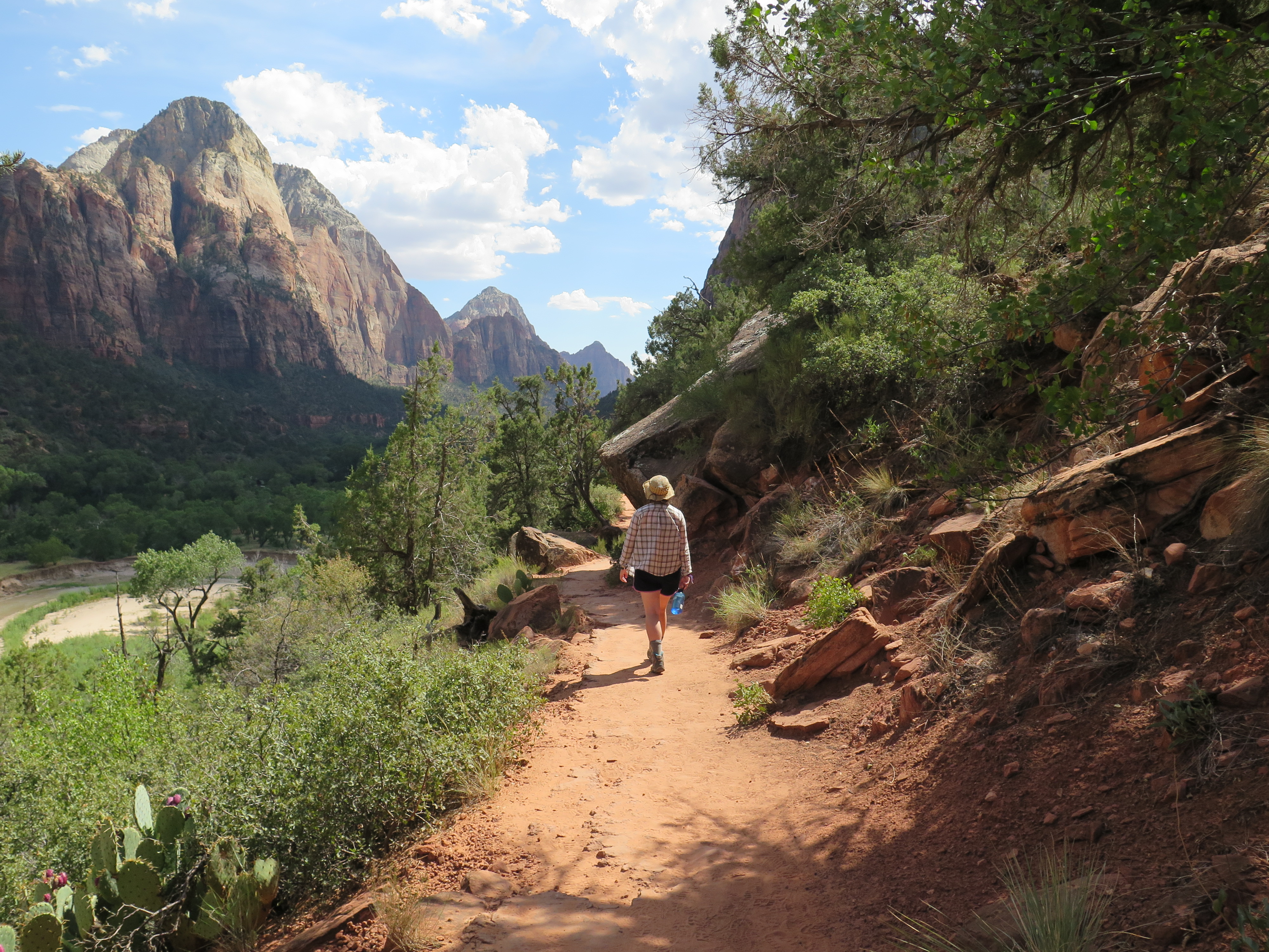
Hiking on Kayenta Trail
For our final hike, Jamie and I decided to check out Emerald Pools. We took Kayenta Trail from the Grotto area towards the Emerald Pools – Lower Trailhead. This hike was the most visually stunning of all the hikes we did that day. The trail was pretty easy too. It’s one of the most used trails in the park, since it connects to the East Rim Trail and to the infamous Angel’s Landing. I’d say if you have only a day to see Zion (like us), than this trail is a must-do (especially from north to south). Emerald Pools were really pretty too, but goodness, that view from the Kayenta trail was unforgettable.
That evening we stayed in St. George, UT using Airbnb. After a few days hiking and camping, we were both very dusty and very smelly and we both needed showers. The next day, we had planned to drive to Sedona to spend a couple days with our aunt and uncle. But, before our long drive, Jamie had noticed a sign about dinosaur tracks while entering the city the night before. So, we did a quick google search and found the Warner Valley Dinosaur Track Site. We didn’t even hesitate, within seconds I found the address and we were on our way to discover some dinosaur footprints!

Checking out the signage.
We found ourselves on a dirt/gravel/sandy road for over 6 miles while on our way to Warner Valley Dinosaur Track Site. We were worried we were lost until we saw signs for it. When we parked, the trail lead us down deeper into the valley. We found a sign with the history of the area and just across from it was a designated area strewn with footprints.
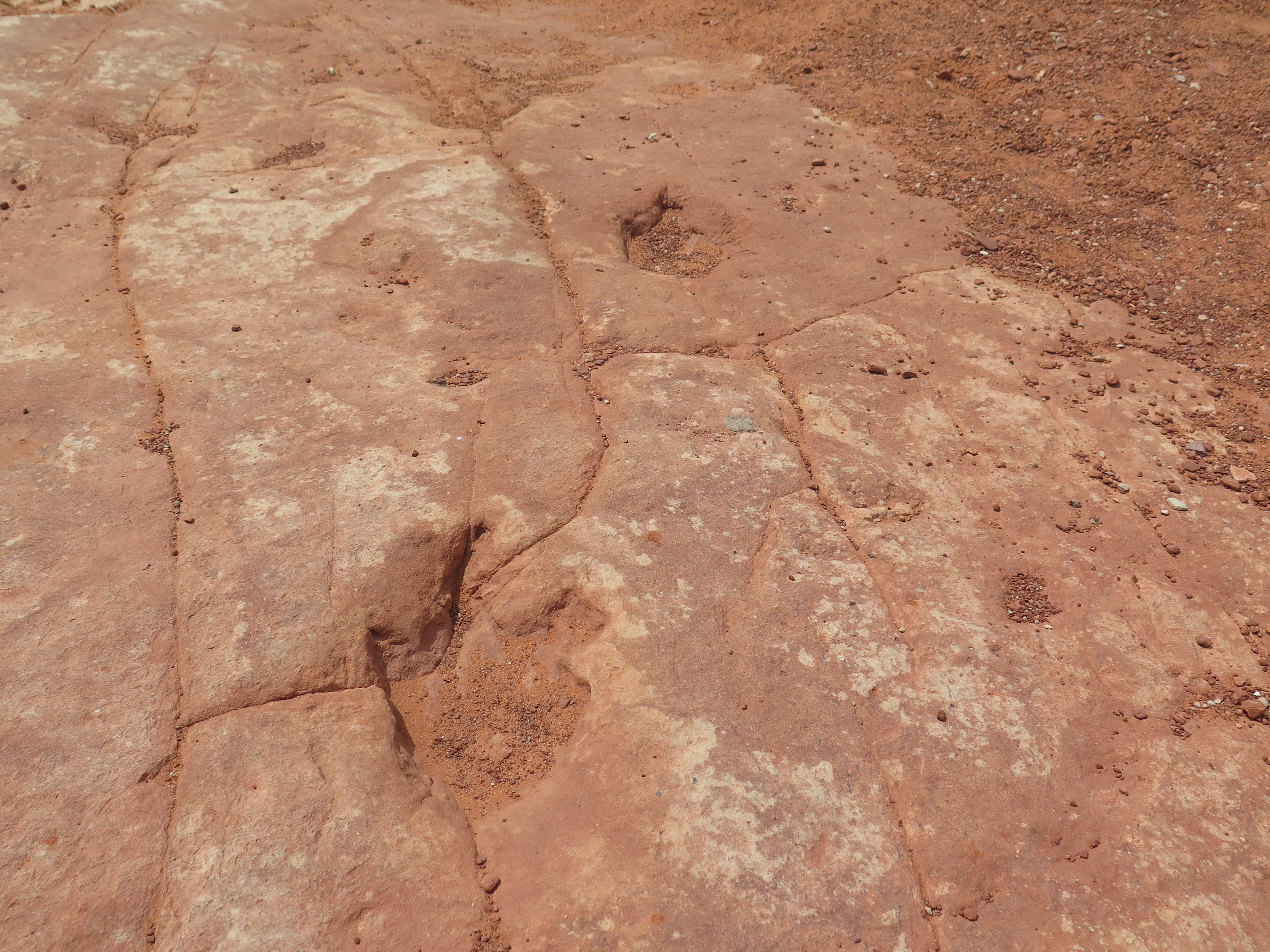
Dinosaur tracks!

A pretty big footprint
I’m glad Jamie and I spent the time to explore this area. It was very beautiful and walking where dinosaurs once roamed was definitely the coolest part. We plan to visit larger dinosaur sites in the future, maybe even Dinosaur National Monument? Alas, all things must come to an end, so we left Warner Valley and began our 8 hour drive to Sedona. I’d like to say it was uneventful, but it was one of the scariest drives of my life! We hit a nasty storm while north of the Grand Canyon and even witnessed the beginning of a flash flood. We learned later that the flooding was very severe. I’m glad we left when we did because we easily could’ve been stranded.
Here’s a video of the storm before we reached it.
Thanks for reading. In my next post, I’ll write about camping in Sequoia National Forest.
Much Love,
-Molly

Hello friends,
In my last post, I wrote about my experiences visiting and hiking in Jackson, WY and Salt Lake City. Well, after spending time in Northern Utah, my brother and I decided to drive south towards Moab. I had heard good things about the town, as well as heard that there’s really good hiking and sightseeing.
The drive to Moab was very scenic and had landscapes that I’d never seen before with my own eyes. The horizon turned red and soon steep cliffs with layered plateaus filled our car windows. The most beautiful part of our drive that day was entering Moab. The city itself is flanked by two world renowned national parks. Since there was so much to do around the city, we decided to stay for two nights. And if you were curious where we slept, we stayed at the Lazy Lizard Hostel and I’d say it was a very characteristic hostel. Simple rooms, quirky people, cozy public spaces, and a communal kitchen. There’s a nomad gentlemen who has been staying at the hostel for awhile and through donations he cooks breakfast and dinner for the guests. What a nice service!
 Arches National Park and Canyonlands National Park
We woke up early the next morning to beat the afternoon heat. After breakfast, our first stop for the day was Arches National Park. (As a side note, I purchased a National Parks Pass, which is a VERY good investment if you plan on visiting a bunch of national parks in a year).
I had heard of the famous Delicate Arch and decided to have that as our first hike for the day. In total, it is a 3 mile hike and can be very strenuous if you hike it midday, since most of the trail is sun exposed. Jamie and I packed a bunch of water and started our hike up the red rock. Even 15 minutes in, I was impressed by the views all around me. You could see arches in the distance and red cliffs domineering the landscape. Most of the hike was uphill and the signs weren’t kidding, most of it was exposed to the sun. Luckily, we hiked early in the morning, but it was still a wee bit hot.
Eventually the trail leveled out and it became evident that we were getting closer to the arch. After another 20-30 minutes of maneuvering simple rock scrambles and walking across slick rock, we reached a trail that had sheer cliffs to our left. The trail was pretty wide, but it was a little unnerving, especially since some of the other hikers clogged against the inner wall. But, it was all worth it when you curved around the bend to find Delicate Arch in the horizon.

Delicate Arch – that little dot is me
Jamie and I spent a moment appreciating it from afar, but soon enough I was hiking down the rock to get a closer look (and an epic picture…). After getting our tourist shot of us under the rock, we then sat along the edge of the amphitheater, embracing our surroundings. Overall, the hike was a little hot, but the views of Delicate Arch and the surrounding red cliffs were absolutely worth the 3 mile hike.
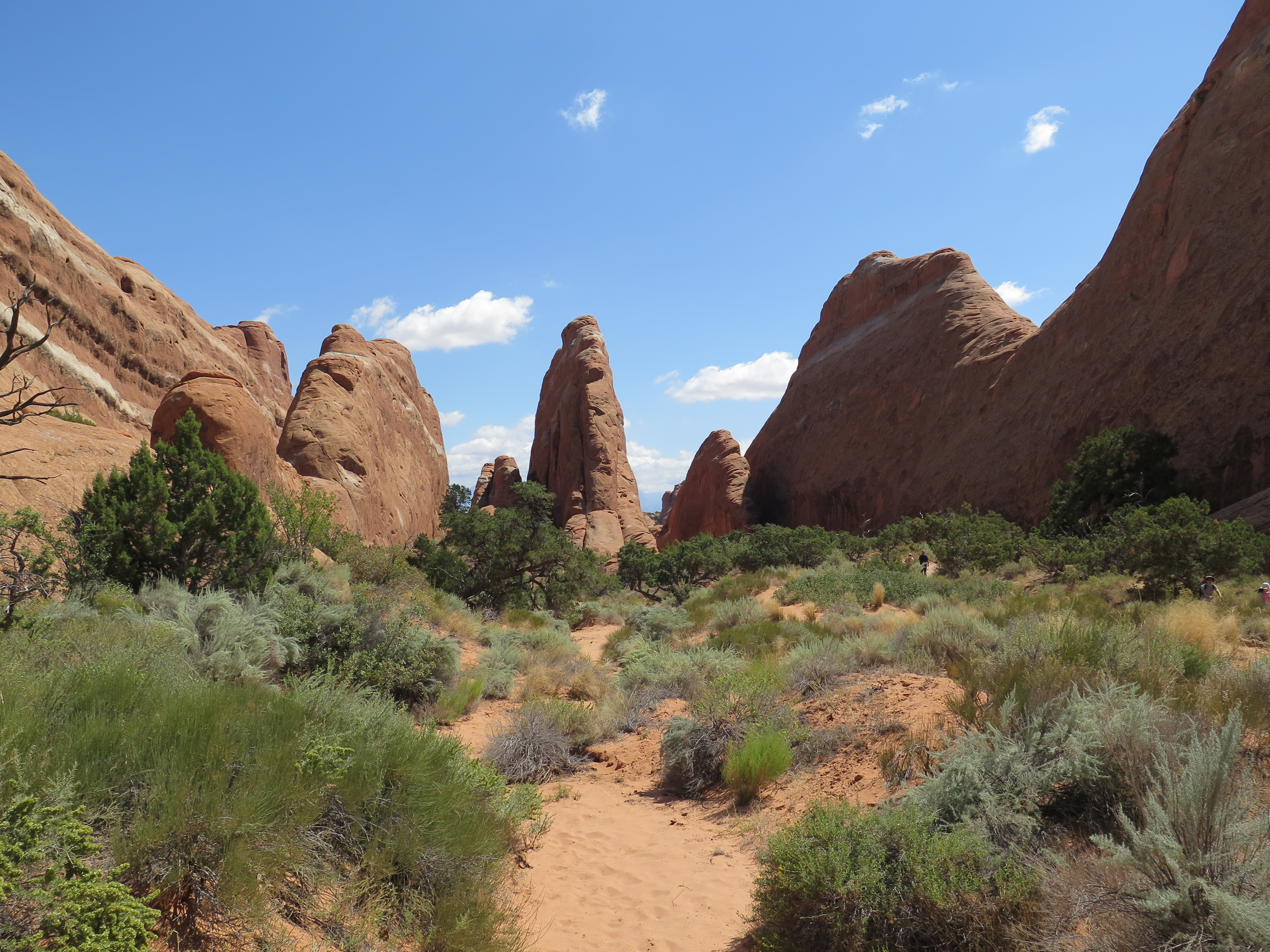
In Devil’s Garden
We decided to drive the rest of the Arches loop so we could hike around Devil’s Garden. We stopped at random vista points and hiking trails along the way, even finding ourselves squishing between a narrow trail between two rocks just outside of Devil’s Furnace. This park was so much fun to explore and is a must-see if you’re nearby!
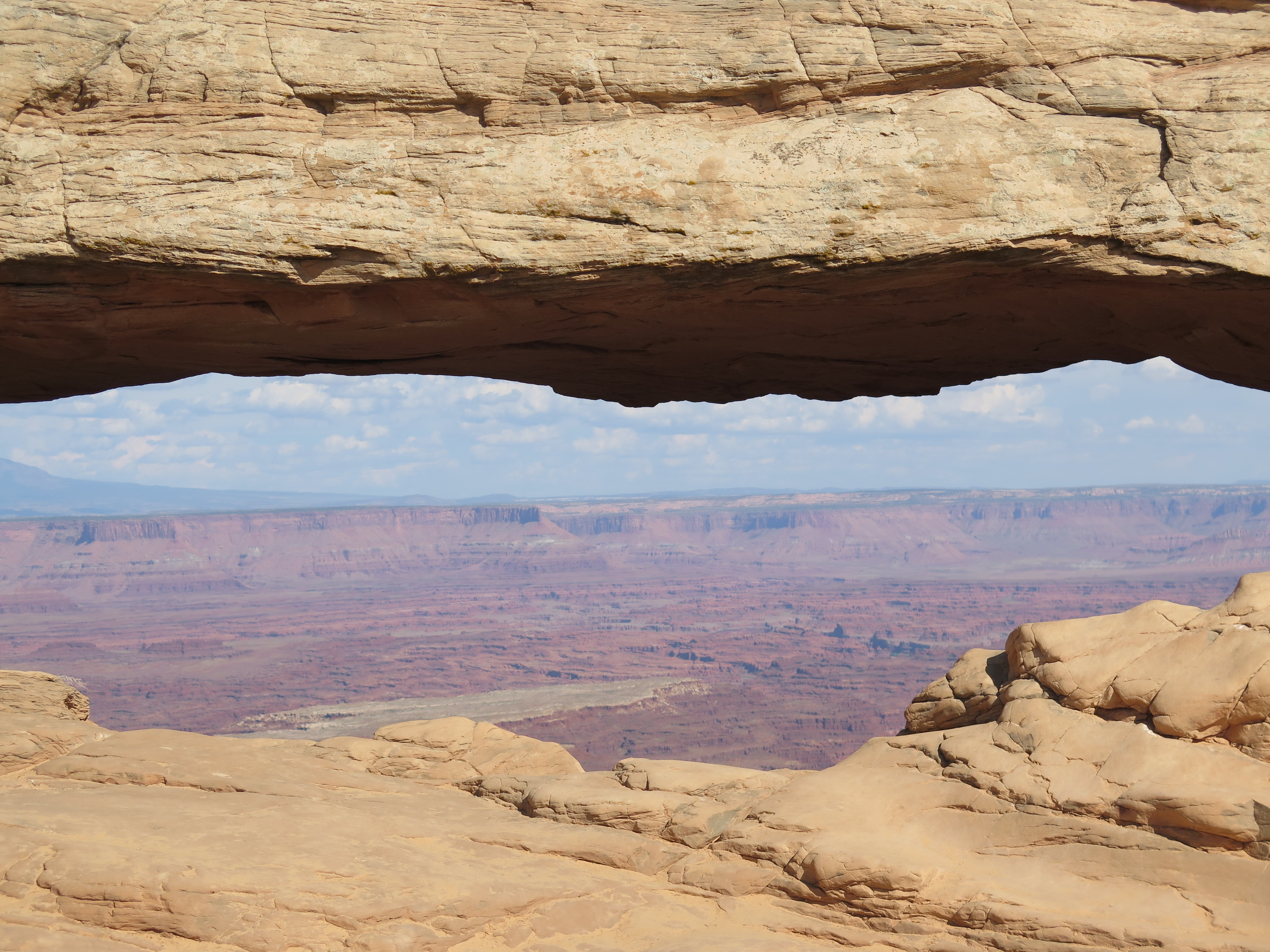
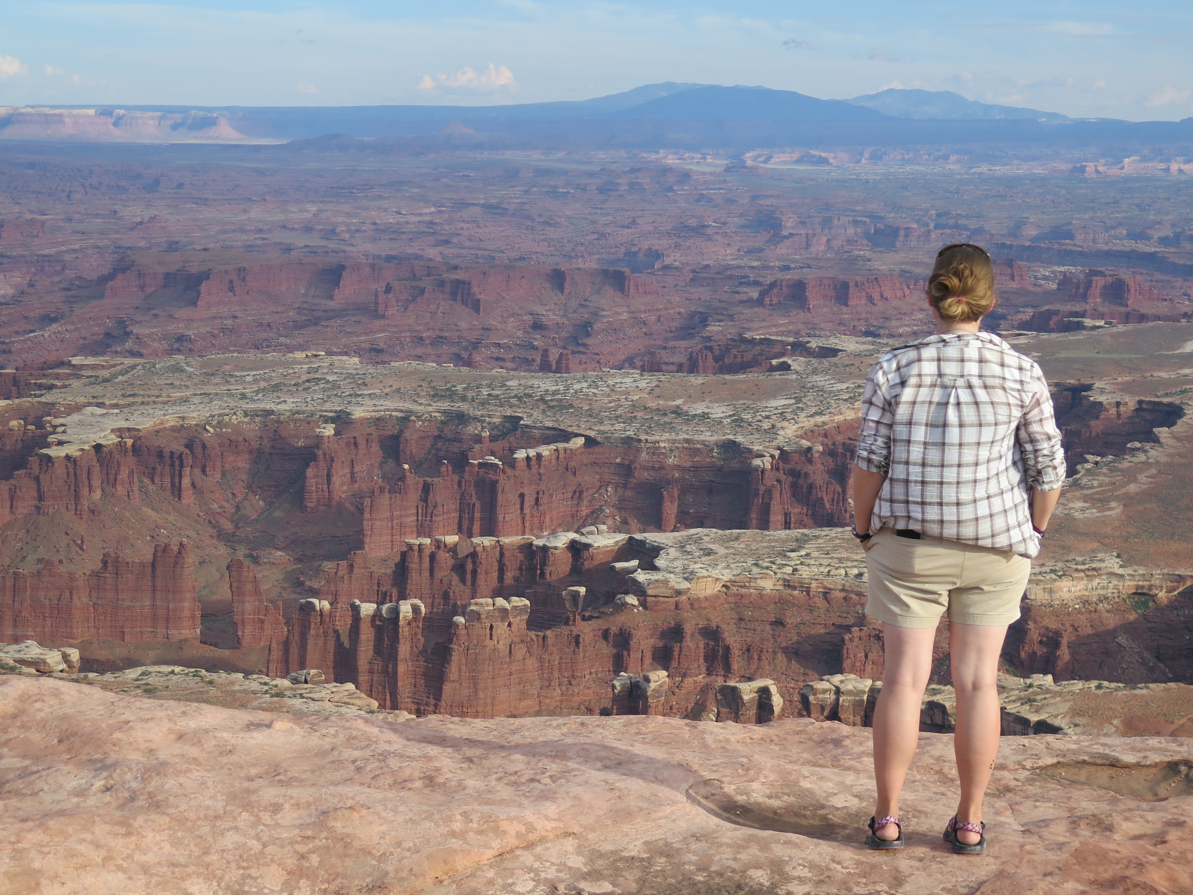
Internal framing of Canyonlands through Mesa Arch
After Arches, Jamie and I drove north to the entrance of Canyonlands National Park – Island in the Sky. We were pretty pooped from our hiking earlier in the day, so we decided to take it easy and to only check out the vistas. And we weren’t disappointed. The views from Grand View were absolutely stunning. The name says it all, the park is pretty much a canyon within a canyon within a canyon, which results in a dramatic view. We were also there during sunset and you couldn’t of asked for a better time of day. We drove around the whole park, getting all the different viewpoints and perspectives we could get. Each spot had its own special kodak moment and we made sure to document each one.

A canyon, within a canyon, within a canyon
The next day, Jamie and I said goodbye to Moab and set off towards White House State Park. We planned to camp there that evening, since it was one of the closest campgrounds to Zion National Park. But, before reaching our destination, I wanted to stop by the mysterious Newspaper Rock. 
Newspaper Rock
Newspaper Rock is a rock panel that has one of the largest known collections of petroglyphs. I had read about it months ago and when I found out I was really close to it while in Moab, I decided that my brother and I had to check it out. It is believed that some of the carving are traced back to the Pueblo people, dating as far back at 100 B.C. There are etchings that are more recent from the Ute people, who still live in the region. Also, there are a handful of cursive signatures carved into the rock from European settlers from the late 1800s. It was really cool looking close at the petroglyphs. There were lots of horses, bighorns, people with weapons, and even demons etched into the slab. Newspaper Rock is off a main road towards the Needles region of Canyonlands National Park, so if you’re in the area, you’d better not miss it!
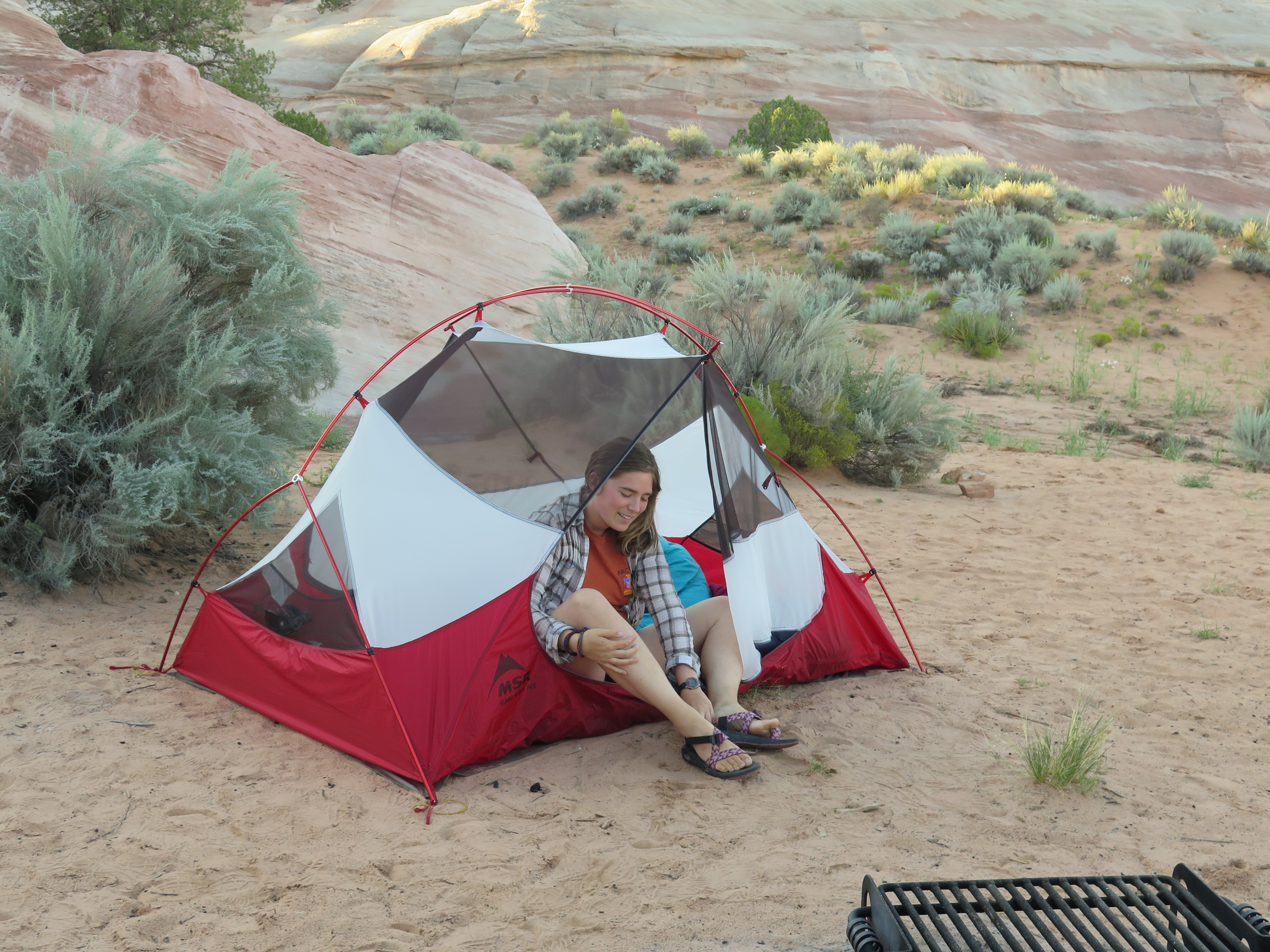
Camping at White House State Park Campground
After a long drive, passing by notable places such as Lake Powell and the famous 4 Corners, we made it to White House Campground. The signs said it was named “White House” because back when the pioneers first settled in the area, they believed the water from the lake was so good that it was comparable to what the president drank. I really liked this campground. It was clean, isolated, and had beautiful views. Jamie and I made a fire and played ukulele till the stars came out. What a perfect place to crash after a long day of driving.
Thanks for reading! My next post will be about Zion National Park and finding dinosaur tracks.
Much love,
-Molly

4 Corners. To be honest, it wasn’t that great, but glad I still saw it.

Hello friends,
As I type, I am in St. George, UT. We decided to use Airbnb to find a place to shower and sleep after our epic day at Zion National Park. I will most definitely write about how awesome this national park is, but for now I will catch you up with my trip!
Well, in my last post, I told you about my couchsurfing experience in Nevada and my day trip to Yellowstone. After watching Old Faithful erupt, my brother and I headed south through the Grand Teton National Forest. When we exited Yellowstone, we wove through serpentine roads until reaching a valley that offered breathtaking views of the Grand Tetons. We did our best to keep our eyes on the road, but it very difficult to look away from the mountains.
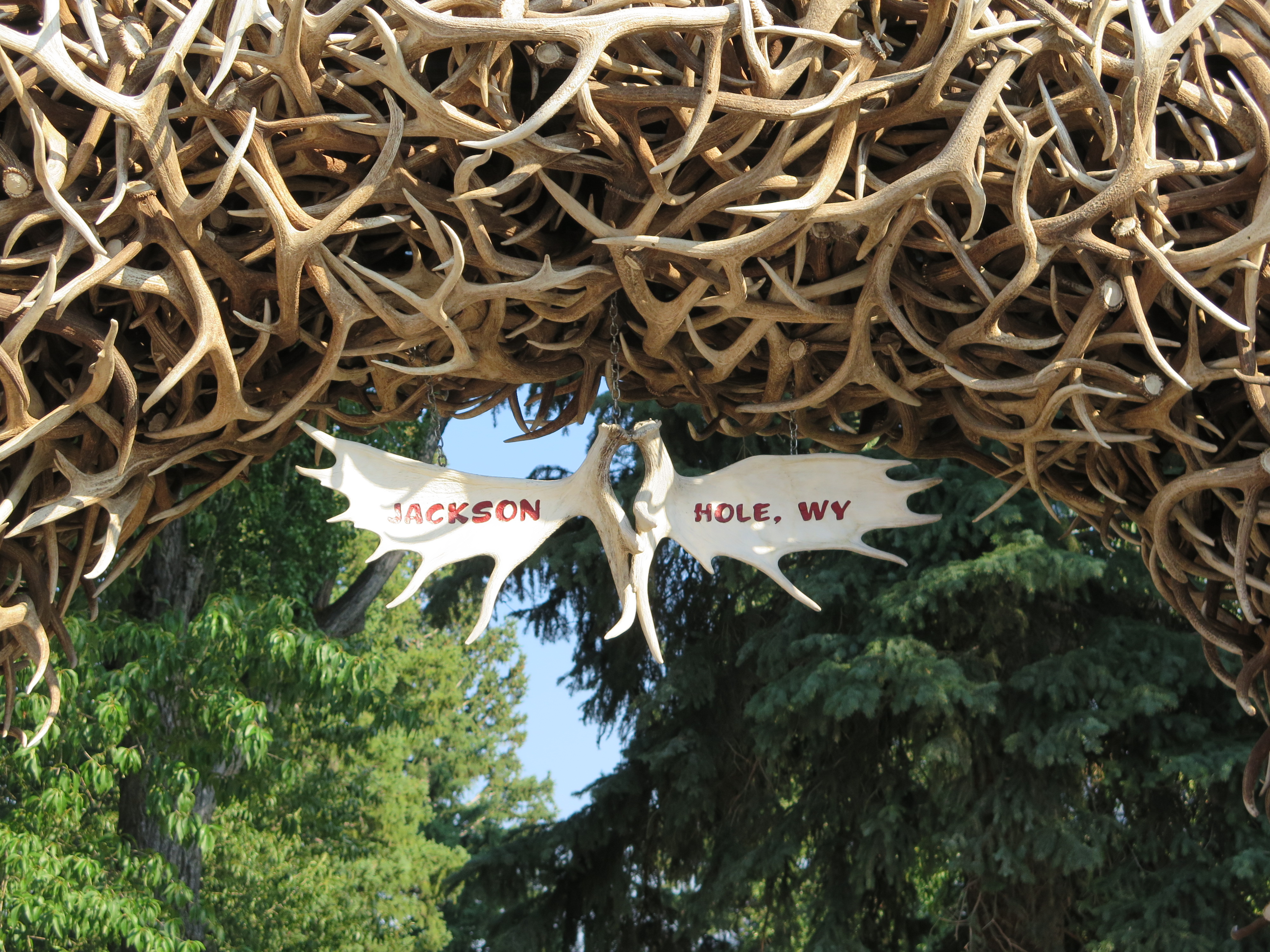 We followed signs towards Jackson, WY and arrived by early evening. We exited the car and explored the little resort town. Near the town center, there was a public theater show catered for tourists. It was full of guns, old west style shoot outs, and ladies in pretty dresses. I’d never witnessed something like that before. It was obvious to me then that I was in cowboy country. After that, we ate dinner at Snake River Brewery and decided to get sunset shots of the Tetons. After that, we dropped off our bags at the Antler Motel and passed out after our fun-filled day.
Jamie and I split for the morning. Jamie went to the park and sketched, while I relaxed in Cowboy Coffee Cafe and had my first good cup of coffee in a long while. It was nice to have some Molly time. Also, during this time, my father called and told me he was in Yellowstone and on his was to Jackson. It was a complete surprise to me! We made plans to have drinks and dinner that evening.
 After, I used my RootsRated app to figure out what hiking trails were nearby and saw that Bridger-Teton National Forest/Cache Creek was our closest trail. Also, since I work at RootsRated as a quasi photo editor, I thought I could take some action shots of hikers, bikers, and trail runners! It was a nice and easy hike. It had a boardwalk along the creek, a wide multi-use trail, and beautiful views of the treelined ridge line. The best part is that it’s at the border of town, so it’s super quick walk, ride, or drive to the trailhead.
The rest of our stay in Jackson went very well. We had beers with our father at the Million Dollar Cowboy Bar, which is famous for having saddle style bar seats, and then ate an amazing meal at Local Restaurant & Bar. It was nice to be spoiled for a night.
The following morning, Jamie and I fueled up with diner-style food, hugged our dad goodbye, and then started our drive to Salt Lake City (SLC). So, why did I decide to come to SLC? Well, for the last 6-8 months, I’ve been photo chasing for RootsRated and one of the cities I worked on extensively was Salt Lake City. From scouring the internet for Creative Commons images via Flickr and google, I learned that SLC is surrounded by mountains, which host dozens of hiking trails just outside (and even inside) the city. This was why I wanted to stop by (and I wanted to see the Mormon temple).
We rolled into town by late afternoon. While staying in cities, I normally use couchsurfing or crash with a friend, but I didn’t know anyone and I tried contacting CSers to no avail. So, that morning, I made an Airbnb account and contacted a host named Dennis. Within minutes of contacting him, he replied and accepted our request. It was relieving to know we had a place to crash, especially a house! We arrived and met Dennis, he gave us a quick rundown of the house, told us some good places to eat nearby, and then gave us the keys. It was easy and painless, not bad for my first Airbnb experience.
It was when Jamie and I were eating dinner that I heard back from a CSer named Austin. He asked if we still needed a place to stay. I said no, but told him that I wanted to go hiking. He said he’d be down, so we made plans to hike the following evening.
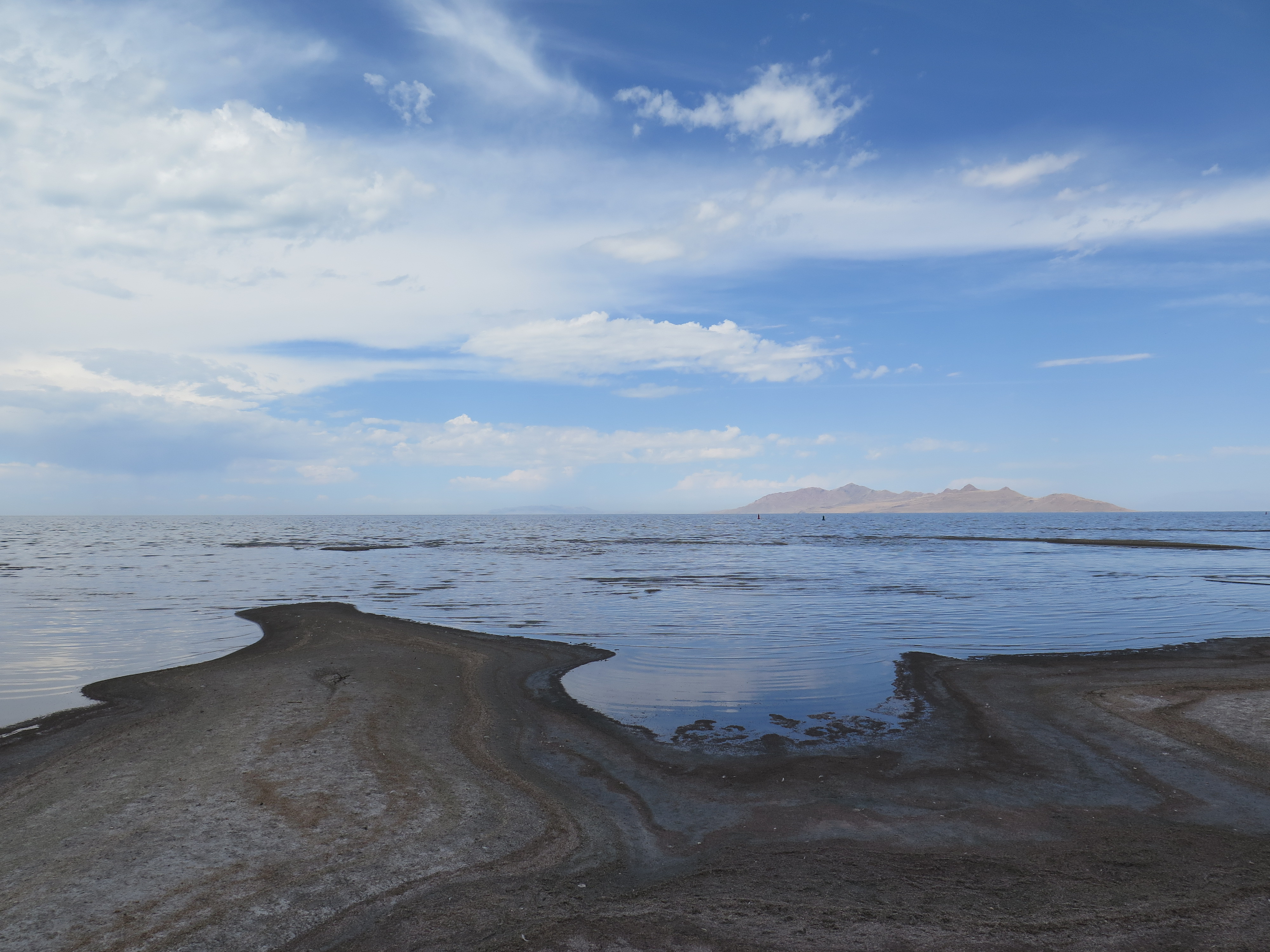
The Great Salt Lake
The next day, after catching up on emails and work, Jamie and I hit the town. First we drove to the Great Salt Lake. As we got closer to the lake, I was surprised that it reminded me of the ocean. The air was saturated with the smell of salt and there were gulls and sandpipers grazing the beaches. If I didn’t know better, I could’ve been at the Atlantic Ocean, but I guess it shouldn’t of come as a surprise, it is a very salt lake after all. I enjoyed walking along its shores, breathing in the air, and crunching the salty, crystalline sand beneath my feet.
 The Mormon Temple
 Walking on the temple grounds.
After the lake, we drove to the city center, parked the car, and walked around. First we visited the Mormon temple. It was pure white and very extravagant. I’d never seen anything like it. While exploring the grounds, I soon recognized that Mormons take their buildings, gardens, and pedestrian pathways very seriously. There were at least a dozen workers cutting tree branches, plucking weeds, and watering flowers. No wonder the temple is so white, I’m sure they keep it very clean, just like the temple grounds.
The rest of the city was like any other city, there were Starbucks, bank buildings, and skyscrapers. Though, there were two major difference that stuck out to me. One was how clean the city center was, the second thing was how wide the roads were. Most of the city streets had at least 3 lanes and sometimes 4 lanes for one-way of traffic. This resulted in long city blocks and little traffic (comparative to other cities I’ve visited). I was told by my CS friend that the roads were built for the Mormon wagon riders who founded this city, since wagons had large turn radii, but that’s just something from word of mouth. Who knows!
After an afternoon in the city, I was done being flanked by buildings. I wanted to go up into the mountains and see those buildings from high up above. This is when Austin and I met up. I learned Austin had just moved to SLC from Colorado, which meant that he hadn’t explored much of the area too. So, I opened my RootsRated app and found the nearest hike, which was called Neff’s Canyon. Austin, his puppy, and I jumped into his car. This is what I like about couchsurfing, I like how you get the opportunity to meet awesome people that you’d never have the chance to meet otherwise. Also, generally, these people are kind, open-minded, and up for a spontaneous adventure, such as an impromptu hiking trip.

Austin on the Neff Canyon Trail, about 15-20 minutes in.
We arrived to Neff’s Canyon pretty late in the evening, I’d say 30 minutes before sunset. I knew we wouldn’t make it to the top of the canyon, but I at least wanted to get a nice view of SLC. I knew my Minnesotan lungs wouldn’t allow me to climb as fast as Austin (Mr. Colorado mountain man), but I didn’t let that deter me. We kept a steady pace as we maneuvered through forested dirt paths and scrambled up rock faces. The start of Neff’s Canyon wasn’t anything special, but after the first bit, the trail get’s rather rugged. I’d even say climbing it while it is wet is probably not the best idea. I was pretty winded when we were nearing the top, but with a few words of encouragement, I pushed myself to finish the last 50-foot incline. I was happy for it too because we got a wonderful view of the SLC skyline at twilight.
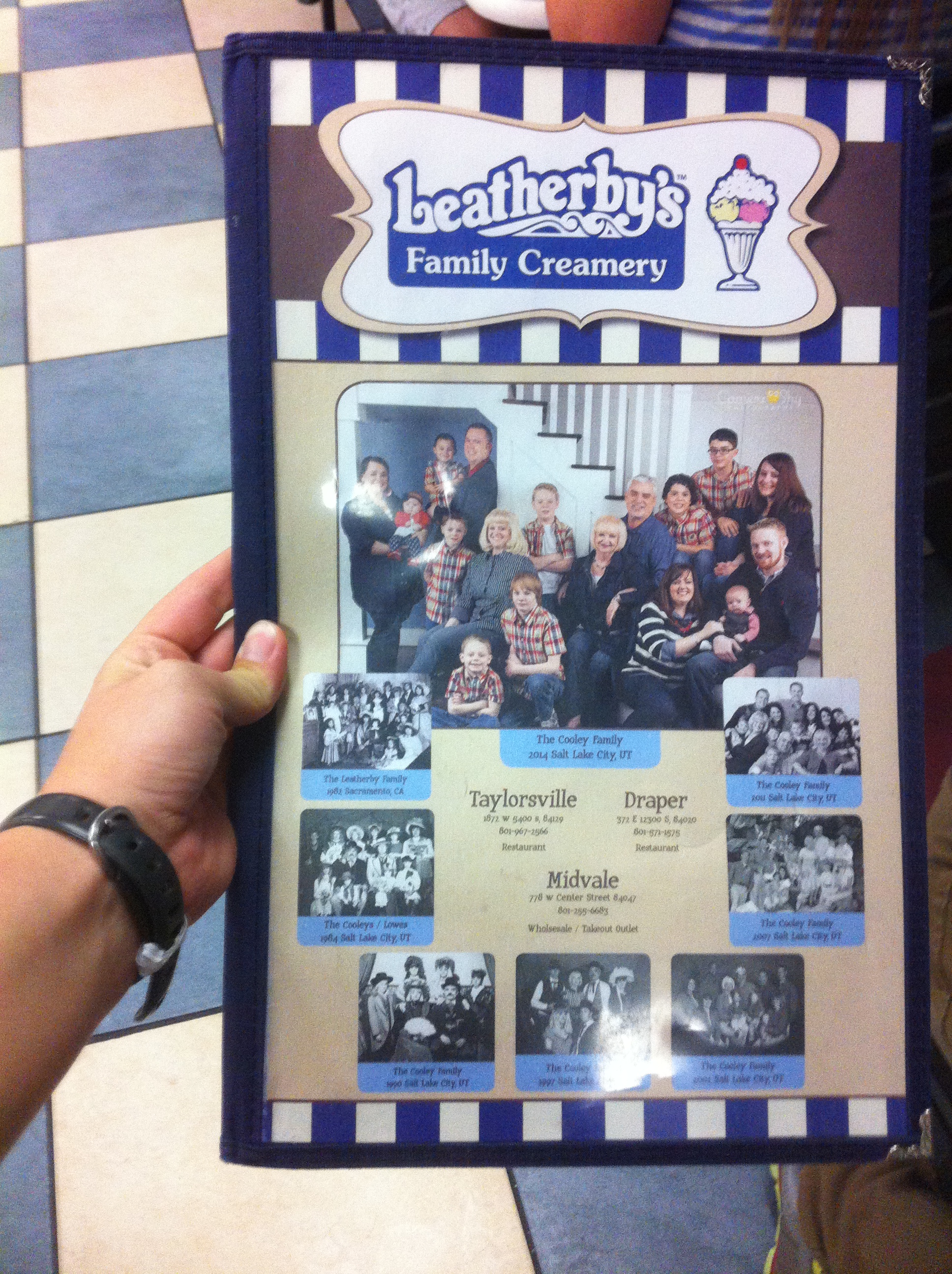
Leatherby’s Family Creamery menu
After our hike, we decided ice cream was a necessity, so we found Leatherby’s Family Creamery. The ice cream was good, but the best part was that I finally experienced some Mormon culture. The creamery is run by a mormon family and was packed with nicely dressed couples and large families. The serving staff was really friendly, definitely some of the best costumer service I’d ever had in my entire life. If you have a car while visiting SLC, I’d recommend stopping by.
Thanks for reading! My next post will be about Moab, UT and our experiences exploring Arches National Park and Canyonlands National Park.
Much love,
-Molly
I’m going to miss Jackson Hole’s beautiful scenery…

Hello friends,
It has been a week since I last wrote and at the moment I am in Moab, UT, staying at the Lazy Lizard Hostel. My stomach is full of homemade potato salad, which was made by the nice gentlemen who cooks dinner and breakfast for the hostel. From where I am sitting, I can see the cliffs of Canyonlands National Park and the mountains are such a deep red. I’ve never experienced such a red landscape; the cliffs in Moab are nothing like the cliffs on the Oregon coast or even Mongolia’s rugged White Mountain. We – my brother and I – only arrived today and we plan on visiting Arches National Park tomorrow, to witness the famous Delicate Arch. We also hope to hike other trails found in the park, as well as look for some dinosaur tracks.
Well, that’s what is happening now, what about what happened this last week?
 San Francisco to Elko, NV to Yellowstone National Park
After a night of pulled pork tacos and wine; my brother, sister, and I woke up early the next morning to retrieve our rental car. (My first plan was to buy a junker, but my family and friends encouraged me otherwise). Our sister dropped us off, hugged us goodbye, and then Jamie and I were soon on our way north. We took I-80 through the flat California valley, which then turned into the breathtaking Sierra-Nevada mountain range. When we drove through Tahoe National Forest (my second time in the last month), my brother couldn’t keep his eyes away from the window.
We had planned to drive all the way to Idaho Falls, ID, which was 11 hours away by car. The reasoning behind that was because I wanted to get us as close to Yellowstone as realistically possible. I also had contacted someone via couchsurfing in Idaho Falls and they had invited us to stay with them. Well, in the end, we didn’t make it; mostly due to car troubles (nothing serious though). We were in the middle of nowhere Nevada, driving in the high desert with no idea where we were going to stay that evening. I saw a sign for Elko, NV and thought, “what the hell, let’s see if there’s a couchsurfer there.” There was and her name was Julia and I contacted her when we were over 200 miles away and it was when we were 15 miles away from Elko that I heard a response. She had accepted our request! Well, the rest is history: we chatted, she let us use her air mattress (I slept on the floor), and bless her heart, she gifted my brother handmade wool mittens the next morning. We said goodbye over coffee, insisted that we should meet again in our respective cities, and soon enough Jamie and I were on the road again, our hearts set on Yellowstone National Park!
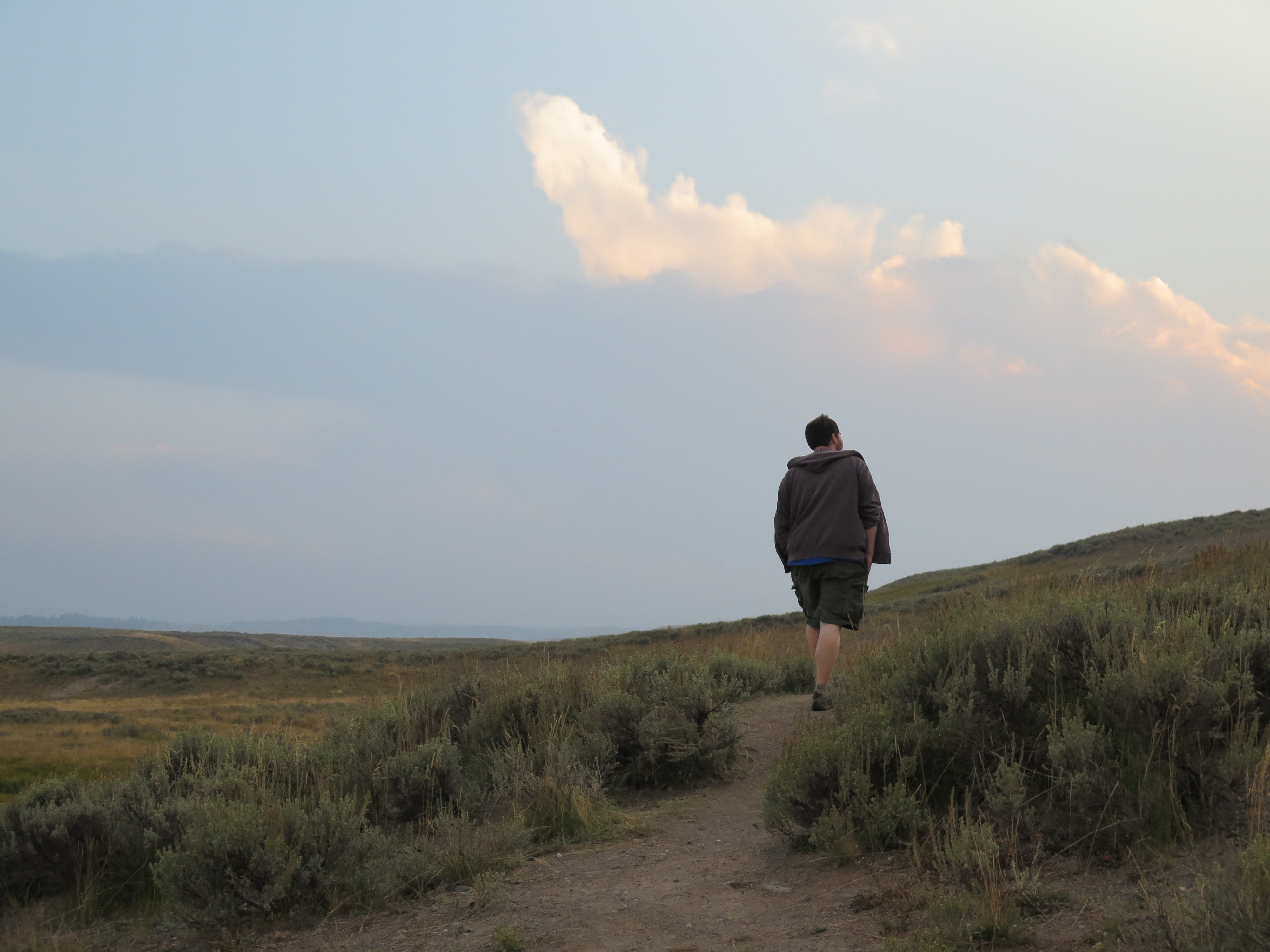 My brother checking out the fields of Yellowstone
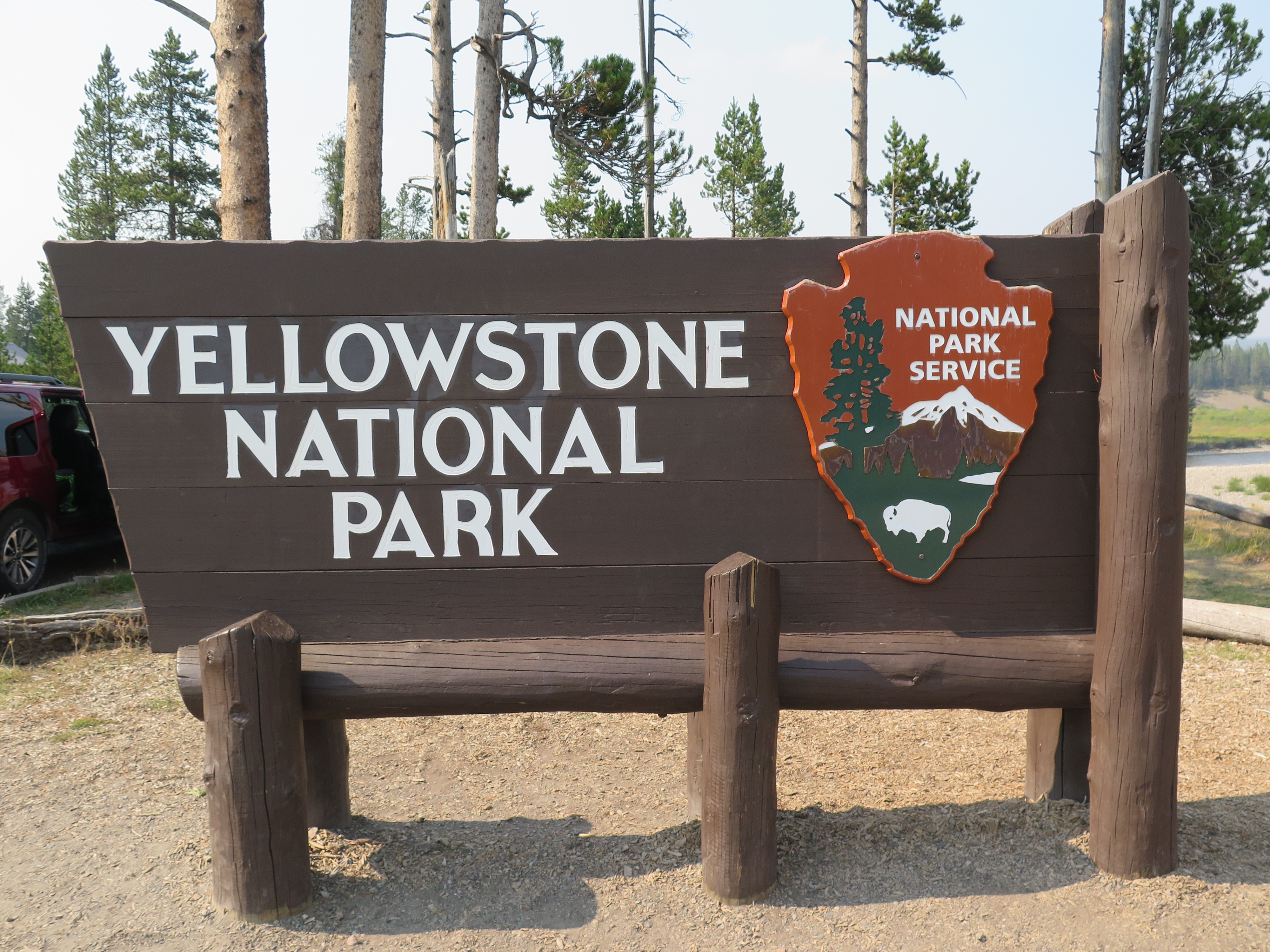
After over 6 hours of driving, it felt so good to get past the Yellowstone gates and to finally see what people have been raving about for all these years. And they weren’t kidding. This place is absolutely beautiful. Yeah, sure, there are sometimes lines of cars wanting to get the perfect elk shot or maybe there is a standstill because a buffalo is in the middle of the road, but it’s all worth it in the end. The wildlife viewing is so phenomenal. Also, at least from the west entrance, the views from the road are stellar. There are drastic cliffs surrounding the whole park, all formed by the massive volcanic eruption that happened thousands of years ago, thus resulting in the enormous caldera we now call Yellowstone National Park.
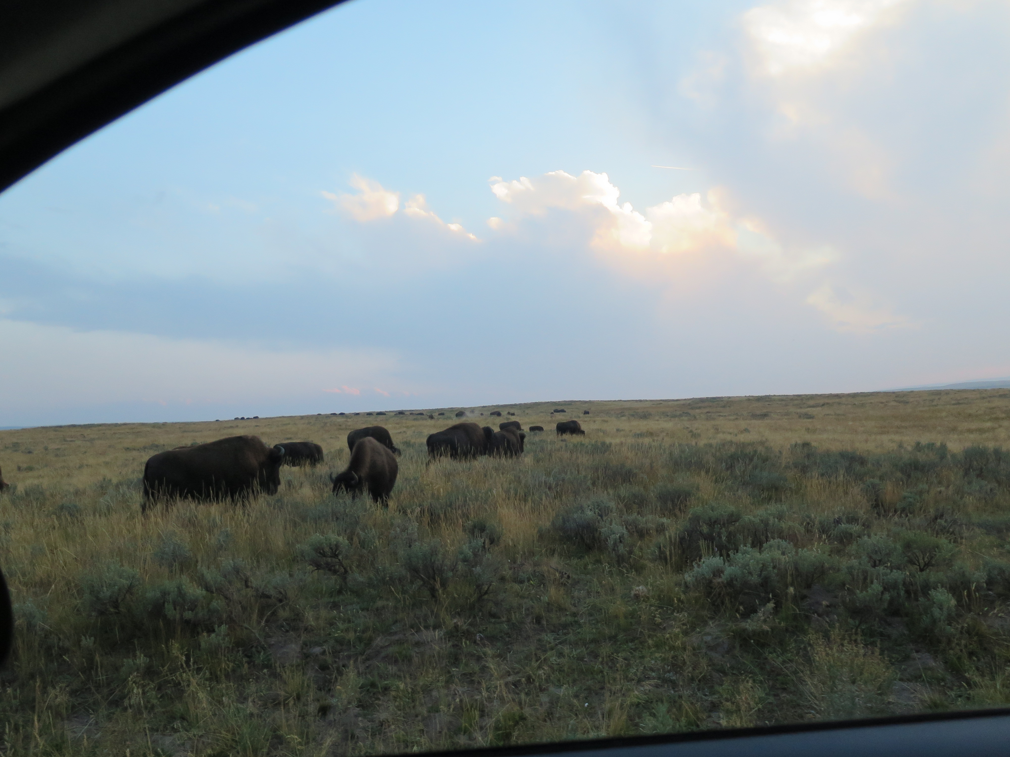
There was a whole field of buffalo.
We veered left at the first major crossroads, and soon the landscape changed from ridgeline to meadow to prairie to then the beautiful Yellowstone Lake. We spent that evening at Bridge Bay campground. I was looking forward to sleeping in my hammock again, but I was disheartened when a ranger told us that someone had been killed by a grizzly bear only a couple weeks before, very near to the Bridge Bay area. We were double disheartened when the park ranger told us there had been a lot of bear activity in the last week, even mentioning that he had seen a bear wondering the edges of the campground the night before. Jamie and I didn’t have bear spray, so we were kinda freaking out. In the end, instead of using my hammock, I decided to share the tent with my bro.
We woke up early the next morning, ate some oatmeal, and packed up our gear. We only had one day in Yellowstone, so we decided to be hardcore tourists and to try and fit in the famous sites. We first took a moment to enjoy Yellowstone Lake and then we drove to West Thumb. We took the boardwalk all around the area, looking at all the steaming geysers and chromatic pools. We soon recognized a sign that we would see often throughout the park, which was a small boy stepping off the boardwalk and then falling/melting into the boiling, uneven earth below. I thought it was silly to have to tell visitors something so obvious not to do, but soon enough I saw people stepping off the boardwalk and taking selfies near the boiling hot pools.
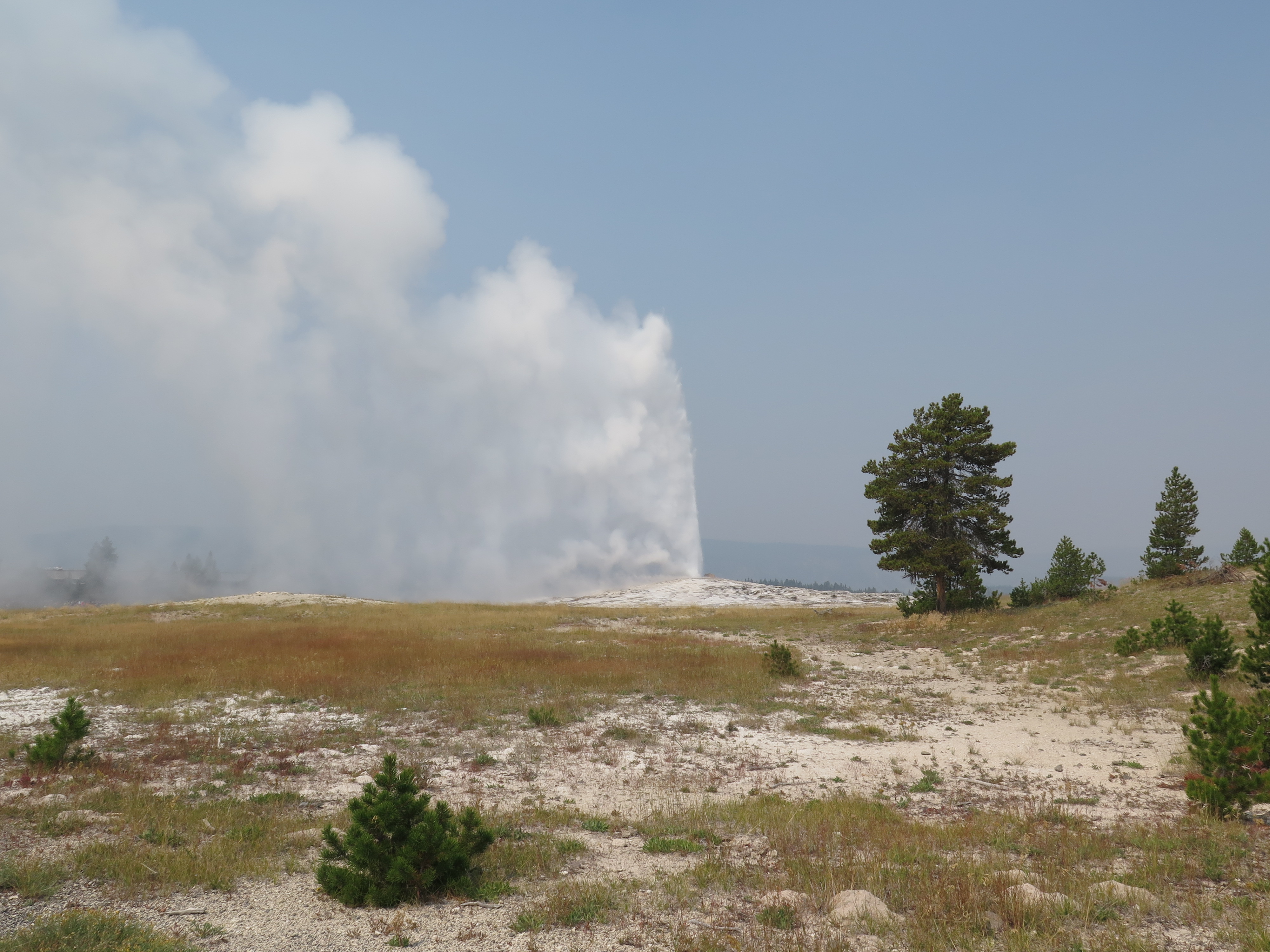 Then, like any good tourist, Jamie and I wound our way to Old Faithful.
At the Old Faithful area, we decided to take extra time to explore the area. We patiently waited for Old Faithful to erupt, and when she did, we got up and continued our way along the boardwalks. We walked beside even bigger geysers than Old Faithful, and we were even lucky enough to witness Grand Geyser erupt, which is one of the largest geysers in the park. Though geysers are cool, my main goal was to find Morning Glory Pool. I had seen images of it on the internet and thought that seeing it in real life would be really cool. It was on the complete opposite side of the Old Faithful area, but a two mile hike, to me, was well worth it to see Morning Glory Pool.
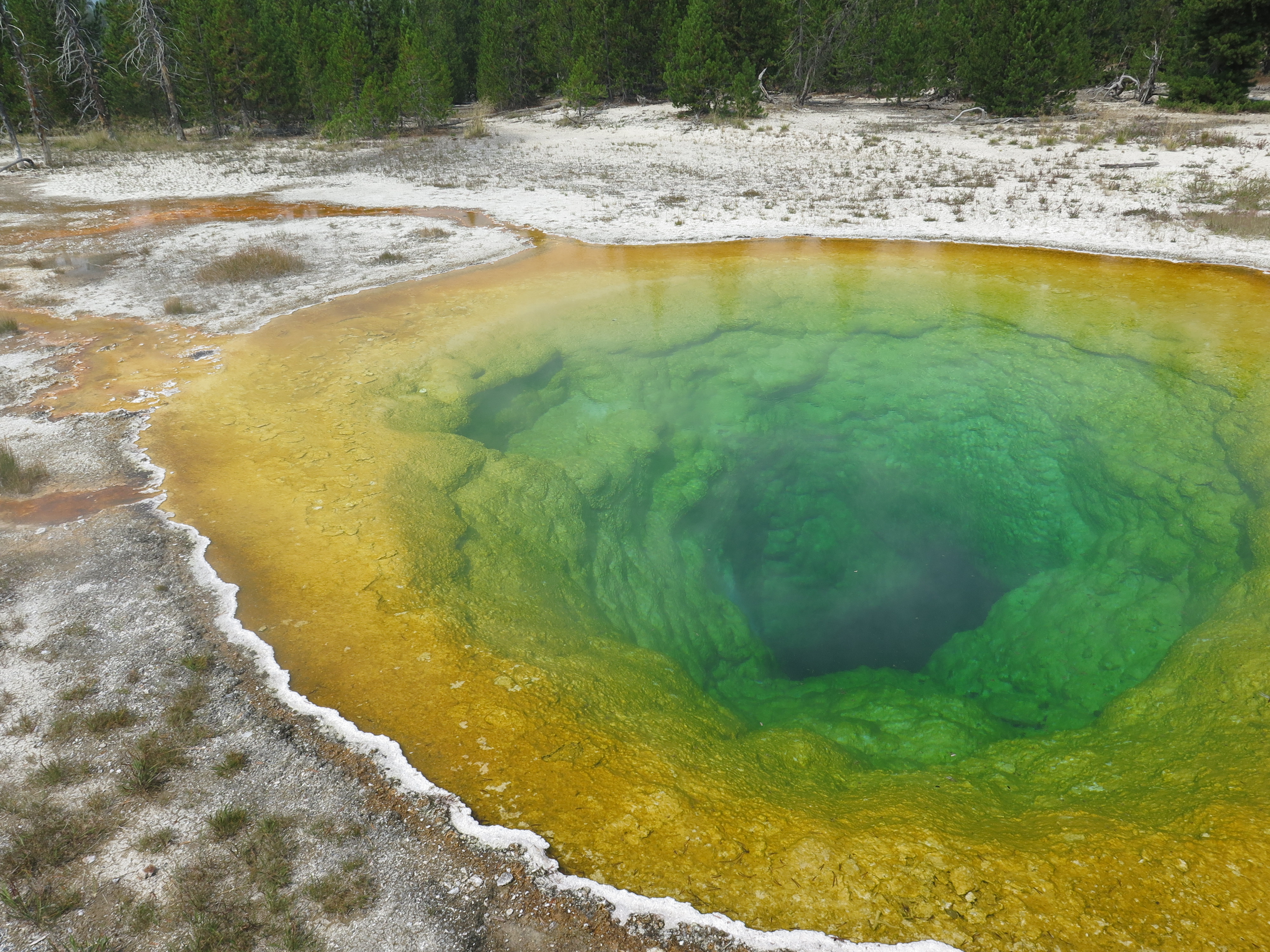
Morning Glory Pool and all of its glory
Well, after hiking a couple hours in the geyser area, Jamie and I hopped in our car and drove towards the south entrance, preparing for our swift departure out of Yellowstone. I know one day is not enough time to see all of Yellowstone. Someday in the future, I plan to return to witness the backcountry perspective of the park, as well as the other famous parts I missed this first time around. But, till then, Jamie and I must continue south to see what else the USA has to offer.
In my next post, I’ll share stories about Jackson, WY and Salt Lake City, UT.
Much love,
-Molly
 There were lots of people waiting for Old Faithful to erupt.

Hello friends,
Today is August 19th and by tomorrow I’m planning on being on the road. Where to? Well, my brother – who flew in last week – and I are renting a car and we’re going to wing it (mostly). We have four major places we want to see: Yellowstone National Forest/Grand Tetons, Zion National Park, the Grand Canyon, and Sequoia National Forest. How about everything in between? I have no idea, I guess we’ll just have to wait and see!

My bro posing in front of China Town. He’s happy because we had just eaten shrimp dumplings… yum.
It’s been over a week since my camping trip in Tahoe National Forest, and I’ve filled my last week in SF with some memorable moments. Such as, catching up with old friends, sightseeing with my brother, spending a day hiking Mt. Tamalpais, and finishing it all off with some theater. If you’re in town and want to see some pub comedy/plays, then check out SF Theater Pub’s annual Pint Sized Play Festival V. Within two hours, you can enjoy 11 short plays, some of which include topics such as beer, Star Wars, and llamas.
 Mt. Tamalpais: a 5-mile hike from the Rock Springs parking lot to West Point Inn to Mountain Theater
I’m lucky enough to have a brother-in-law who spoils his in-laws. On Sunday morning, my bro-in-law picked us up in a convertible and then we were whisked away towards Mt. Tamalpais. While driving through the city, I enjoyed cranking my head upwards and seeing the famous SF architecture from a whole new perspective. With no roof to block my view, I could see every bay window my heart desires, I could follow the aerial bus wires as we maneuvered the city streets, and I could enjoy the fresh SF bay wind blowing through my hair. We also drove on the Golden Gate Bridge, which was a treat.
It took us an hour of winding through mountain roads to reach our destination. While on the drive, we could tell it was a hot day, but it wasn’t until were were unpacking the car that I realized how hot it actually was. It was a dangerous, dry kind of heat; the kind that’ll dehydrate you pretty quickly. I didn’t pack enough water for both my brother and I, so I was grateful that Kevin brought extra water. We set off towards the Cataract trail, which eventually connects with the Bernstein trail. In this portion of the hike, there are grassland meadows and Douglas fir/tanoak trees. If it weren’t so dry, I’m sure the air would be moist, similar to a Pacific Northwest forest, but alas, California is in a serious drought.

Walking through the meadow
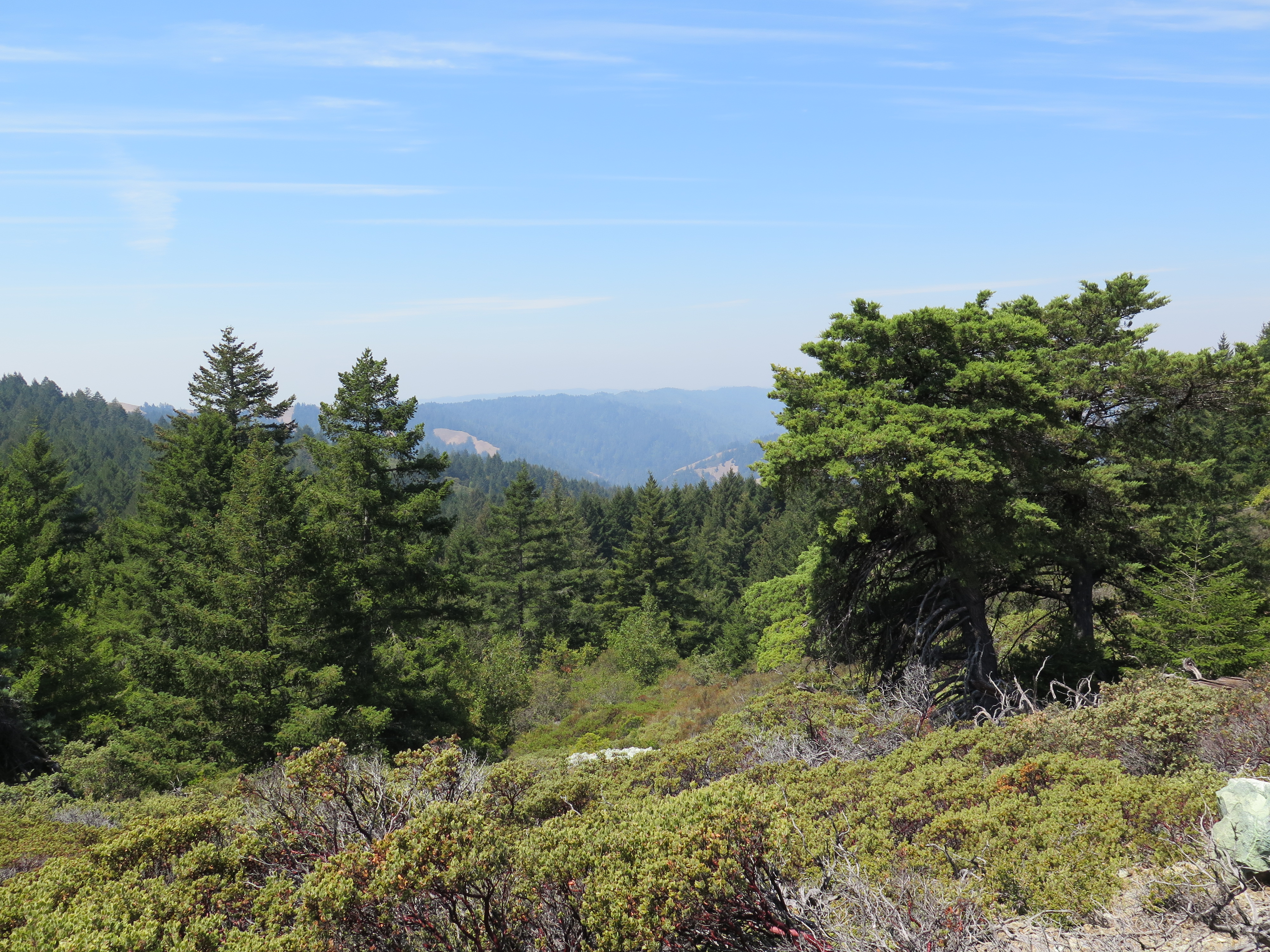
The views to the North
We followed the Petrero Meadows trail until Rifle Camp. We crossed through the picnic area and started our upward climb on the Northside trail. Except for the smokey haze due to the nearby forest fires, we saw some fantastic views to the north. The terrain got more rocky as we wove our way through serpentine ridge line. The trail itself was overgrown with a shrub called manzanita, sometimes even forming a natural tunnel. Near the top of the ridge line, we veered right onto International trail and followed it till we intersected with Ridgecrest Blvd. I believe we were at our highest elevation at this point and we got our first hazy view of San Francisco and the ocean. We started our descent down the Miller Trail and then took a right onto Old Railroad Grade trail. From here, it was a little less than a mile to our rest stop: West Point Inn.

West Point Inn – Looking towards SF 1905 (photo credit: westpointinn.com)
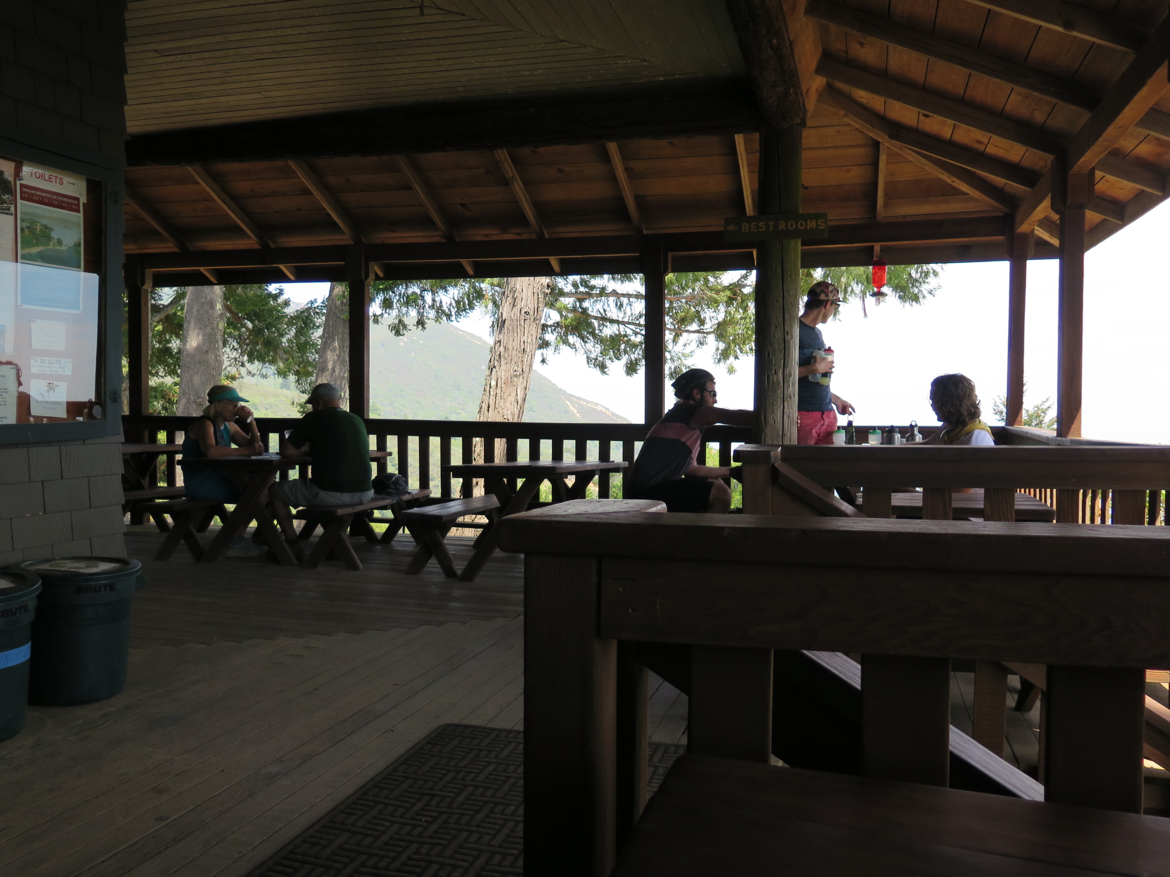 The Porch
West Point Inn is a really cool spot. It was built in 1904, and was used as a rest stop on the Mill Valley and Mt. Tamalpais Scenic Railway. Sadly, in 1915, the railroad closed and stage couch service stopped coming to West Point Inn all together. The years were rough during that time, wars and the Great Depression came and went, but thanks to the innkeeper and local volunteers, the buildings were maintained. Now, the cabins and main building are the only surviving buildings from the railroad era and are listed in the National Register of Historic Places.
West Point Inn is only reachable by foot and is perfect for travelers who don’t want to camp outside, but want a night in the mountains. For non-overnights, the inn is a haven for hikers and mountain bikers. There is water from a faucet, lemonade (for a $1), and snacks. There are also tables in the shade which offer respite from the elements, while also offering amazing views. If you’re around over the summer, there are pancake breakfasts every Sunday (I believe). All the pancake money goes into maintaining the historic nature of the inn.
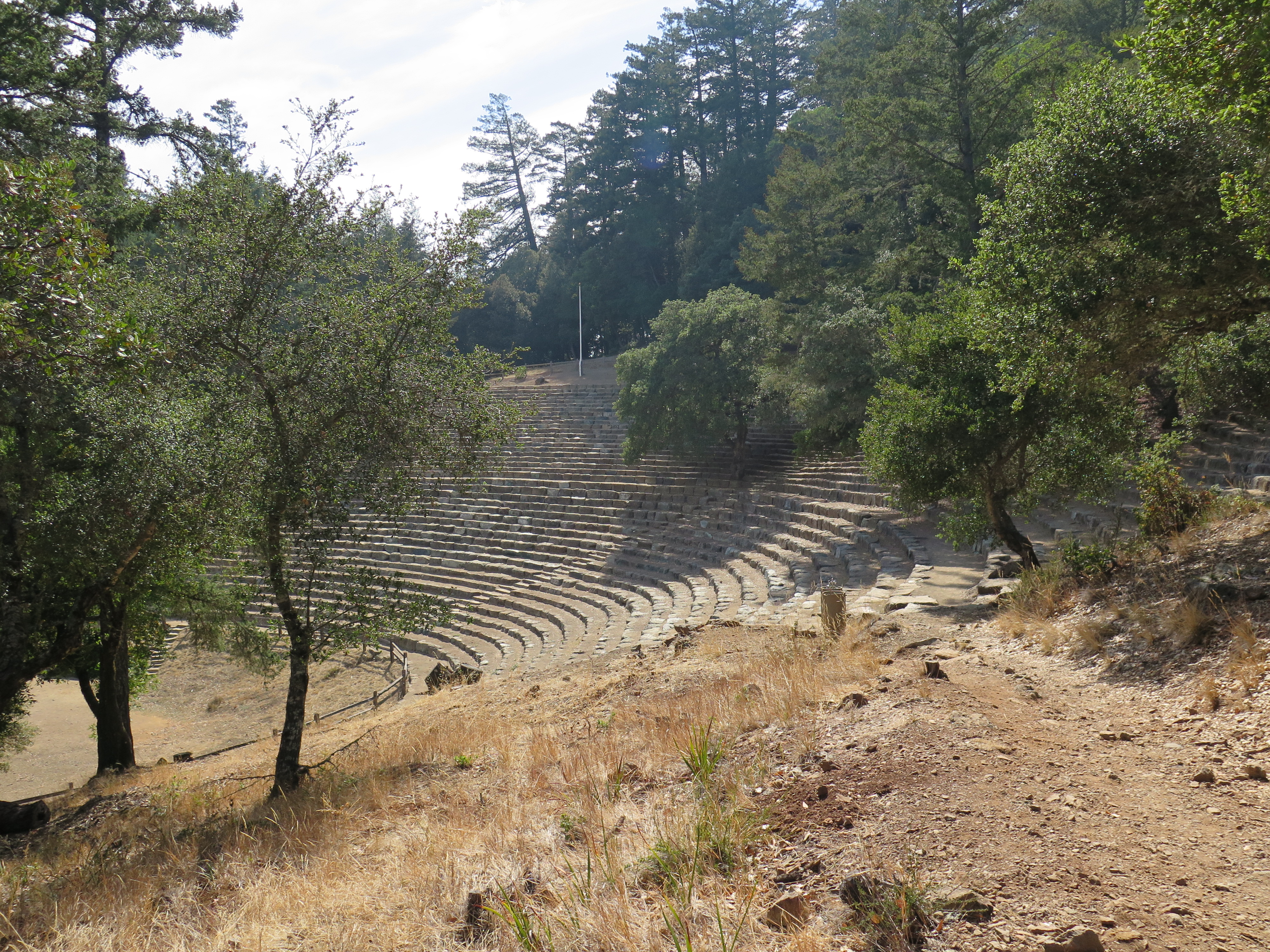
Mountain Theater (Sidney B. Cushing Memorial Amphitheater)
We rested and rehydrated for a while at West Point Inn, allowing our bodies to heal after the gruesomely hot hike we had just endured. When we felt recuperated, we said goodbye to West Point and followed signs to Rock Springs trail. For 1.5 miles, we traversed through exposed ridge line and shaded conifer forest until reaching our second destination for the day: Mountain Theater. Something you might’ve not known is that there is a theater venue nestled in Mt. Tamalpais. Mountain Theater (or Sidney B. Cushing Memorial Amphitheater) hosts one musical a year and can hold up to 4000 people. It has a great view of the SF Bay too. Overall, it’s a really neat venue and I’d recommend checking it out if you’re ever in the neighborhood.

Driving across the Golden Gate Bridge
It was a quick hike back to the parking lot from Mountain Theater. After 5 miles of hiking in dry heat, we were all exhausted, so we were pretty excited to take the scenic route back, enjoying the ocean breeze on our way back home. On our way back to the city, we drove on the Golden Gate Bridge again. The bridge had an orange glow, due to the setting sun, thus resulting in an epic view and return to San Francisco.
Thanks for reading. My next post will be about my experiences on the road. :)
Much love,
-Molly

Hello friends,
I am in San Francisco and I have been here for over a week. I’d like to say I filled last week with a bunch of fun SF stuff, but in actuality, I caught a cold. Though I was under the weather, I did fit in some fun stuff with my sis and brother-in-law. We cooked tasty food with friends (I made Japanese cabbage rolls… mmmm), we went to Sunday’s Finest – San Francisco’s wacky non-religious church service, and we went to a Chinese Ballroom Improv show! Okay, maybe I did fit in a lot of fun SF stuff… Well, another highlight of this last week was my weekend camping trip in Tahoe National Forest.
 It was a treat to wake up to Carr Lake’s calm waters
Camping at Tahoe National Forest’s Carr Lake
I was happy when my brother-in-law (Kevin) invited me to join him and his friends to Tahoe National Forest. On Friday afternoon, Kevin retrieved our rented Relay Ride car, we picked up our carpool buddies, and then we were off towards the Sierra mountain range. With some expected SF traffic, it took us about four hours, but it was well worth the drive. When we hiked the quarter mile to campsite 11, we were delighted to hear “hello” and “you made it!” from Kevin’s friends who got there earlier in the day. We were also welcomed with a warm fire and a few bites of delicious steak…mmmm. While sitting around the fire, I couldn’t stop peering up to the sky. The stars were spectacular; it had been far too long since I’d seen the Milky Way so crystal clear.
The next morning, I woke up quasi-early to the sounds of bees buzzing, water running, and friends snoring nearby. I felt cozy and warm in my sleeping bag and decided to embrace the moment. I laid in my tent listening to those sounds, while watching the pine trees sway from the wind.
 My tent and campsite. It’s a Hubba Hubba NX by MSR.
I was the first awake, so I decided to read my book and eat my breakfast on the cliff-lined shore of Carr Lake. (If you’re curious, I was reading Speaker for the Dead by Orson Scott Card.) I probably spent a good hour reading and enjoying my quiet morning. When everyone was awake and had their breakfast, there was a group decision to go hiking. Kevin had been here before and said there were a string of lakes nearby, each of which got prettier and prettier the farther you went. So, most of us packed our lunches, got our hiking shoes on, and walked east towards Island Lake.
 On the East side of Island Lake
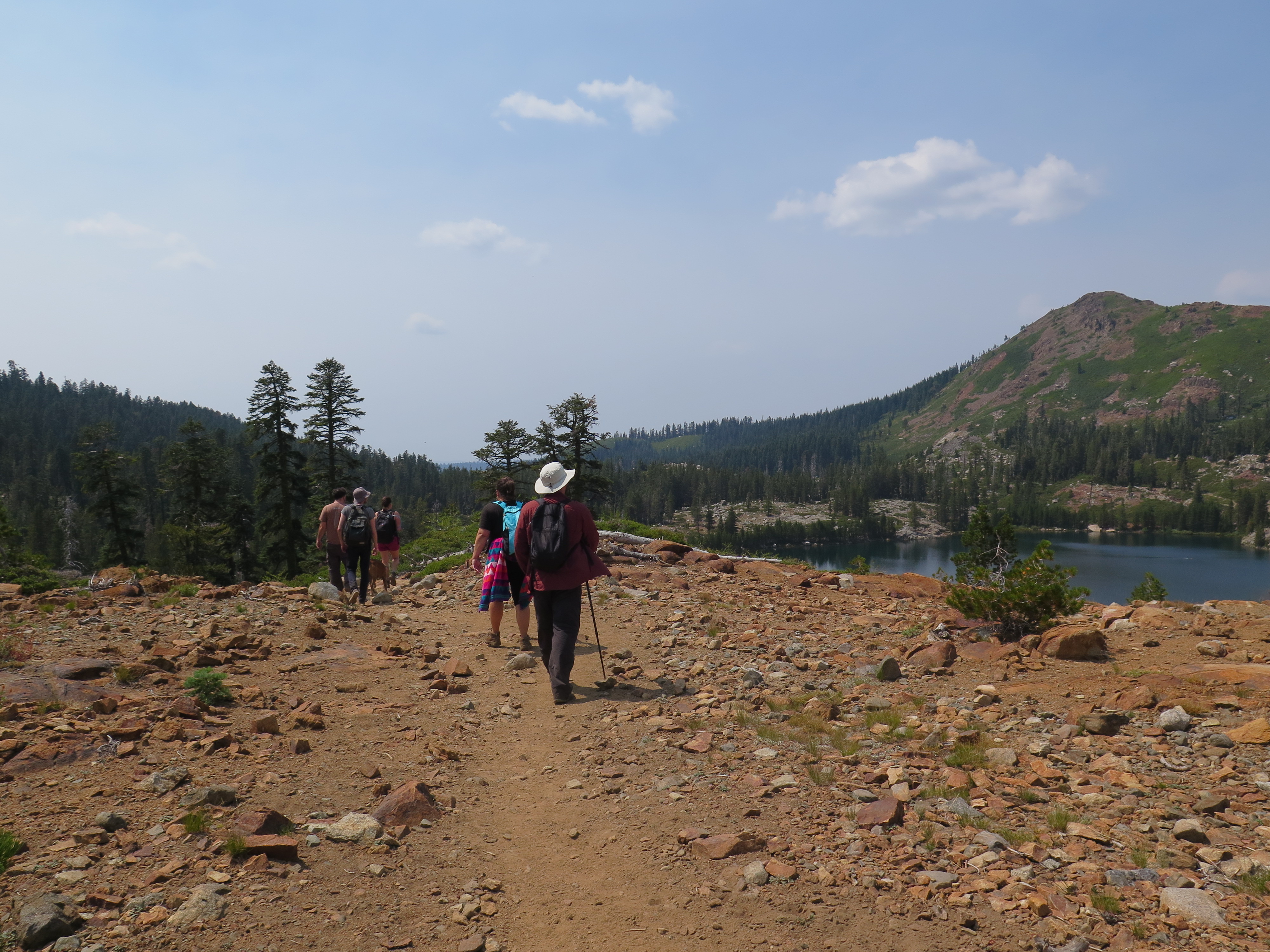
 Island lake
In total we hiked 5 miles and the trails we took led us through wooded glens, rocky lakeshore, and dusty peaks. I’m not often in the mountains, so it was a treat to hike in higher elevation (I believe we reached almost 7000ft) and to see some spectacular views of the Sierra mountain range. It was also pretty dusty on our hike, since California is in a drought. We ate lunch at Round Lake and we all decided to turn around to finish the day with swimming and relaxing by the fire. Instead of swimming, I went back to the campsite to rest my feet and to read my book.
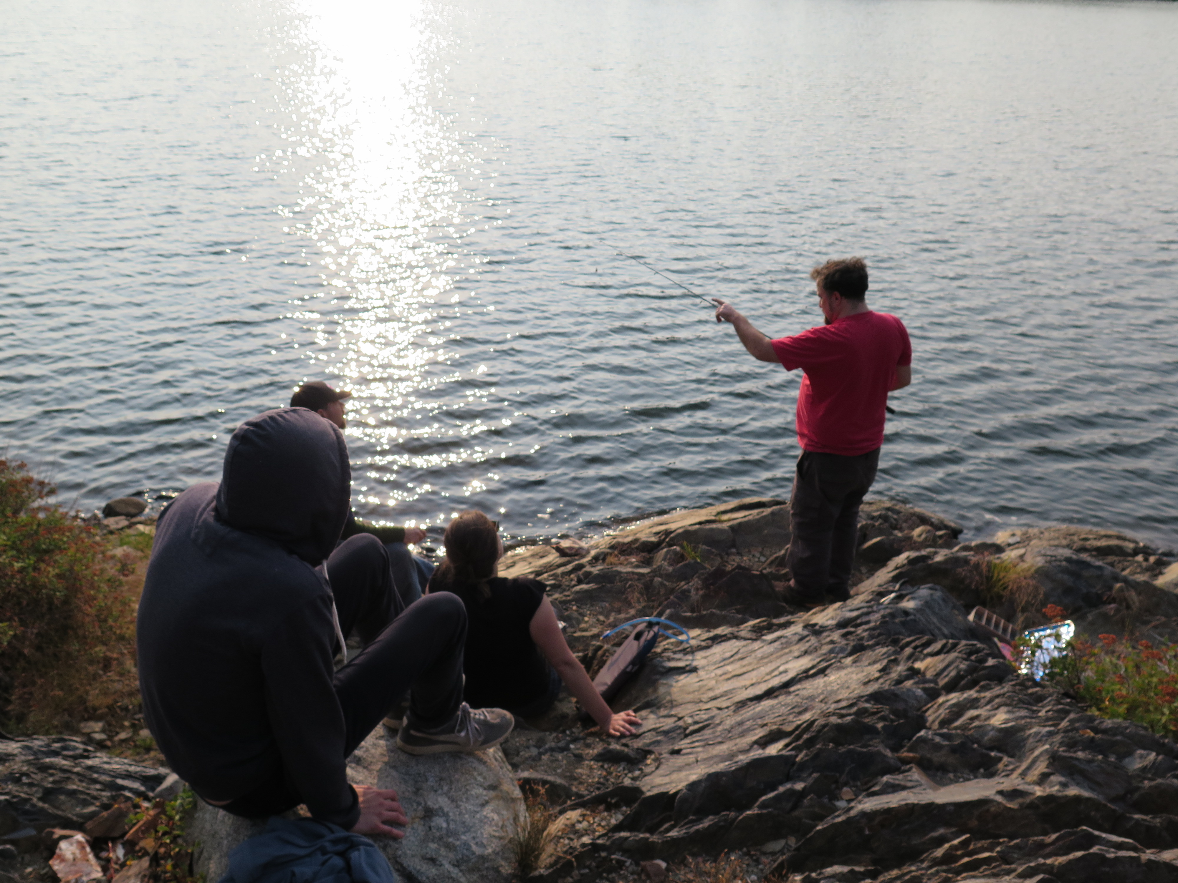 When people got back, some people took naps, while others joined me in reading around the fire. There was also a small group of people who went fishing. I stopped by the fishers for a short time, but then decided to climb/scramble the cliffs bordering the lake. When I got to the top, I could see for a long ways. I could see that we were bordering a wooded canyon to the West; It was beautiful. That night, we all made a huge pot of chile and ate under moonlight. We then sat around the fire and spent the rest of the evening talking, singing, and enjoying each others company – What a great night.
That night, I slept like a babe and woke up to a crisp, cool mountain morning. It was our last day at Carr lake and whenever I camp, I always pack my bag before doing anything else in the morning. It’s something I’ve learned from my camping experience. To me, there’s nothing better than packing up everything first thing in the morning and then not having to stress about packing up later in the day. When I was all packed up, I sat by the lake and finished my book. By that time, more people were up and coffee was being brewed. While drinking coffee, I recognized it was much hotter today and so did everyone else. It was decided that before leaving we should have one more swimming session, and soon enough, I was in my swim suit, inching slowly-but-surely into the Carr’s cold waters. Everyone else was already in, either swimming or floating in inner tubes. With some courage (and peer pressure), I jumped in and MAN was it cold!
After that, lunches were made and people slowly but surely started to pack up their stuff. Since I was packed up, I took extra time to relax by Carr Lake and get those last views saved into my memory. When all was packed and brought back to the cars, we all hugged goodbye and wished each other safe travels home. On our ride home, we decided to take the scenic route in the Sacramento Delta region. It was such a pretty drive, so much better than I-80.
Well, that’s that. Thanks for reading. Hopefully, in my next post I’ll have a game plan for my road trip. My brother flys in tonight and he’s going to join me. :)
Much love,
-Molly
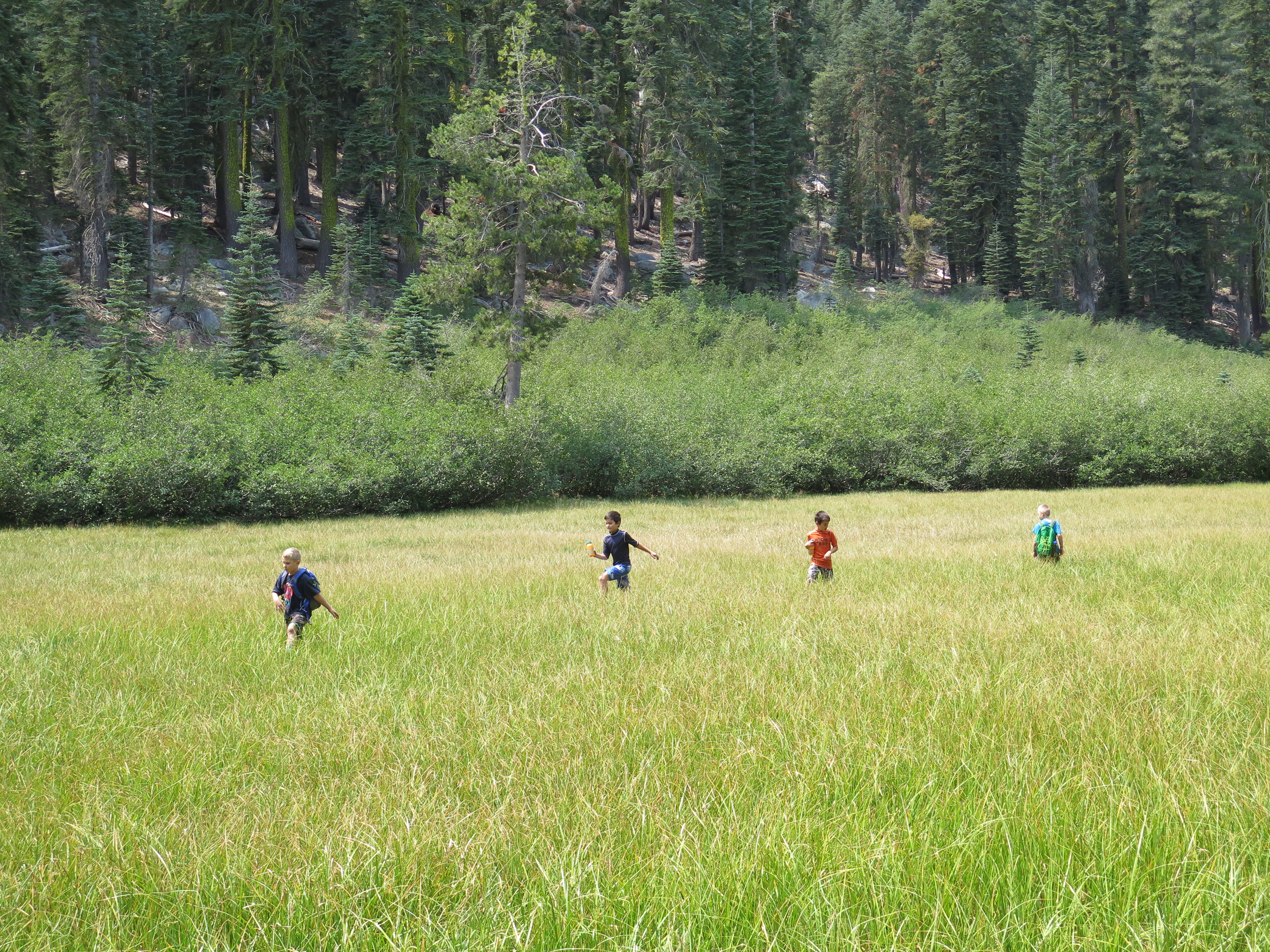 There were boys having the time of their lives while in Tahoe

Hello friends,
Today is my last day in Portland, OR. It’s bittersweet to leave such a beautiful city. Where else can you find towering Douglas-firs adjacent to exceptional food carts? I also don’t know of any other place that offers so many urban trails all within the city limits. I’ve been exploring them these last couple days and they’re awesome.
Starting last week, I was graced with the presence of a gentlemen named Mike. He’s my friend Ben’s roommate and he was kind enough to hang out with me on his days off from work. On those days, we went rock climbing at Portland’s Rock Gym, we ate lunch at Fire on the Mountain, and we made delicious homemade pizza together. But you know what has been my favorite part? It’s been the early morning coffee runs and long conversations we’ve shared. He’s good people and I’m very grateful to have had the chance to get to know him better. Good luck on your marathon, Mike! I have a good feeling that you’ll qualify for Boston. :)
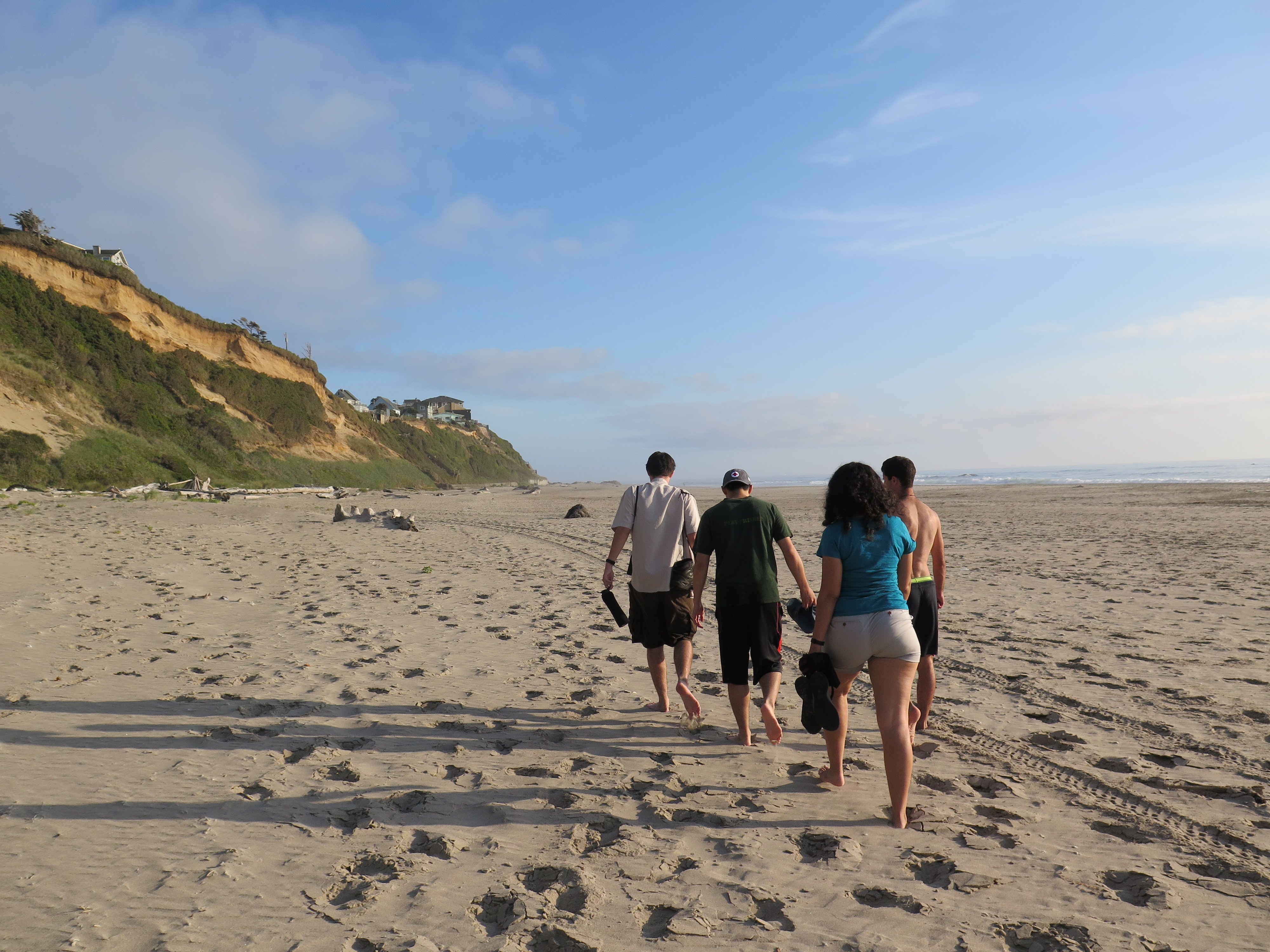
So, after a week of coffee runs and conversations, I found my way to Lincoln City’s Oregon Coast. My friend was having a birthday extravaganza and on the drive there, I watched as the flat Oregon countryside turned into hilly wine country to then the coastal mountain range. Oh, and I can’t forget that Queen was our inspirational road trip music.
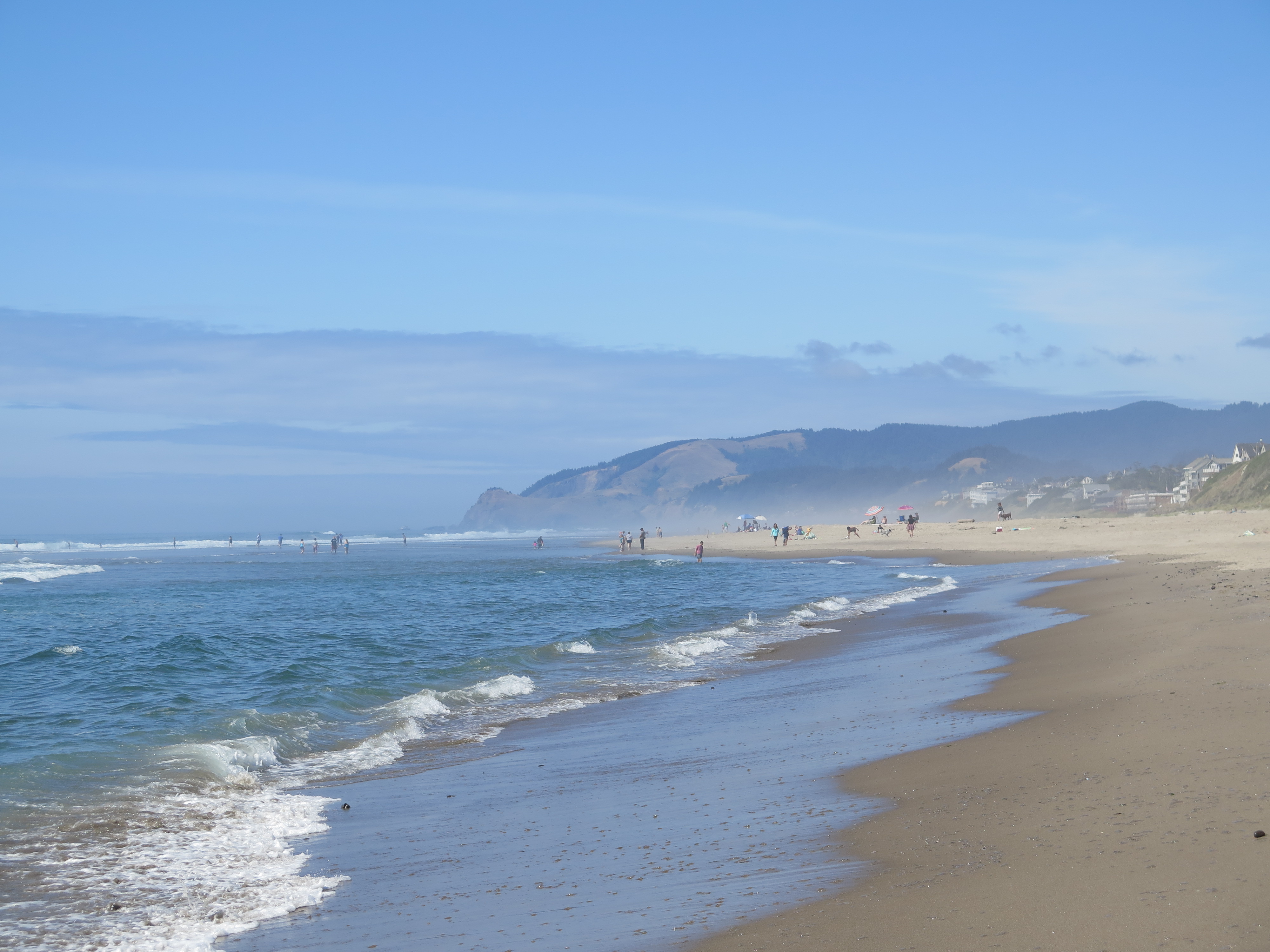
Lincoln City’s picturesque coastline 
We played frisbee on the beach!
We got there early and decided to take advantage of the beautiful day (a rarity on the Oregon Coast). We went to the beach and enjoyed ourselves. One friend did some taichi, another got their feet wet in the ocean, and I spent a few special moments walking along the beach by myself. It had been a long time since I’d been on the Oregon Coast. It felt good to have the Pacific’s frigid waters grace my feet once more.
We returned to the house to find more people inside. Many of them I had met in college and it was so great to see them again, especially my friend Neil. I hadn’t seen him in over 3 years. That first night was full of eating delicious food, sharing stories, relaxing in the hot tub, and then watching the sun set over the Pacific Ocean. In all honesty, watching the sun set over the horizon never gets old for me. <3
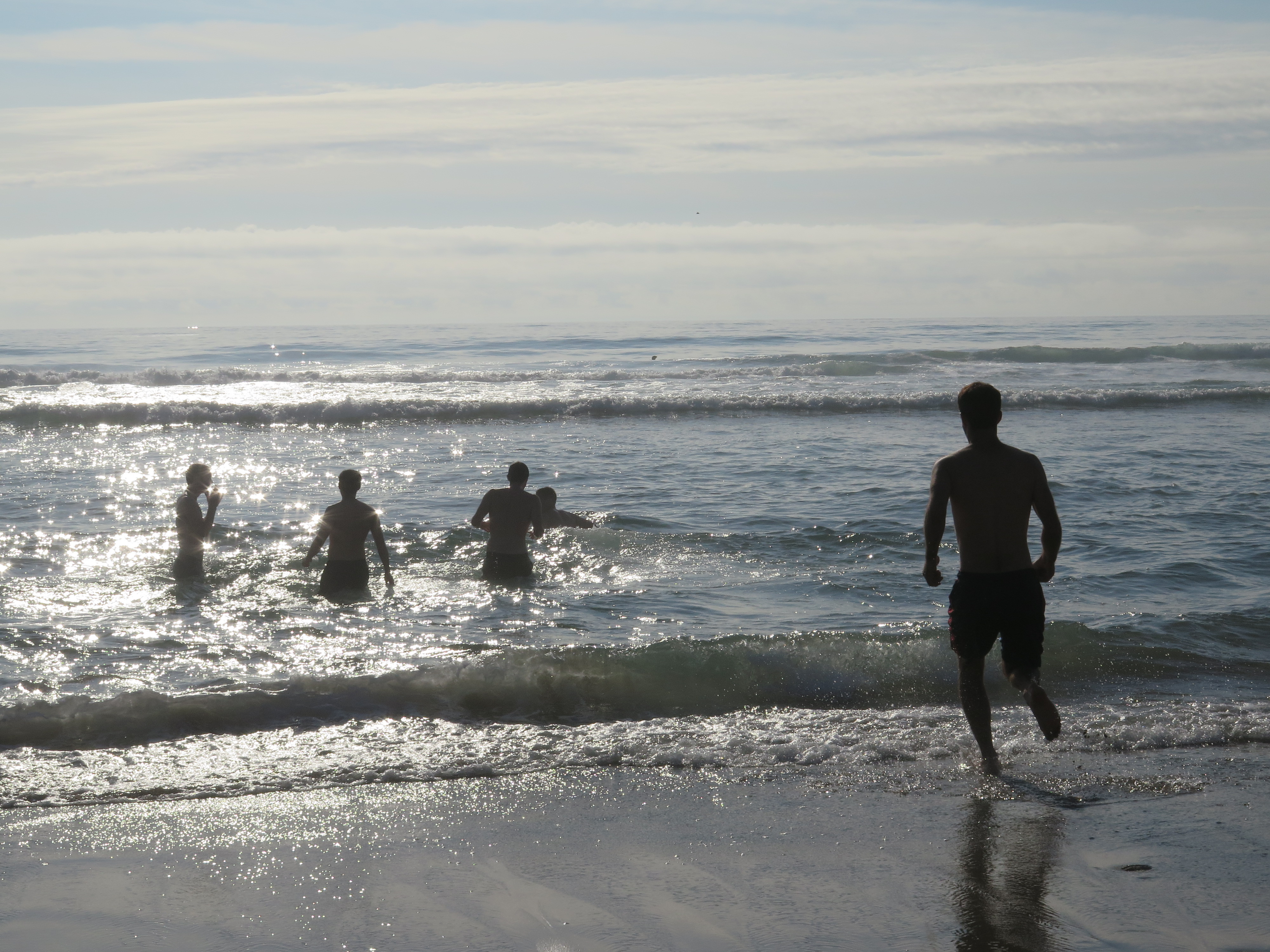
Braving the Pacific Ocean
Finding a staircase to take us back to our beach house

Photo cred Ariston
Before I go on much further about this beach party, I just want to give you a better idea of what Neil’s beach parties entail. There are traditions that Neil and his buddies have followed since high school. One of which is digging a giant pit into the sand and then finding a log to lay across it, thus creating (in Neil’s eyes) a Death Pit. For years, friends have fought, skin has been torn, and pride has been bruised, all for the chance to be the champion of the Death Pit battles. So, early on Saturday morning, a small crew and I started the long task on digging this Death Pit. It took most of the day, but when we finished, it looked pretty epic. We even hit the beach’s water table, which resulted in the bottom pooling with water. At first we were saddened, but soon realized the water only made the pit even more deadly!
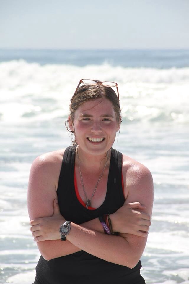 Photo from Ariston
The rest of the day, I relaxed and rested my sore shoulders and back. I took a nap on the beach and then decided to do what I’d never done before; jump into the Pacific Ocean. It was freezing! I don’t know if it was completely worth it…but I’m glad I did it.
There were moments when I sat on the beach, watching the tide come in, and thought how lucky I was to be there at that very moment. How I was lucky to have such great friends, to be blessed with perfect weather, and to have been given the chance to work and travel simultaneously. For that, I am grateful.
Honestly, the rest of the day was a blur. I believe some board games were played, dinner was prepared, and the sun had set. Once the moon had come up, I decided to do something that I’ve been wanting to do since May, which was scream as loud as I could at the ocean. When night fell, a group of us walked to the beach and then I separated from them. I walked to the shore, let the cold saltwater numb my toes, and I stood contemplating for awhile. Thinking of what? Well, I was thinking of my old roommate Paul. He’s the one who inspired me to scream at the ocean. While thinking and remembering him, some of my friends came up and said hello and asked what I was doing. I told them I was going to scream as loud as I could at the ocean. I thought they would be weirded out by this declaration, but they were not and highly encouraged it. In the end, we all screamed together and I belted as loud as I could.
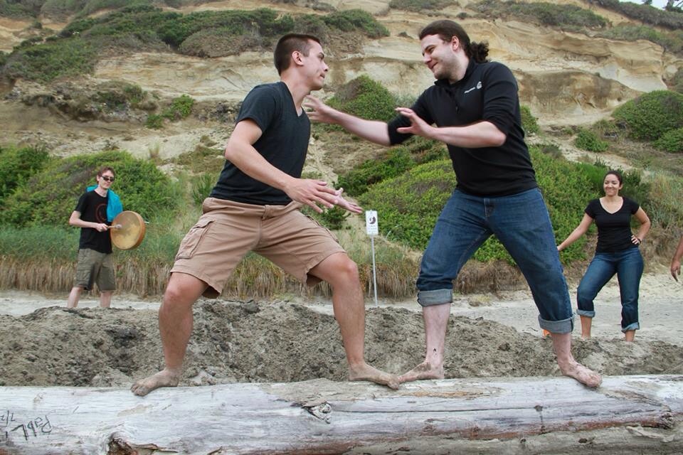 Photo cred Ariston
Well, after that, all that was left to do was the fight over the Death Pit and man was it intense.
It was dark, there was a storm brewing in the distance, and somehow, almost all the participants returned back to their ancestral state. For some of the participants, it was mostly fun and fear that fueled them to fight, but there were a select few who were fueled by adrenaline. As I sat by the fire, watching as men tangled and wrestled on the log, I felt like I was reliving Lord of the Flies. There was even a battle drum, which was continually played throughout the whole thing. There were some heroic leaps, a dazzling kung-fu style evasion, and a little bit of blood spilled; and let’s not forget about the crowd who was yelling and urging the participants on. In the end, there was a winner, and damn was it a close call, but I was glad when it was over. That was enough intensity for one night.
For the rest of the evening, the whole group sat around the fire, laughing, drinking beer, and playing games. I also learned of a new tradition, which was reading a raunchy romance novel around the campfire. The book was called Lobster and it was about a human woman who falls in love/lusts for a Lobster. Yeah, it was weird, but I believe that’s the point for that tradition. To find the weirdest book possible, read it aloud, and see how uncomfortable people can get. Man, what an unforgettable night.

Hiking Cascade Head
The next morning was clean up time. We packed up our stuff, swept the floors, and got ourselves outta the house. As a group, we decided to do one more fun thing before the weekend was done and that was to go hiking at Cascade Head. I was super excited to hike in coastal old growth forest again!
It was a short hike, but it was jam packed with stunning views of the Oregon Coast and humbling moments among the Sitka Spruce-Western Hemlock coastal rainforest. When we reached the top, I sat among friends looking out to the ocean and I felt very happy.

A smooch for one of my favorite people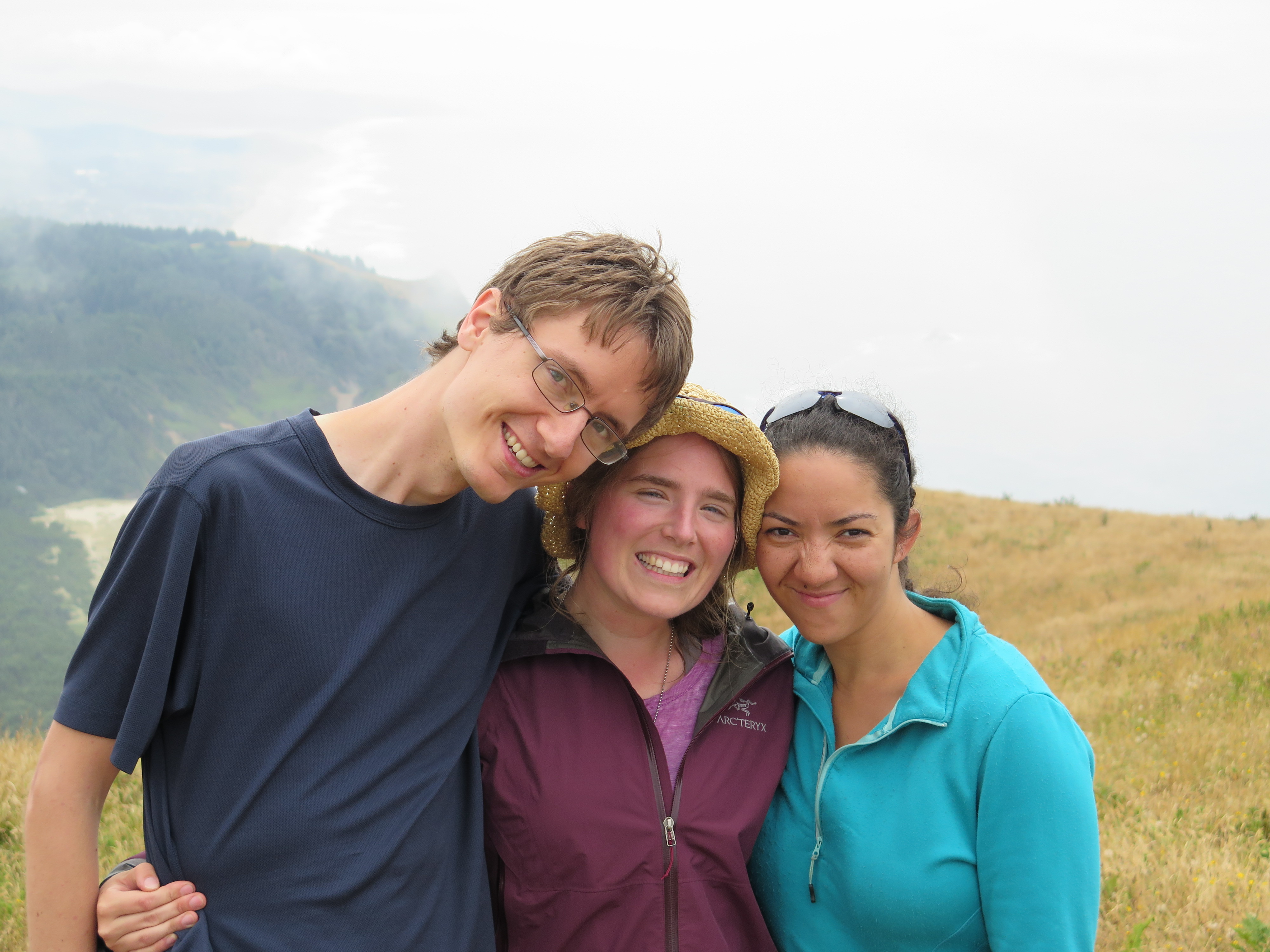 Two of my favorite people. I was in their wedding 4 years ago.
Thanks for reading. My next stop is San Francisco to visit my sister and brother-in-law. <3
Much love,
-Molly

Such an amazing trail!

