

Hello Friends,
I made it to Portland and I’ve been here for almost a week. It’s been great catching up with old friends and exploring new parts of the city. Let’s not forget about the amazing donuts this city has to offer too. I’m partial to Blue Star myself.
As for what I have been up to, well my friend Ben has kept me busy. One morning, we woke up early to go blueberry picking. It’s the season and man are they delicious. Ben’s friend, Chris, joined us and we ended up making breakfast/blueberry muffins afterwards. Yum. It was decided by Ben and Chris that we should go hiking somewhere. Chris knew of a place called Indian Point, but had never been there himself. We all decided to go hike there the following day!

Hiking to the Infamous Indian Point
(All photos were taken by Chris Knight)
We woke up bright and early to start our way to the Columbia River Gorge. It had been at least 6 years since I’d driven through the gorge (I had gone to Multnomah Falls once upon a time). While on the road, I’d forgotten how beautiful the gorge was. I spent those 1.5 hours glued to the window, watching each cliff pass by.
 Chris, Ben, and I eventually made it to the trailhead and within minutes (and one cute picture of Ben and I!), we were on trail. This was my first time hiking in old growth Douglas-fir forest in a long while and man have I missed those big fir trees. The San Juans (from last week) had huge fir trees, but hiking beside Douglas-firs brought back good memories of my time living and studying in Eugene, OR.
Pretty near to the start of the trail, we saw signs for the Pacific Crest Trail (PCT). We didn’t go, but it made me happy to know that I was nearby. Instead of the PCT, we took the Herman Creek Trail up towards the Herman camp, and then we took a left at Gorton Creek Trail. This trail was a little overgrown and was narrow at times, but that just made the trail even better. I enjoy hiking in a more rugged environment anyway! There was also some elevation changes by this point too. Though the elevation wasn’t too dramatic, I could tell my Minnesotan lungs were not prepared for some of those switchbacks.
As we hiked, the trail weaved along ridge line and took us higher and higher above the tree tops. There were times where downed logs blocked our path, but a simple hop-and-a-skip over did the trick. After a few miles, we finally reached the Ridge Cutoff crossroads. Chris’ hiking guide said to look for an unmarked trail just passed the fork. At the bottom of this trail was the infamous Indian Point. And lo-and-behold, we found it!
 It was a helluva steep decline though, which most definitely meant a helluva steep climb back out, but I tried not to think about that as I climbed into the abyss. Halfway down, there was a clearing in the brush and we could see a cliff side and a beautiful view of the Columbia River Gorge. It was only a taste of what was to come.
At the bottom, we reached a narrow clearing. On our right was a steep cliff and to our left were prickly shrubs. From here, we got a great view of the Washington mountain range. We didn’t know what mountain we saw, but it sure was majestic. After that, it was only a handful of steps more till we found our halfway mark: Indian Point.
The views were phenomenal. From one side, you could see shear cliffs with the Columbia River Gorge as the backdrop. The other, Indian Point with the Washington mountains as your backdrop. It was a win-win. Ben and I took our shoes off and snacked, while Chris went out onto Indian Point to take some awesome photos. Though, it isn’t encouraged to hike/climb out onto Indian Point, we did see a nice fellow climb it and it seemed pretty epic.
We spent a long while embracing our surrounding (as well as resting our aching feet). Eventually, we did say goodbye to Indian Point and climbed out of the unmarked trail. The rest of the hike went well. We did a loop, so instead of retracing our steps down the Gorton Creek Trail, we took the Ridge Cutoff Trail, which then connected to the Nick Eaton Trail.
 The Nick Eaton Trail was fantastic. It had good understory growth, which meant it had younger Douglas-fir and cedar trees bordering its trail. This resulted in some pretty flowers and more bird sightings. This trail was pretty steep though and I couldn’t decide if it was better or worse to climb down the steeper trail (the world may never know).
 There was one more epic vista with Mount Hood’s cap in the distance.
Though I was reaching my Molly Hulk stage (which means I was a little h-angry, since I didn’t pack enough food), the rest of the hike went swimmingly. The trail lowered us to the Herman Creek Trail, where we then returned back to the parking lot.
For anyone looking for a trail that’s off the beaten track, I’d recommend Indian Point. The views were amazing and the narrow trails were just dangerous enough to be thrilling.
Thanks for reading. For my next adventure, I’ll be traveling to the Oregon Coast for a friend’s birthday extravaganza. I’m looking very much forward to it.
Much love,
-Molly
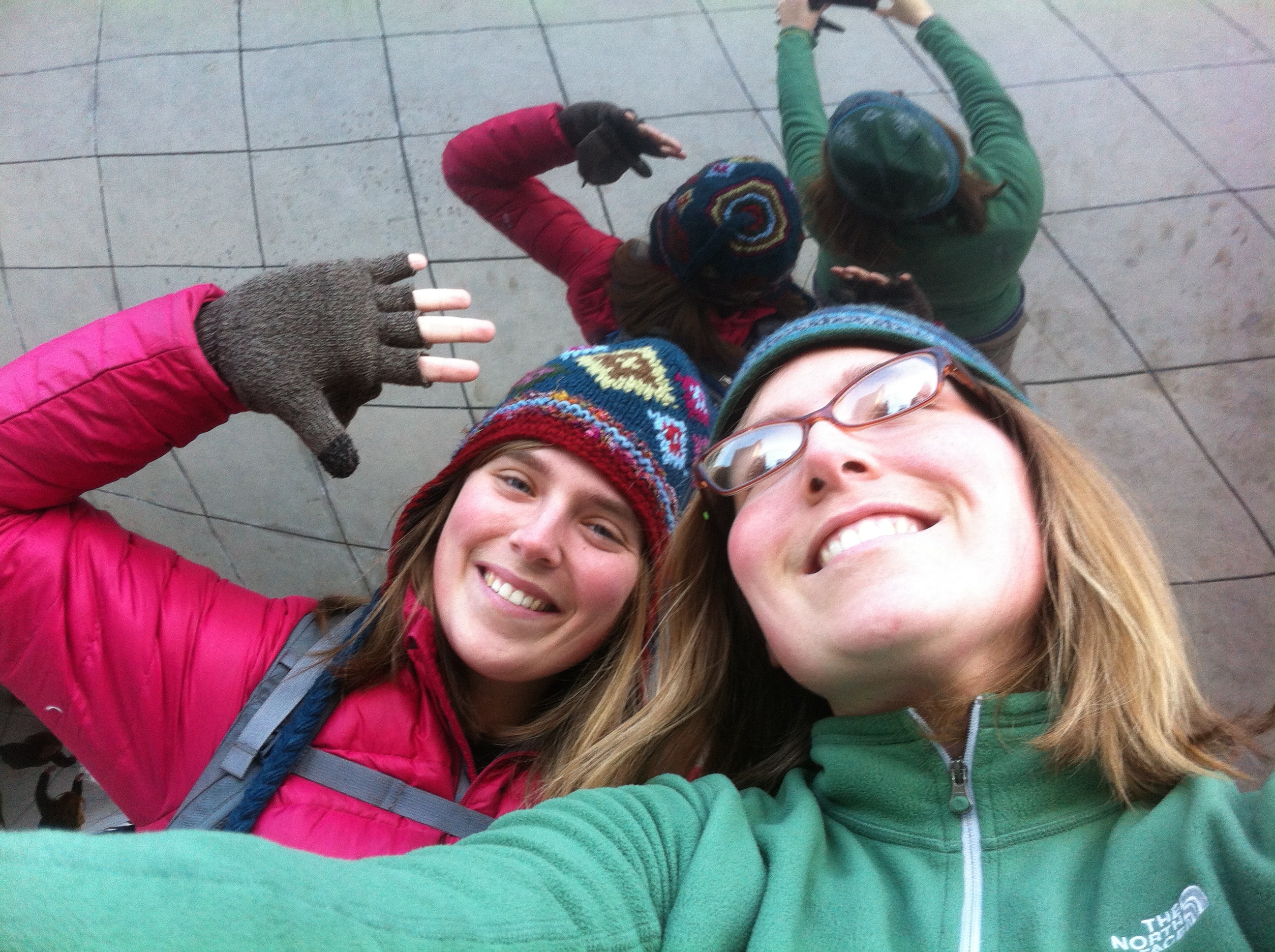
 Chris, me, and Ben

It is official. As of last Wednesday, I am on the road. It feels good to have everything I need in a backpack again. For me, there is nothing better than entering a new city/place with an open-mind and a packed backpack.
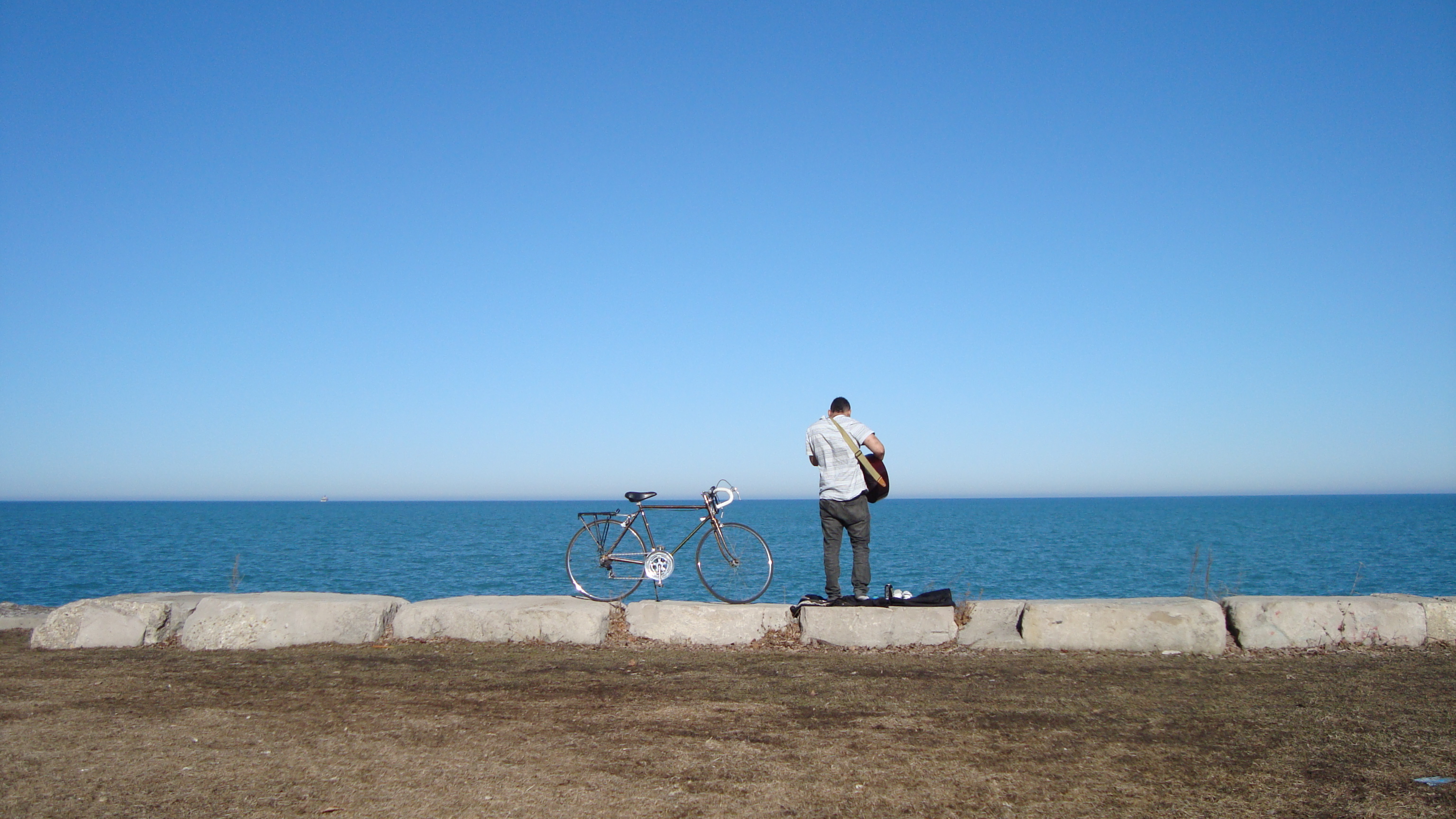
I caught a one-way ticket to Seattle and decided to spend a few days there. It had been over 10 years since I’d been to Seattle, so I was looking forward to seeing the city again. After dropping off my bags and getting my bearings, I caught a bus to the city center. I decided to be a hardcore tourist for my first day, so I went to Seattle’s most famous sites: Pikes Place Market and the Space Needle.
I enjoyed my time walking through the market, especially the outdoor part. I also can’t forget to mention about the fish throwing. I totally forgot how much of a spectacle it is, watching fish fly across a crowd of people. I then continued walking through the city, letting the Space Needle be my guide.
After seeing the Needle and eating delicious clam chowder, I met a very friendly lady named Youjin. She bought me a peach and invited me to walk along the pier with her. Soon after, we met a nice man named Fearas (my spelling is probably off). We all had one thing in common: we were all traveling alone. Soon enough, we were all friends and I brought up the idea to explore a new part of Seattle called Lincoln Park. They were delighted and we all jumped into Fearas’ car.
The park itself has dirt trails meandering through tall firs and pines. We walked through this area until we reached a cliff edge. We followed this trail till it started to veer down towards the sound (the water). Now this is the trail to write home about. This paved path offers pedestrians and cyclists a fantastic view of Seattle’s sound. It was so beautiful down there and a must-see if you have a car in Seattle. I was happy to share this experience with my new friends.

I thought the day couldn’t get better, but after being dropped off at my friend’s house by Fearas, I received a text message from a stranger from couchsurfing.com. The message said that a group of people was going up to the San Juan Islands for a day hike and that there was one spot open. Without hesitation, I said yes and asked when and where they were meeting. They said they were meeting at 7am in downtown Seattle the following morning. I told them I’d be there.
San Juan Islands: Orcas Island and Mt. Constitution
I caught the 6am bus to get to downtown Seattle in time for our rendezvous. We met on a street corner, 2nd and Pike, and I was the first to arrive. It’s always a funny experience to find people who you’ve never met before. I end up giving everyone a “are you a couchsurfer look,” and then if there is no response, I look sheepishly away. Luckily, my big hiking boots were a dead giveaway and Corinna was to first to find me, then Brad, and then Randy. Soon enough there was a gaggle of couchsurfers, ready and excited to explore the San Juan Islands.
The drive up to the ferry building was nice and easy. We even made it with time to spare. We drove the car onto the ferry and then once we were unanchored, we all went up above deck to enjoy the hour long ride. When we got to the outer railing, I stood and watched my surroundings. The scenery was so picturesque, I couldn’t believe that someplace so beautiful was only a short drive from Seattle. As we went along, I noticed that each island had their own shape and personality. They all seemed to be covered in firs and hemlocks and some had houses/cabins on the shore, while others seemed uninhabited.
When we reached Orcas Island, we were all very much ready to get up into the mountains. But, we weren’t there quite yet, we had to drive for another 20-30 minutes to get to the island’s largest park: Moran State Park. This park is famous for its’ tallest peak, Mt. Constitution, which (supposedly) has the best view of the San Juan Islands. Our goal that day was to reach the top.

Once we parked our car, we all jumped out, got our hiking shoes on, and hit the trails. It was evident that these trails were going to be exceptional. It smelled of fresh detritus, the fir trees were thick, its crevasses deep, and the trail followed ridge line to ridge line through open valleys and narrow gorges.
There were moments on trail that I felt so small. Once, we entered a mossy valley, which seem to have been untouched for centuries (except for the path we were on). The firs and hemlocks were so tall and completely covered in moss and lichen. While walking past them, though they were so tall, they seemed small in comparison to the cliffs that flanked us on both sides. There were also the moments when we were hiking along a ridge line and you could see the sound through the thick stand of trees.

I’d say it took us almost 2 hours to reach the top (we didn’t start at the bottom, we started at Cold Springs trailhead). We were getting pretty winded by the time we reached the top, but goodness was it worth it. There was even an observatory tower that made the view on top of Mt. Constitution much grander. From the tower, you could see Vancouver B.C., Mt. Rainier, Mt. Baker, and the northern Cascades. I sat upon the edge and looked out into the distance for a long time. It is hard to believe that within 48 hours, I had found myself in one of the prettiest places I’ve ever been. I am very thankful for my new friends who invited me to join them on their trip.
The best part of the whole trip was watching the sunset on the ferry ride back to Anacortes, WA. It had been far too long since I’d seen a sun set over the ocean.

One of my goals for this trip is to see as many beautiful places as possible. I want to fill my life with happiness, beauty, and new experiences. It has definitely started out with a bang and I look forward to what more is to come.
Much love,
-Molly

Hello friends,
It has been awhile. As you can see in my title, a lot has happened since my hammock camping trip on the Superior Hiking Trail. I’d love to say that it was all good things, such as…
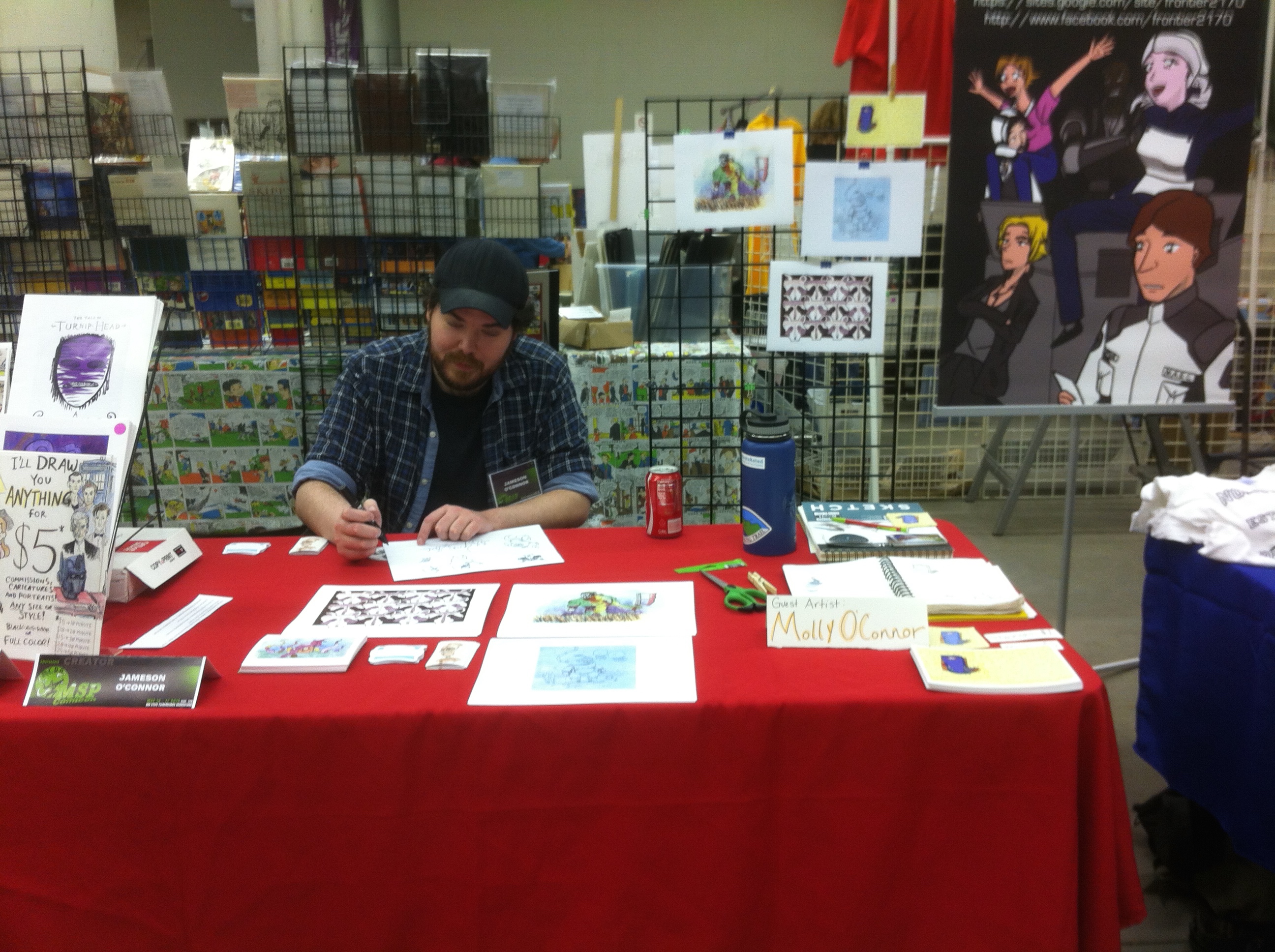 Tabling at MSP Spring Comic Con with my talented brother…
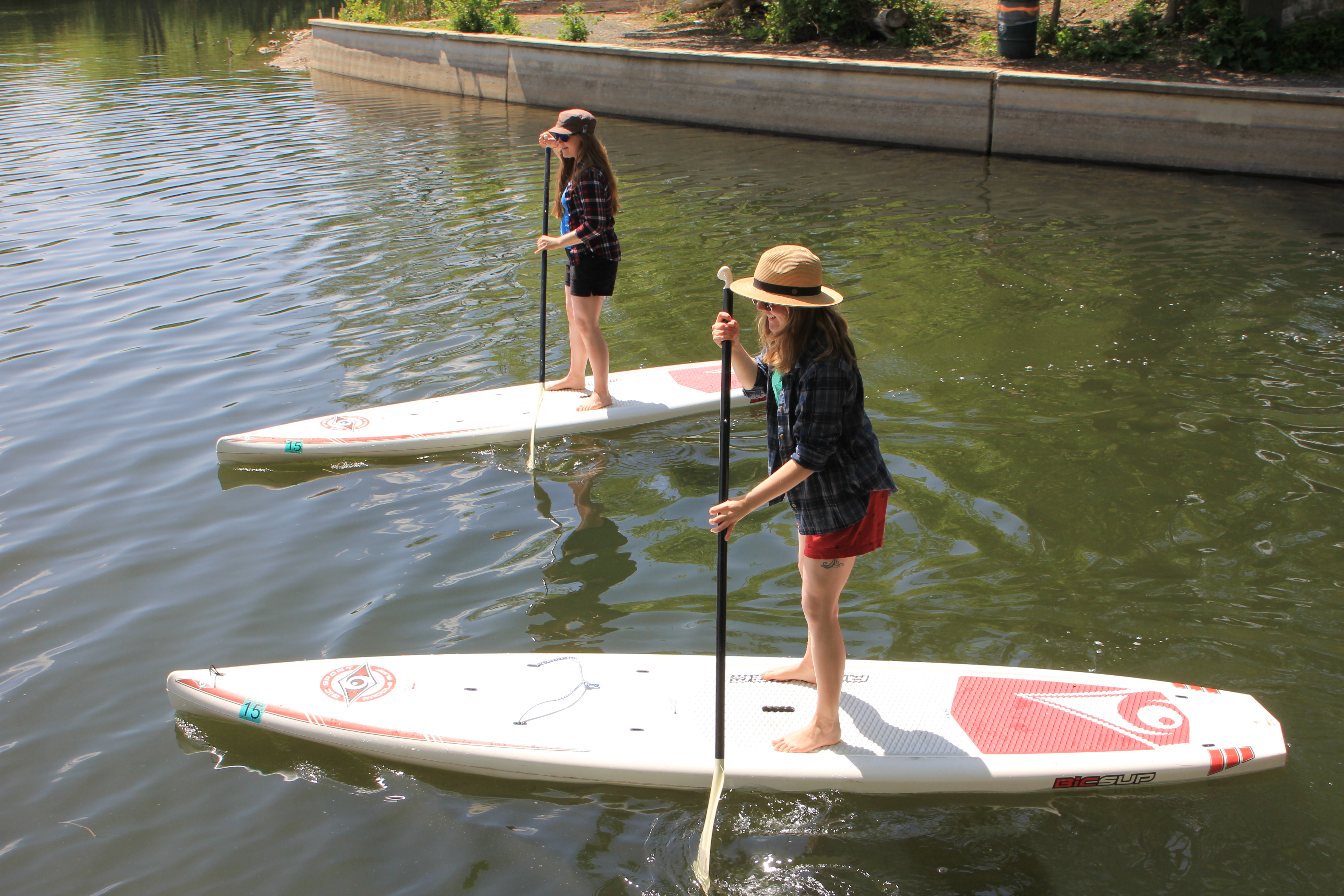 Taking photos of my friends paddle boarding at the Chain of Lakes for a RootsRated feature…
 And exploring Medicine Lake’s urban wilderness with my brother.
But, sadly there was a terrible and traumatic thing that happened. On May 19th, my roommate Paul made the choice to take his own life and it was his father and I who discovered him the following morning.
 Paul is on the right. (Photo cred: David Cooperman)
As the days went by, I learned a lot about Paul through his family and friends. I learned that he had been battling with depression and anxiety for most of his life. He left a note, which explained how he saw himself as an individual, as well as describing his inner torment and self loathing. His note brought a little clarity to the situation, but it still left me (and everyone else) with so many questions.
One tear-jerker for me was (and still is) that Paul didn’t realize how wonderful he was. Paul was beautiful inside and out. He read weekly for the blind, he was a huge advocate for bicyclist rights, and he has helped countless friends through their own troubles. He was a selfless man, and very humble. Due to his depression, instead of understanding his worth as a friend and human being, his mind told him constantly that he was ugly, dumb, incapable, and worthless.
 I’ve been reading a lot about depression and anxiety lately, hoping it will help me better understand Paul and my other friends who I know have depression. I’ve been reading The Chemistry of Joy by Henry Emmons, which is a self-help book for people with depression. I’ve also read a few articles about the science behind anxiety. But, what has been most helpful to me is hearing personal stories from my friends. Since Paul’s death, people have reached out and have shared with me their personal struggles with depression and even attempts of suicide. They shared with me their perspective of life, the side effects of medication, and how depression and anxiety are a daily struggle for many people. It’s their stories that have brought me better understanding.
It’s hard to see a bright side to something so tragic, but I have learned to be grateful for a few things.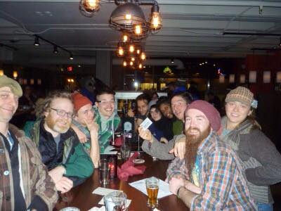
Photo cred: Pizza Luce Trivia Mafia
1. Paul had wonderful friends who have been so helpful to me and Paul’s family. I’m lucky to know them and I now consider a handful of them as new friends. I look forward to sharing new experiences with them. <3
2. Through this experience, I believe I gained a whole new level of empathy, especially for people with mental illness. I know I will be much more patient and gentle with people who are prone to anxiety and depression.
3. I have realized that even during a very traumatic situation, I am capable of being a responsible first responder. I called 911, I took care of Paul’s father, and a slew of other things. Though it was mostly adrenaline that kept me on my two feet, I’m still astounded at how I dealt with the situation.
I’m grateful for all the training I had as a Resident Assistant, as well as for the First Responder course I took in college, and let’s not forget the countless CPR/First Aid trainings I’ve been through. I remember sitting through my first responder class and my RA trainings, thinking that everything I learned was interesting, but also thinking that it’ll never happen to me. But, when it does, it’s crazy how all the training floods back to your brain.
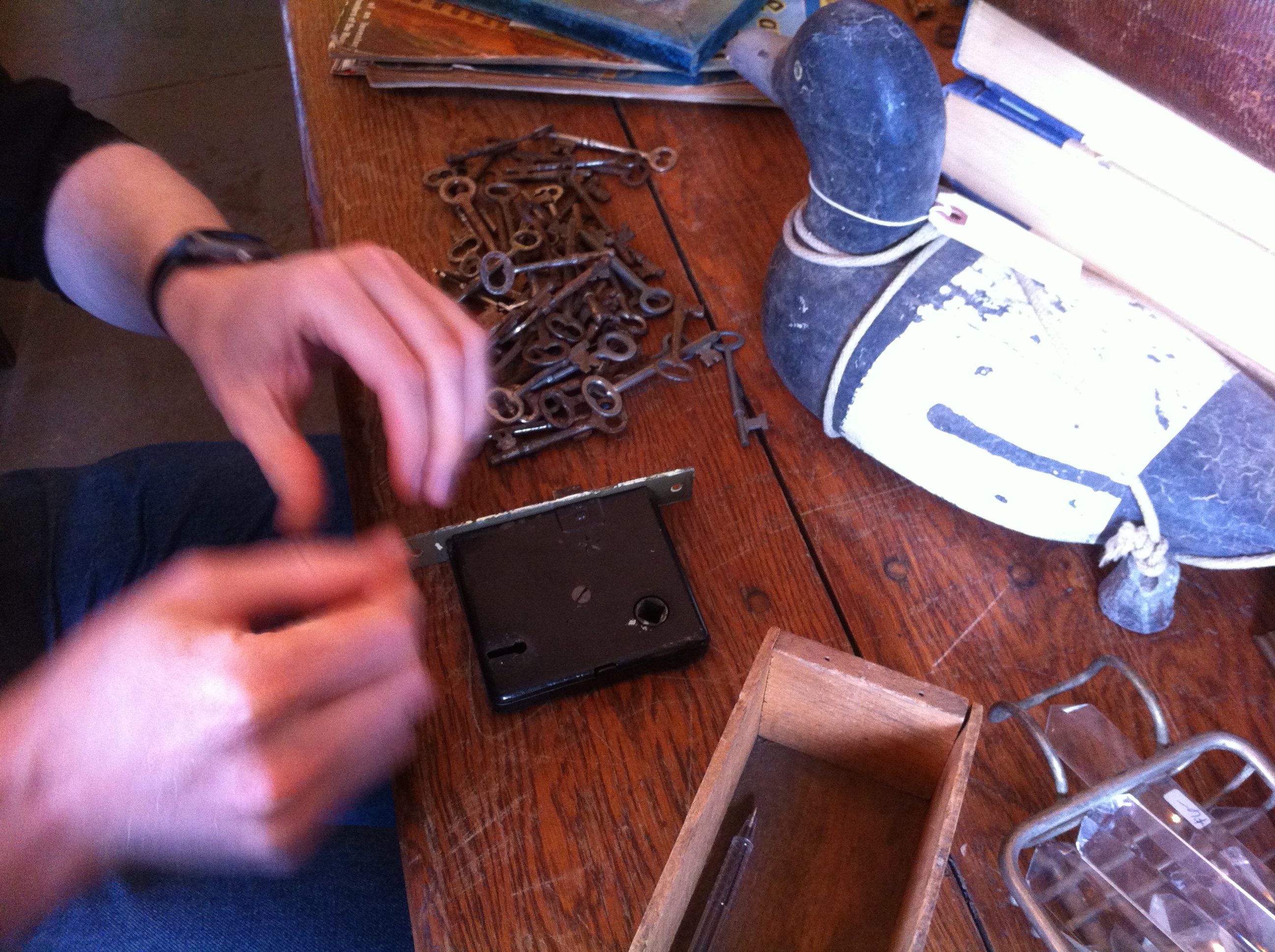 4. I’m also grateful to have met Paul. Though I didn’t know him for too long, I’m glad to have had the chance to get to know him the little that I did. Some good memories include: spending an afternoon looking for skeleton keys and eating cupcakes, cooking and eating Japanese food together, going to trivia, and sharing travel stories over tea.
A friend joked with me that I am supernatural. That I have an inhuman amount of inner resilience. And maybe I am. Maybe I’m actually an alien. But from reading The Chemistry of Joy, I’ve come to learn that some people are born with a higher capacity to deal with hard situations, while others don’t have that natural “container full of magical resilience potion.” The people that don’t have inner resilience are often the people prone to depression and anxiety. I’m lucky and very grateful to have the capability to deal with stress and sadness (though, I promise you, it still isn’t easy.) Also, I think practicing zen meditation has been a key factor to my self healing. Not to mention that being able to calm your mind is huge for trauma therapy. So, I’m also grateful to my sensei, Lin-san, who gave me the opportunity to study zen meditation at Tokurinji Temple.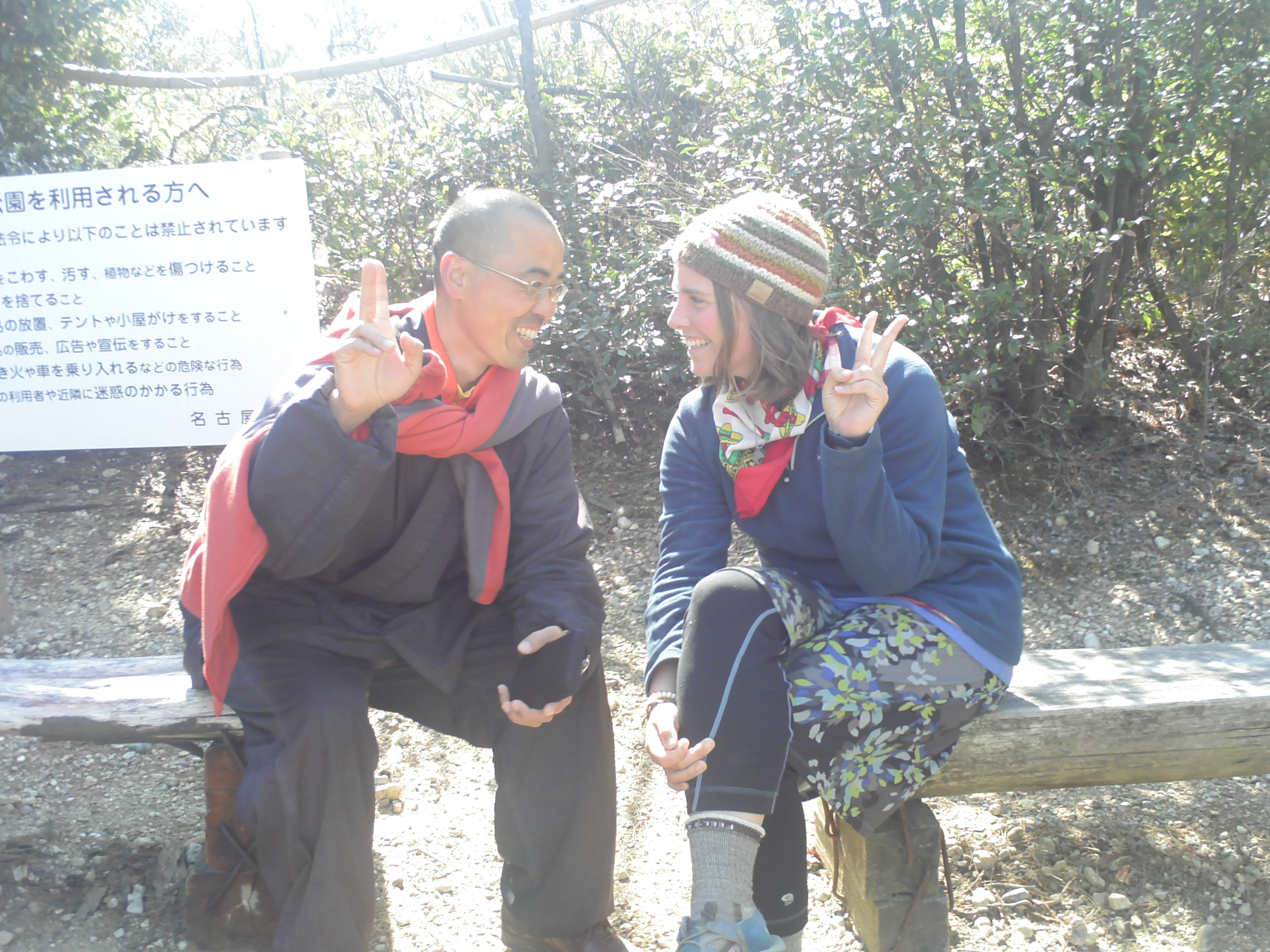
Lin-san and I
So yeah, it sounds weird to be grateful for things, but as a grieving person, I think it’s good to find a silver lining, even in the worst situations.
Well, now you guys are up to speed with my life (for better or for worse). As of now, I’m still in Minneapolis, but I plan on traveling to Oregon in July. I believe I’ll be going on a road trip across the USA with my co-workers at RootsRated starting July 28th.
I’ll tell you details in my next post.
Much love,
-Molly
 On a happy note, this is the print I made for MSP SpringCon. I made stickers too. It’s me sleeping under the stars in Mongolia’s Gobi Desert.

Hello friends,
In my last post, I was putzing around on my bicycle and I shared a video I made for my Japan presentation. Well, a lot has happened since then. I went to the May Day Parade for the first time and enjoyed it immensely. If you happen to be in Minneapolis during the first weekend in May, you’ve gotta see May Day!

After the parade, there is a play run by volunteers, which revolves around the theme of rebirth. This year’s story was based on #BlackLivesMatter.
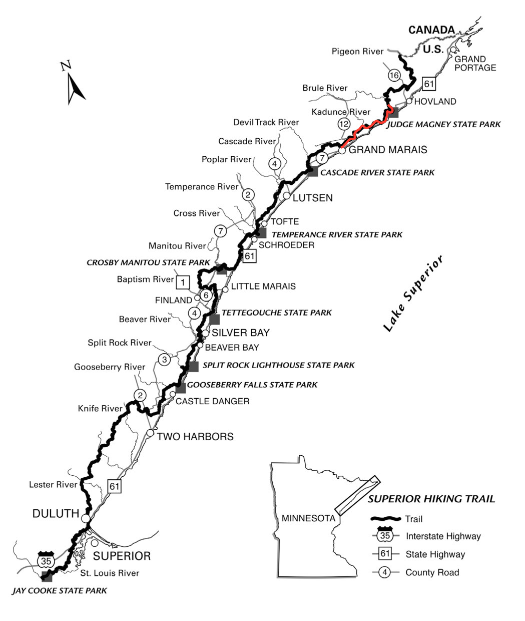
As for after May Day, the following weekend opened up for me. At first I thought I could get a lot done, mostly pertaining to laundry, prep for MSP Comic Con (which is this weekend! Come see me and my bro!), and a list of other things. But, then I thought about the last time I had gone camping, which had been ages ago (last Fall in the BWCA). It was a no-brainer, without hesitation, I headed north to Minnesota’s Superior Hiking Trail (SHT).

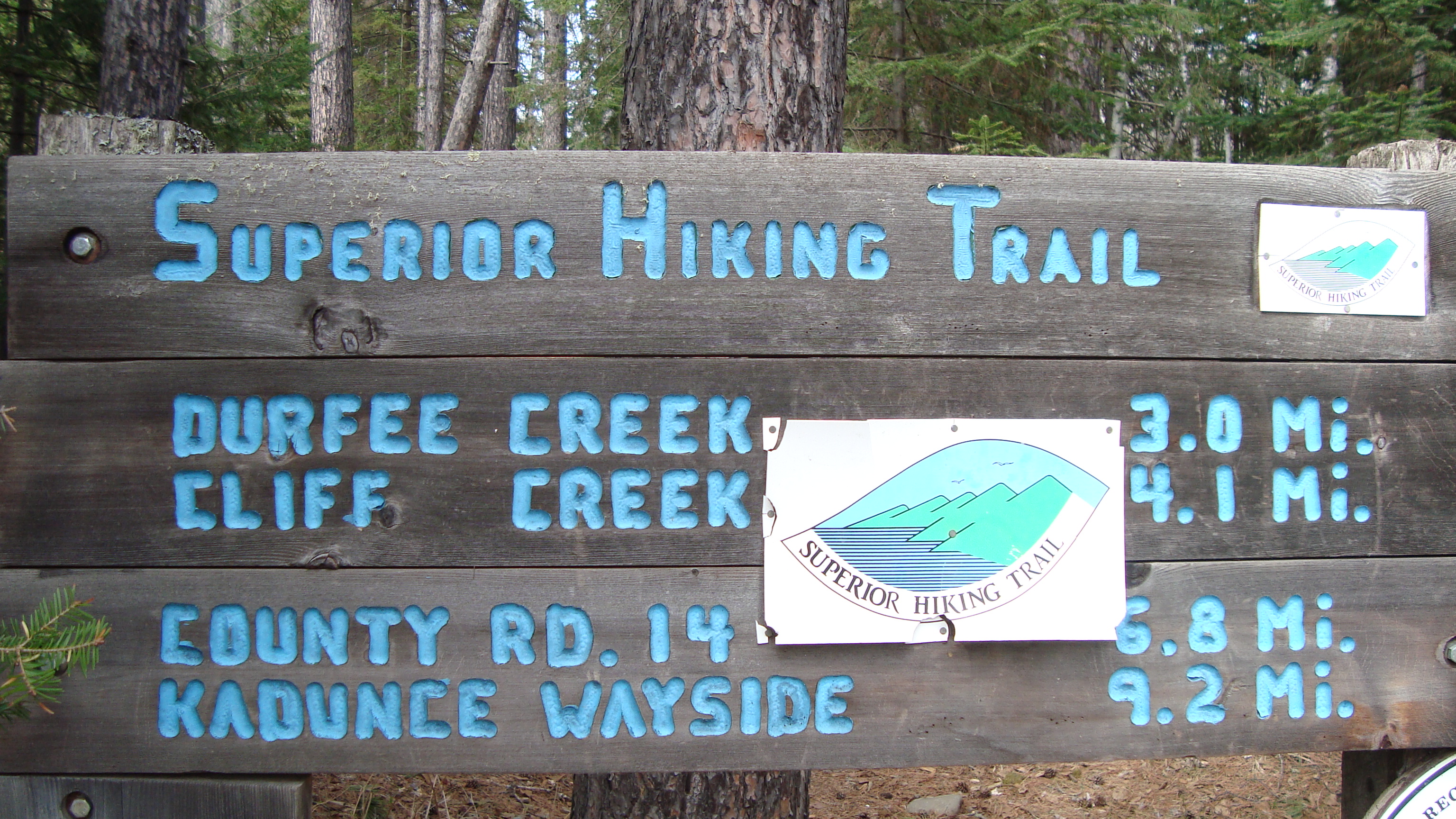
This is a trail marker. You can find them all along the SHT. They help guide you through the rugged terrain.
Hammock Camping on the SHT
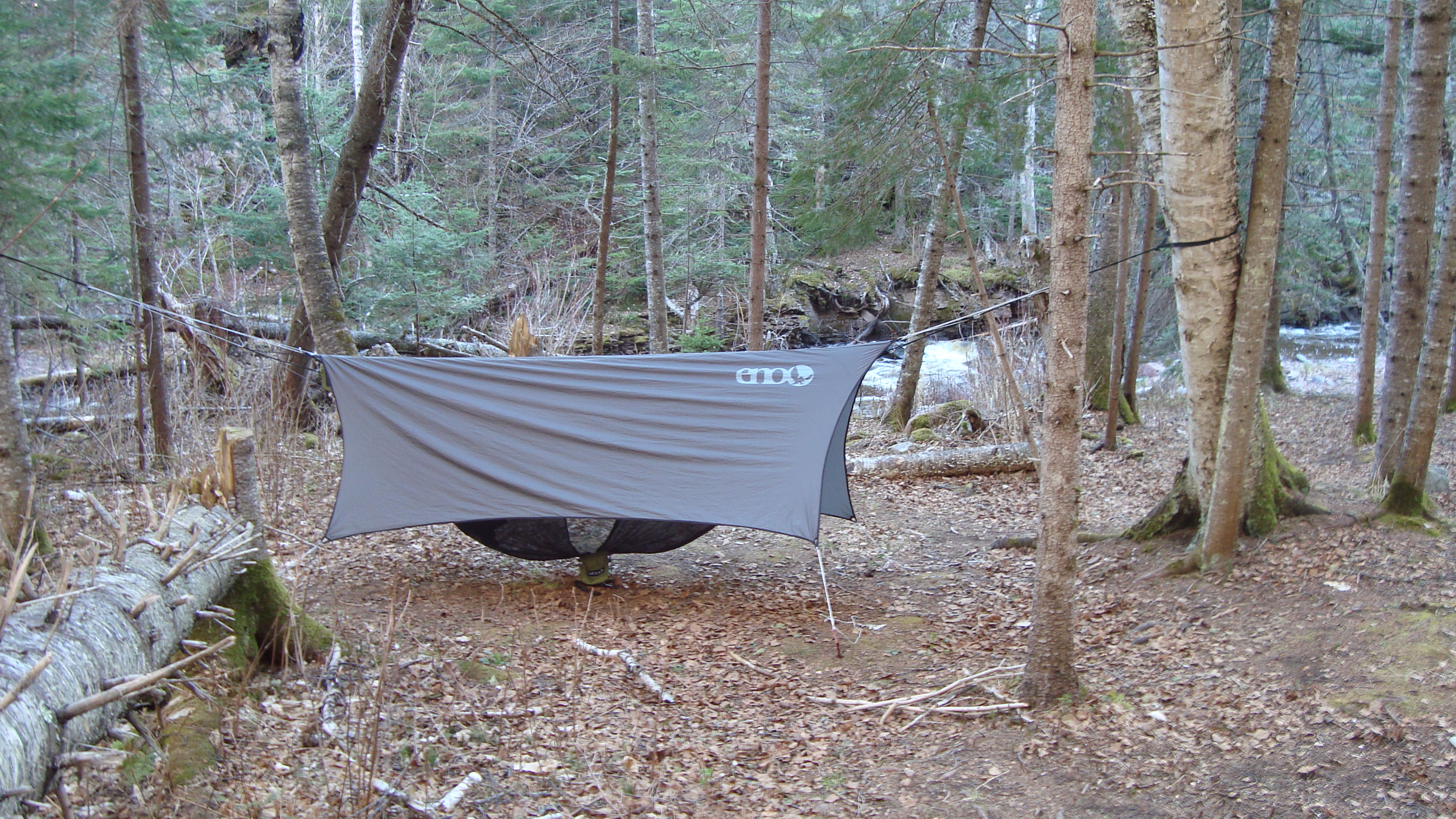
So why hammock camping? Well, I work at an outdoor store and I’ve heard a lot of my coworkers rave about hammock camping. I was skeptical, since I have been using a tent for a long time, but I was also intrigued. Luckily, one of my coworkers let me use his whole ENO (Eagle Nest Outfitters) hammock set. This included the hammock, an underbelly to stow your gear, a bug net, and a rainfly tarp. I didn’t weigh it, but I would say it is pretty comparable to the weight/size of a 2-person tent.
Now, for my planning. I didn’t plan too far ahead. What’s nice about the SHT is that you don’t need to. Thanks to the Superior Hiking Trail Association (SHTA) and the Superior National Forest, the 296-mile long trail hosts 96 backcountry campsites and dozens of easily accessible trailheads for no cost at all (no permits either!). So, the next time you have some money or time to donate, consider helping out the SHTA. They are the reason this awesome trail exists.
In total, I hiked 26.6 miles in 3 days.
The only thing I did plan is where I’d be starting and finishing and how I’d get there. I decided to start at Judge Magney State Park, which is famous for it’s mysterious Devil’s Kettle Falls, and then walk for 3-4 days south to Pincushion Mountain (just outside of Grand Marais). Something most backpackers do is park their car at a trailhead and then they get a ride to the other trailhead. They then hike back to their car. This is what I did, so I parked my car at Pincushion and then asked Harriet Quarles Transportation to give me a ride to Judge Magney. For one person, it cost $47, but it gets less expensive the more people you have in the car. There are other transportation services too.

Judge Magney’s Devil’s Kettle Falls. It’s famous for being split in half. One half flows over the rock face, the other half falls into the rock face. No one knows where the water escapes to.
Day 1: Judge Magney State Park (plus 2-mile hike in and out to Devil’s Kettle) to South Little Brule River campsite. (~5 miles)
My first day was a long one. After the 4 hour drive, plus the transportation to Judge Magney, I was tired mentally, but not physically. When my driver dropped me off, I put on my pack and started my hike to Devil’s Kettle Falls. Though the trail was well marked, it was pretty rugged. Probably due to the recent rainfall, the trail was muddy and hard to climb at times (especially with a pack on your back!). It was all worth it though after getting to the falls. I’m happy to say that I’ve witnessed the mysterious flow of the Devil’s Kettle.
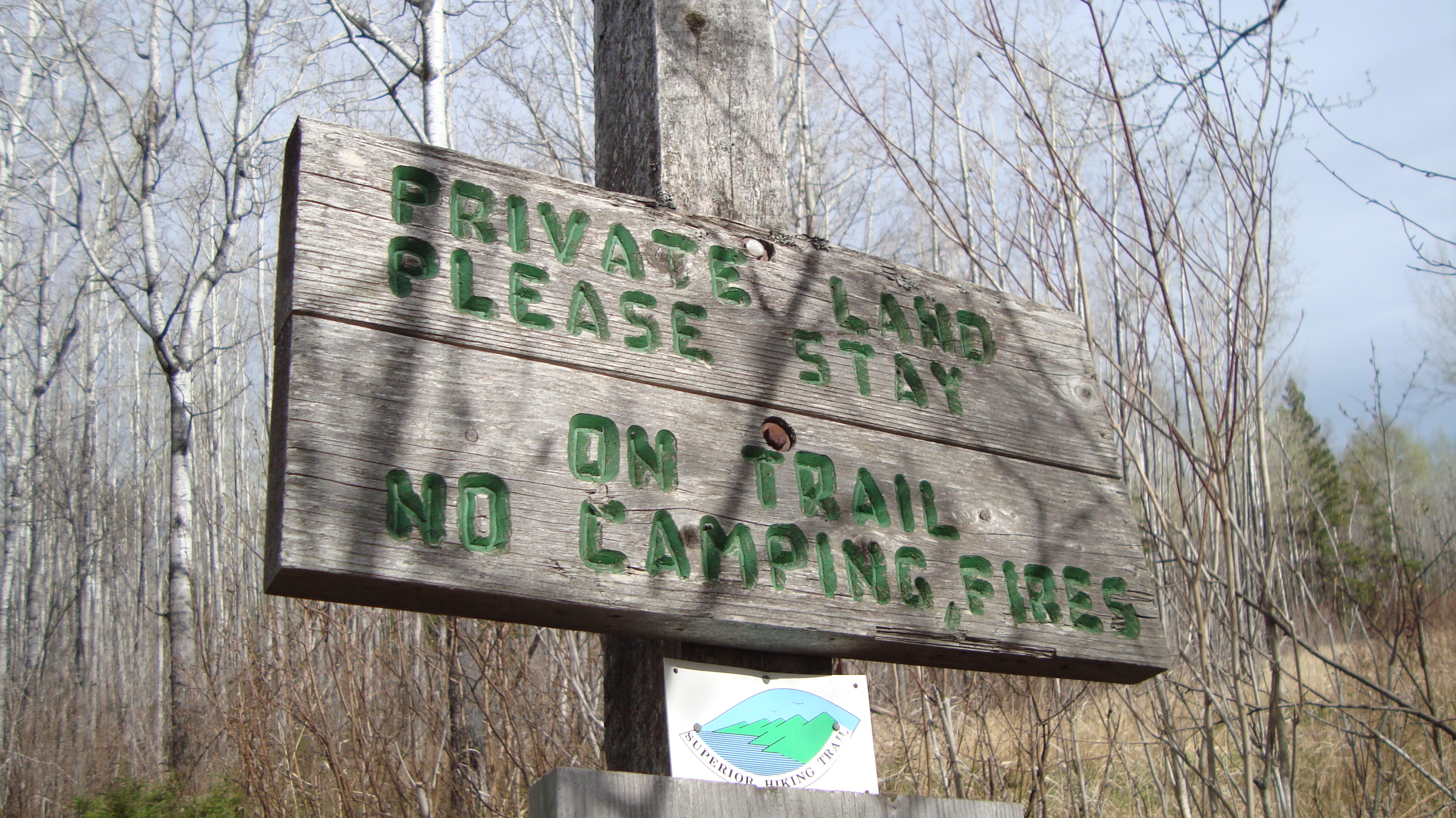 I climbed back down and followed the signs for the SHT. They are easy to follow, since they often have arrows pointing you in the right direction, as well as there are blue markers in the trees to help guide you. To be honest, the next 3-miles I hiked from Judge Magney to Little Brule River weren’t too exciting. It was a lot of private land, so there was some logged areas and wet fields to trudge through (there are lots of boardwalks, thanks to the SHTA). I did see a Pileated Woodpecker though!
Once I got to the Little Brule River, the trail became much more interesting. I climbed up rugged and rocky ridge lines and followed the river for a quarter mile to my campsite. It was the perfect time of day to soak up the Superior National Forest’s beauty. The sunlight hit upon the trees just right, giving everything a soft look.
 I set up camp at the South Little Brule River Campsite. It had everything you could ask for: a fire pit, makeshift wooden benches, a trail to my water source, and a view of the river. It also had 2 very sturdy trees, perfect for a hammock to fit between. Sadly, the wood was too wet to make a fire. Overall, my first day on the trail was a success!
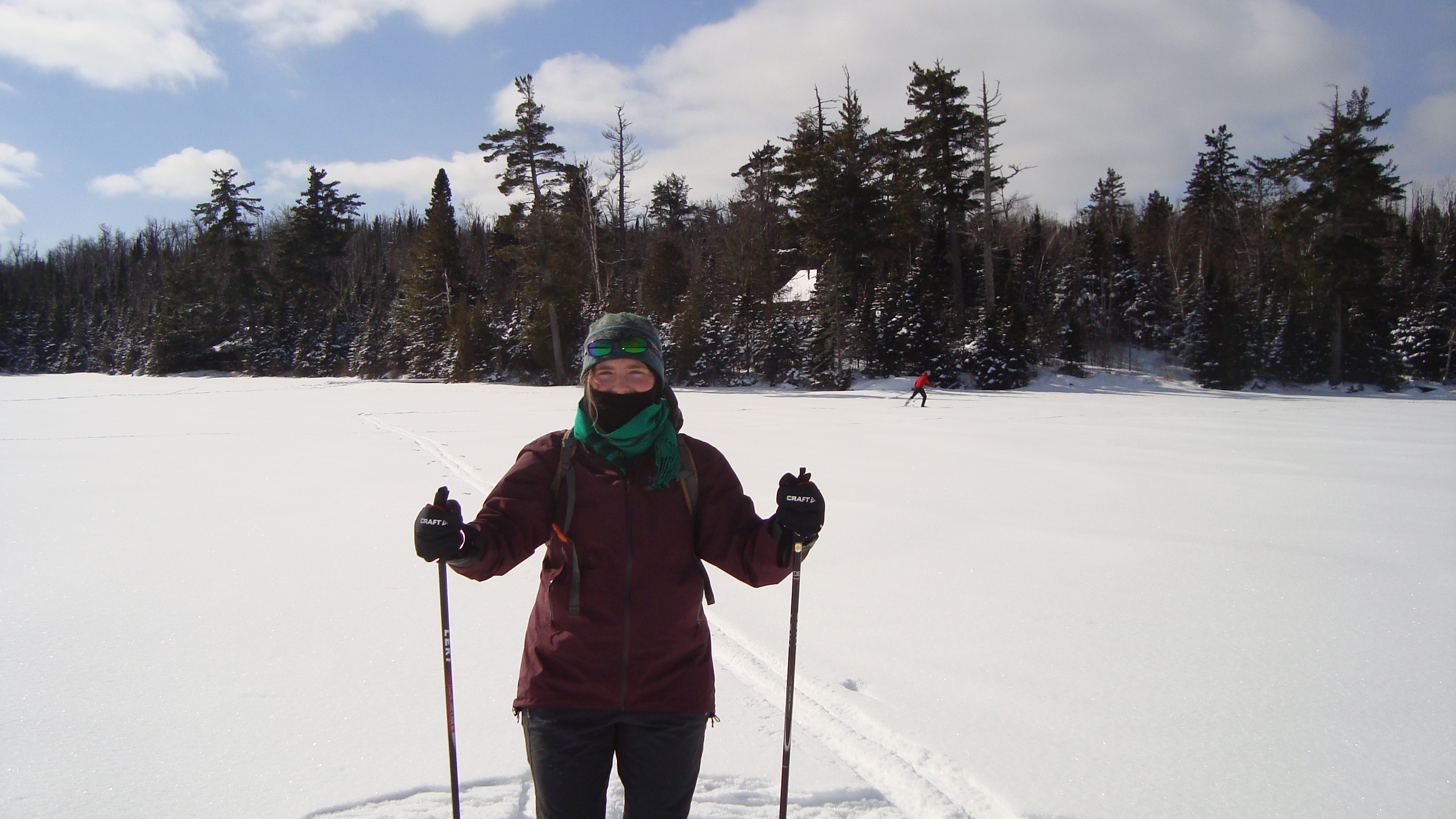
 Day 2: South Little Brule River Campground to Kimball River Campground (~6-7 miles)
For my first night sleep in a hammock, I slept pretty well. It had been awhile since I’d slept in the woods and the sounds of the forest kept me up for a short while, but I was quickly lulled to sleep by the sounds of the Little Brule River. When I awoke, I felt so comfy warm in my sleeping bag. I spent at least 20 minutes relaxing in the hammock, letting the morning light shine upon my face. After packing up all my gear, I made myself a peanut butter bagel sandwich. I also boiled a liter of water from the river, so to have water for the day. I soon said goodbye to my campsite and started to walk south, following the blue markers in the trees.
Something I genuinely enjoy is walking silently in the woods. Not only is it prime time to see some wildlife (and birds!), but it is also a time for me to reflect. Or sometimes I honestly don’t think at all; I just walk. I didn’t see anyone on the trail that day. It was just me, a ruffed grouse, and a mixed forest of spruce and cedar.
 There was a 1.5 mile section of the trail that bordered Lake Superior. It was nice for the first half mile, but walking on pebbly sand became a bit tedious (especially with chaco sandals!)
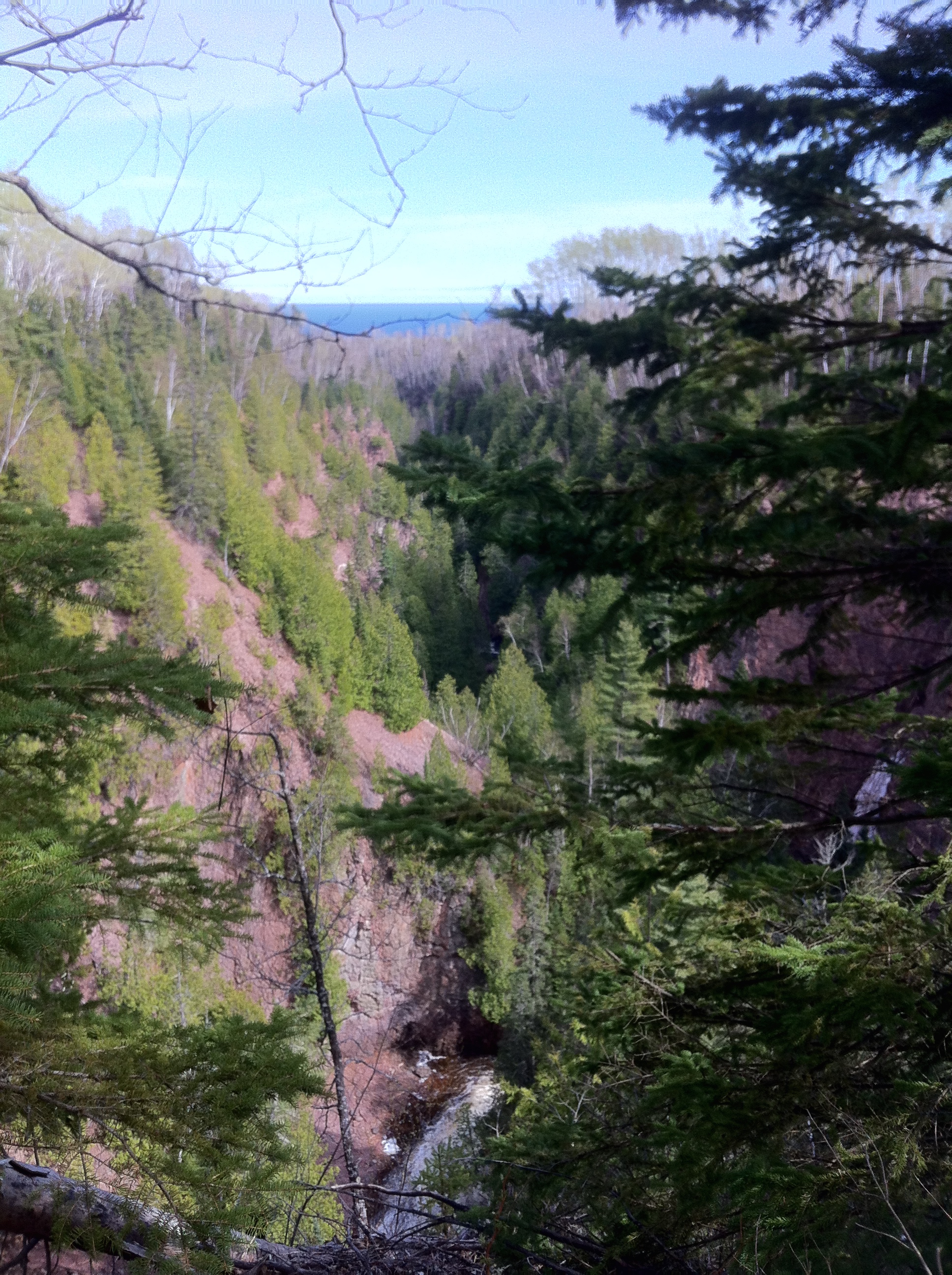
Today’s trail section was much more geologically interesting. I passed through a few quiet creeks, climbed ridge line shrouded in conifers and birch, and delved deep into two river gorges: the Kadunce River gorge and the Kimball River gorge. I decided to camp at Kimball and was pleasantly surprised to find a tent already set-up. It was empty, but it meant that I’d have company for my second night on the SHT!

The steep decline down into Kimball River gorge. The campsite was at the bottom.
What a view I had on my second night hammock camping!
Before meeting my campmates, I spent at least 45 minutes setting up my hammock. If you’re a pro, I’m sure it would take only 10-15 minutes, but since it was my second time putting everything together, I made sure to be meticulous with my knot tying and tautness. Now, that’s something to know about hammocks, understand that if you have the whole set up, you have a bunch of knots to tie, all of which must be taught and even. The hammock and underbelly are a breeze to set-up, but the rainfly and bug net are a bit tricky. I promise you though, once you get the hang of it, hammock camping is bomb. I slept much sounder and it was nice not having to worry about wet gear, since all of it (except for my food) was in the underbelly, hanging above the wet earth. (I didn’t bring a bear barrel or bear bag, so I usually double/triple bag my food into plastic bags and a water proof bag. I then chuck it into the woods, far from camp, so if a bear were to come, he/she wouldn’t come near the campsite).
The rest of the evening went swimmingly. I boiled some water for drinking, as well as for making my first dehydrated meal. I started with Backcountry Pantry’s Organic Sicilian Lasagna. I cooked it in my MSR reactor stove and was pretty impressed. It tasted real good and it even had a kick to it! There’s nothing better than having a warm meal after a long day of hiking.
It was when I was writing in my journal that I heard voices coming from up trail. Within moments, a friendly gentlemen with fishing gear appeared and we exchanged hellos. His name was Jeremiah and he told me that him and his friend had spent the whole day fishing different rivers and that they were pooped. I offered to help gather firewood if they wanted a fire, and we both decided that a fire is a must! In no time, firewood was collected and Jeremiah got the fire going. His friend Joel eventually appeared with a very sweet puppy too.
I was happy to share a fire with these gentlemen. They told me all about fishing and what to look for while hiking on trail. They also shared some scary stories about the BWCA and a nearby wolf pack that lives up the Kimball River. The best part though was sipping a Bent Paddle IPA (brought by Jeremiah) while looking up at the crystal clear stars above. Thanks to the fire and good company, I didn’t feel cold at all.
 Day 3: Kimball River Campground to Pincushion Mountain parking lot ( ~13 miles)
I woke up the next morning feeling refreshed. The sun was out and I could see blue skies. I spent a majority of my morning putting away my hammock and packing up my things. Jeremiah and Joel said their goodbyes just as I was eating breakfast. They told me they had more fish to catch at the Devil’s Track! When I left the campground, in my mind, I was expecting to walk around 9-10 miles that day. Little did I know that a bad storm was coming and that I’d be hiking all the way to Pincushion!
I couldn’t of asked for a better day to hike though. When I hiked out of the Kimball gorge, I ended up hiking along a rocky ridge line. Through the birch trees (dotted with bright green due to the baby leaves), cedar, and spruce, I could see glints of Lake Superior. I was deep in the Superior National Forest and I could tell that the trees that I hiked beneath were very old. I had to evade their uprooted roots and low hanging branches, heavy with conifer leaves. It was still a bit dewey too, so the smells of pine and humus were strong. I love those smells.
This is a SHT sign from Lindskog Road, looking north.
The third day was definitely the most scenic day. It was also the most strenuous day too. I hiked in and out of 3 creeks and 1 canyon, each of which got more deeper as I went along. Cliff and Durfee creek offered quiet escapes, shaded by the nearby conifer trees. Between each creek were stunning views of of Lake Superior. After Durfee Creek, I climbed higher and higher until I reached the top of a prairie called Wildflower Hill. From there, I popped-a-squat and embraced one of the best views of Lake Superior.
As the story goes, once you reach the highest point, you must go down again. So, I reached Woods Creek and started a slow descent to the bottom of the gorge. It was a beautiful walk. I took a lunch break at the Woods Creek Campground and made my final dehydrated meal of Chicken and Dumplings. I decided to eat half of it and put the other half into my Hydroflask thermos to save for later (I was thankful I did that near mile 11!). It was here that I had phone connection and looked up the weather report. It told me there was a high chance of rain and heavy wind. It was disconcerting. I decided to hike till Devil’s Track Campground and to decide from there if I wanted to spend the night or not.
The Devil’s Track. A view near the top.
The most beautiful and most difficult hike of the whole trip was my time on the Devil’s Track River. Compared to the other river’s I hiked beside, this took the cake (and then some). From Lindskog Road, you enter the Devil’s Track Canyon. For at least 2-3 miles, you climb up the steep Devil’s Track River Gorge until you reach the canyon’s edge. Near the top, there is an amazing view of the canyon and Lake Superior. (The above picture didn’t do it justice.) By this time, my legs were really sore, mostly my calves. They had not been ready for so many climbs in one day, but I knew I had to press on; the storm was coming and I had to decide quickly if I wanted to brave it or hike the extra 3 miles out to Pincushion.

Near the top of the south staircase from Devil’s Track bridge
Once I reached the Devil’s Track Campground, I pulled out my phone and checked the weather again. It showed even worse winds and rains than before. I decided then and there to hike as quickly as possible to the parking lot. I gobbled down the rest of my Chicken and Dumplings and prepared for the steepest climb of the day: hiking out of the Devil’s Track.
It was a constant uphill climb till Pincushion Mountain’s parking lot, but within 2 hours, I had made it. I was a bit sad that I had to cut my trip short. I had been looking forward to camping overnight in the Devil’s Track canyon and then sauntering out, but I guess there is always next time. While driving back to Minneapolis, I was very glad I decided to leave early. The storm was very bad. Heavy rain and winds even made driving home treacherous. As I drove south, I thought what it would’ve been like to hammock camp in such a heavy storm. A part of me was intrigued and wanted to brave the elements, but most of me was grateful to have the car to shield me from the wind and a bed to look forward to for the coming evening.
Thanks for reading. <3
Much love,
-Molly
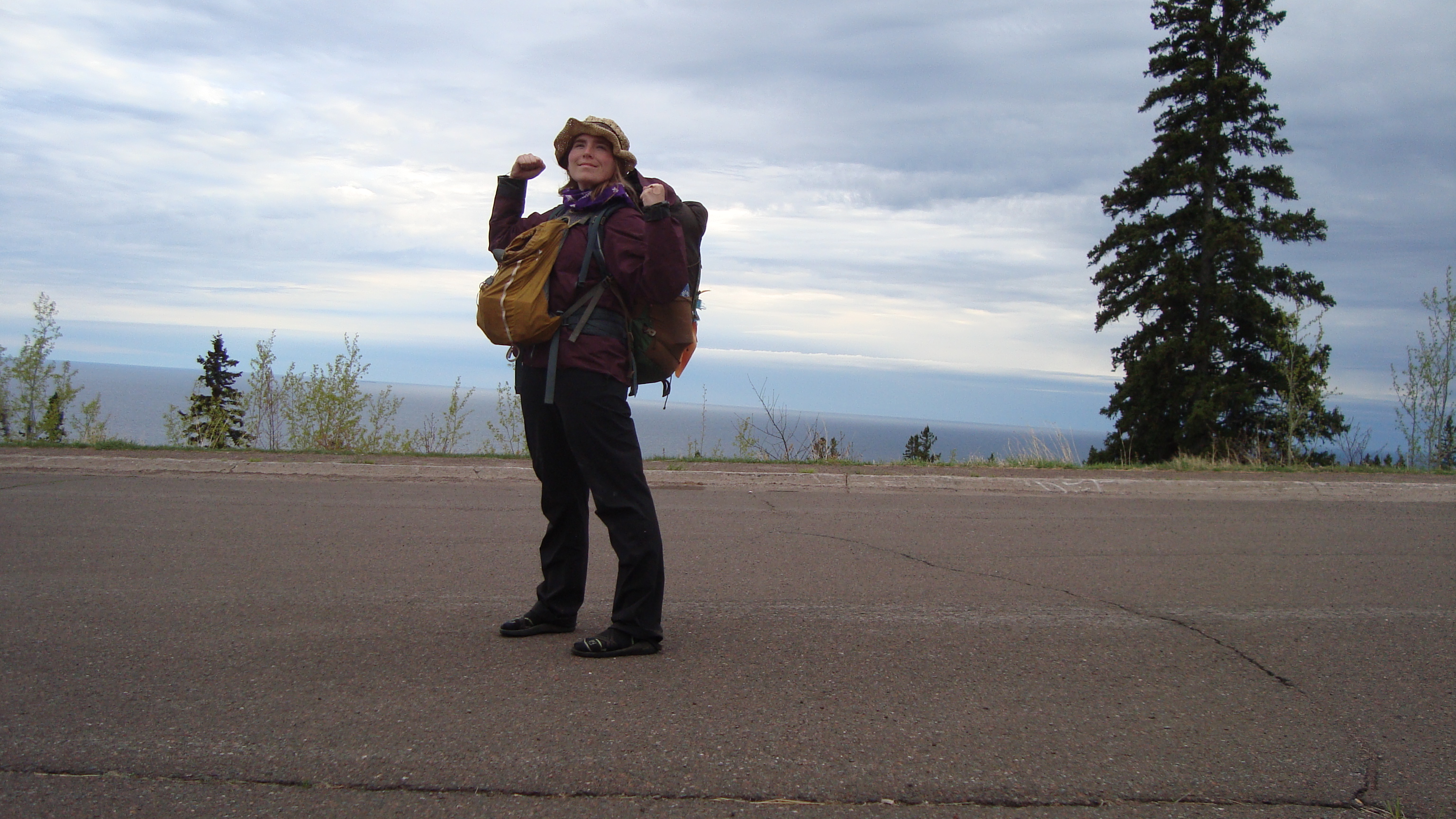
I made it. I beat the storm!

Me in a vibrant kimono. If I remember correctly, this kimono signifies a young, single lady ready to be courted.
Hello friends,
I woke up early today to appreciate the warm spring morning. I made oatmeal, brewed some coffee, and sat on my front stoop, listening to the robin’s birdsong. I love spring for many reasons, these are just a few of them.
I took full advantage of this week and went on a few bike rides. The most memorable one was my ride to Fort Snelling State Park. I wanted to pick up an Annual Minnesota State Parks Permit, so I jumped on my bike and headed south. If you didn’t know, there are paved bike lanes all the way to Fort Snelling. I had never biked there, so I decided to check out the bikeways. I was not disappointed.

Here’s me on the paved road that leads to the park office.
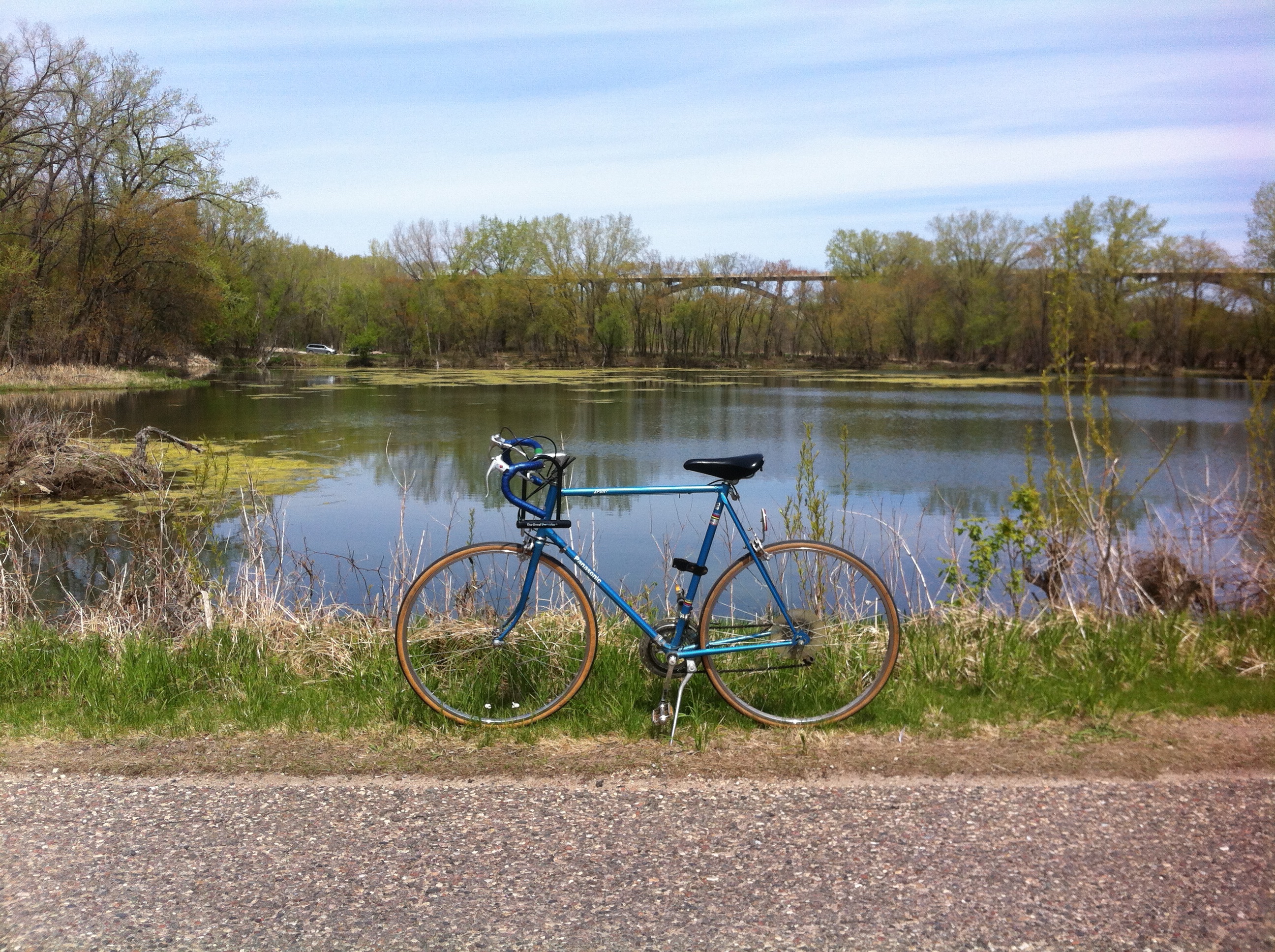 My dad’s old panasonic chilling by the ponds.
After getting the permit, I decided to pop-a-squat next to a visitor sign on Pike Island. It felt very nice to rest my legs. On the ride back home, I stopped by Sea Salt Eatery and got myself a grilled salmon po boy. It was so good. I had never had one before, but I plan on eating another one in my near future.
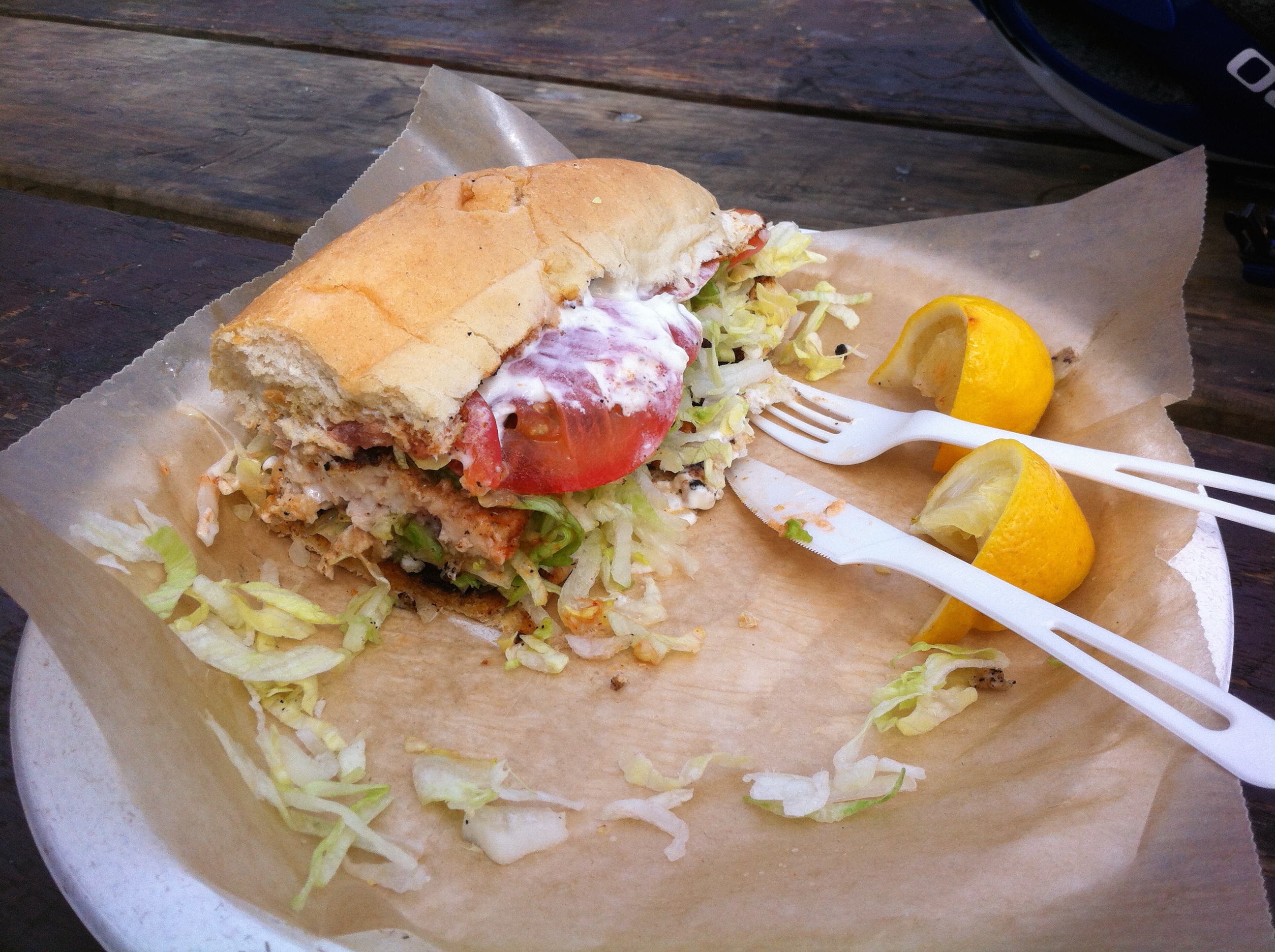
A grilled salmon po boy… mmmmmm.
As for the rest of my week, I had a fun Friday as well. I hung out with my new roommates. First I made them a Japanese lunch of Uri-Dofu (scrambled egg tofu) and then we went to an antique shop to search for a key. Since we live in an old house, all the locks require old keys, and something I learned recently is that you can find old keys at antique shops. There’s buckets of them and you have to bring your own lock to test them, until you find the right fit!
That big brown thing is the lock. Here’s our first key trial. It didn’t fit.
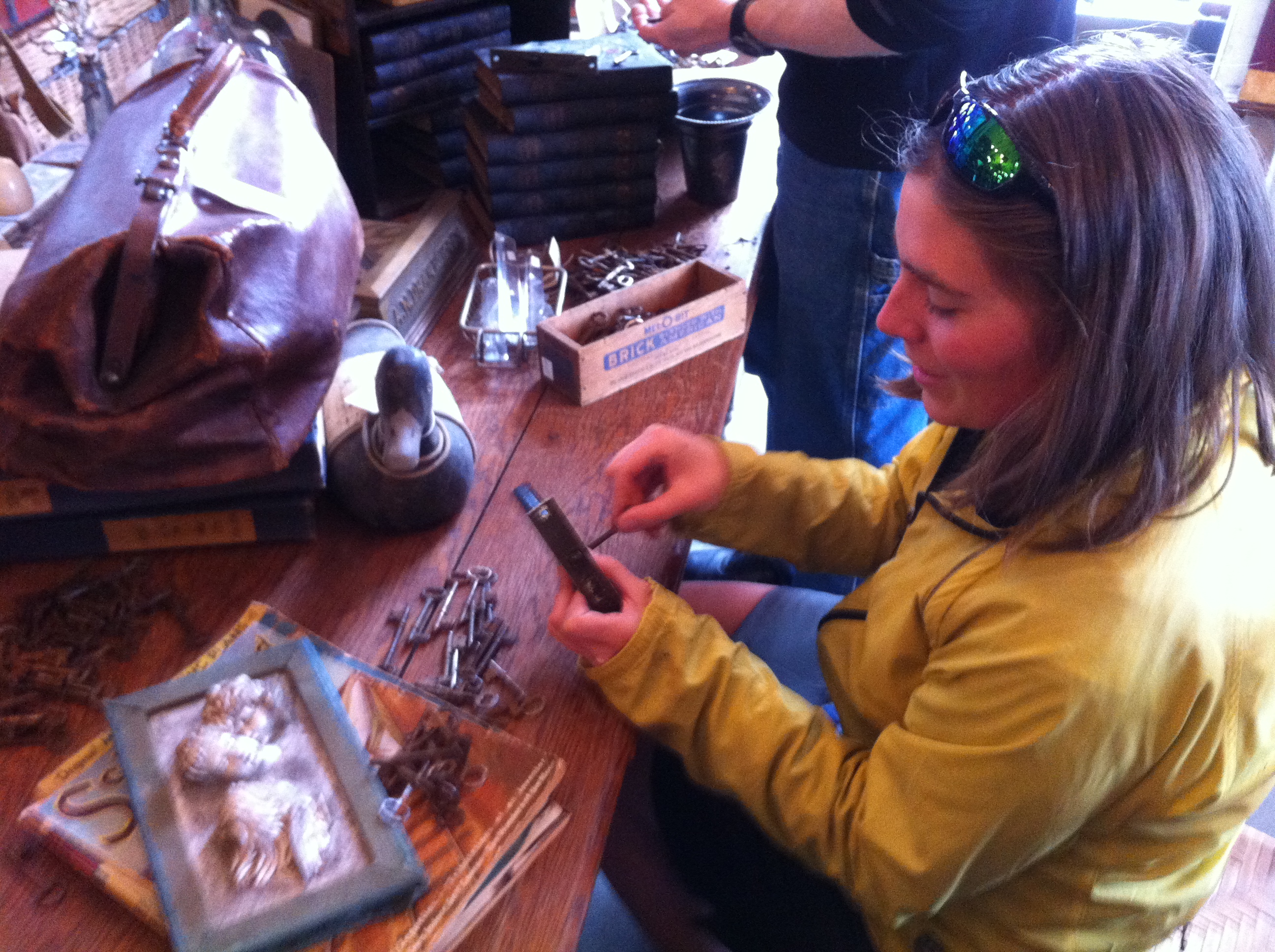 Here’s me after testing key number 50-70. Whew… lots of keys! In the end, we found a key for one door, but not the other. I’ll have to go on a quest next week to find the missing key.
But enough about bike rides, keys, and po boys, I’m sure you guys saw the title of this post and were wondering about my short film on Tokurin-ji. If you’re new here, then check out my last blog post. In it, I talk about how I gave a presentation on WWOOFing in Japan and My Experiences Living in a Japanese Zen Temple at Midwest Mountaineering’s Spring Outdoor Expo. I had an (almost) full house. I didn’t take a head count, but I believe there were over 60 people in the audience. Just before my presentation. (photo cred: my Mom. <3)
I was told by friends, my Mom, and strangers that I gave a great presentation. They said that having photos, video segments, and stories made my presentation engaging and fun. Almost like they were there with me. One nice lady said that it was the best presentation she saw all weekend! I was touched by all the great feedback and I am thankful to have had such a friendly audience.
As for my short film, here it is. It is called Tokurin-ji: My Experiences Living in a Japanese Zen Temple. It shows you the temple grounds, the hondo (main hall), and the people who made my Japan experience unforgettable.
Well, I’ll leave you here. In my next post, I’ll probably have pictures from the May Day Parade and I’ll hopefully have a better idea of what merchandise I’ll have for Spring Con!
Much love,
-Molly
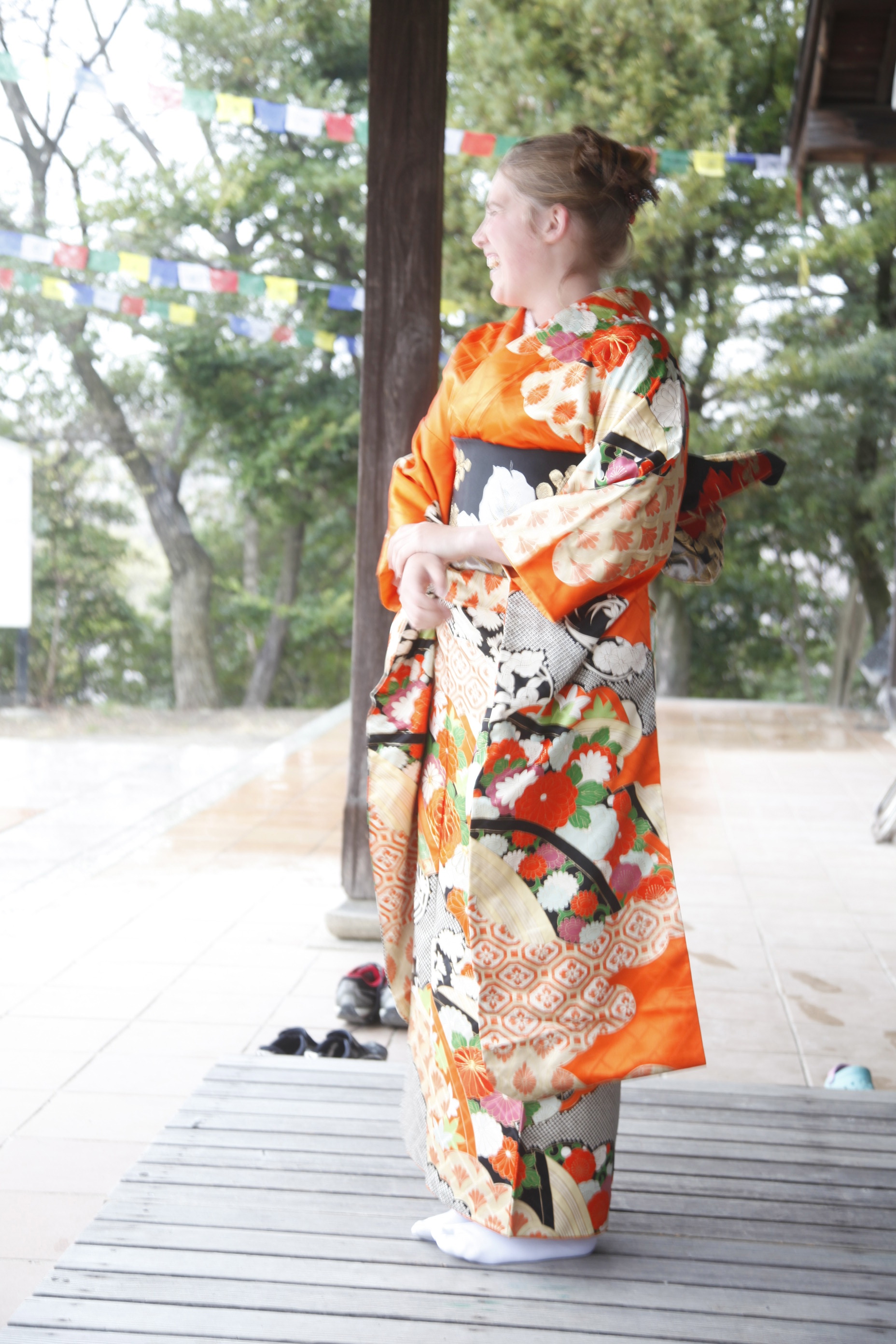
Photo cred: Kenji Usui

 Last week, Colleen and I went hiking at Westwood Nature Nature. Colleen has now returned to China. I miss her a lot.
Hello friends,
Spring has come (haru ga kite). I say this because while cycling around town, I see the beginning signs of spring. The hedges outside my house once had fuzzy protective buds, but now I see small specs of green erupting from their cores. Outside my window, I see that the migratory sparrows have returned, as well as the robins. Not to mention that those bitter cold nights are well behind us now.
It feels good to put away my big winter jacket and to prepare for warm days to come. I’m also looking forward to this upcoming spring because (in a sense) I am starting my life anew. I moved into a new house with two lovely roommates. I’m planning on meeting new people and making new friends. I’m also hoping to get myself to more state parks, as well as the BWCA.
 The Nagoya Sakura River Path.
In Japan, spring is a time for celebration and rejuvenation. This is when the sakura blossoms are in full bloom and most people are spending their afternoons picnicking beneath the sakura trees. This is called “Hanami” and two years ago, I was one of those people, enjoying the beautiful flower displays in Nagoya. I was also living in a zen temple. During this time, I was helping the temple prepare for their Spring Festival (Hana-Matsuri). It was an honor and pleasure to be apart of this age-old tradition and I was thankful to have been invited to attend their Buddhist ceremonies. I was even more grateful when the head monk, Oshou-san, invited me to stay longer. He told me that I could stay as long as I wanted, but that I must do my duty as a zen student to help around the temple. This resulted in my cooking for the monks, cleaning the main hall (hondo), and studying Japanese (so to better communicate with my zen peers). It was a perfect situation.
So, why am I bringing up something I did two years ago? Well, in a couple weeks, I’ll be giving a presentation about my time living in the temple, as well as, I’ll mention my time WWOOFing (World-Wide Opportunities in Organic Farming) in Azumino. I’ll be presenting at Midwest Mountaineering’s Spring Outdoor Expo. Last year, I gave a presentation on my backcountry backpacking trip through Mongolia’s Bogh Khan Uul Strictly Protected Area. I had such a good turn out that I was asked to return.
 Tokurin-ji. Here we are preparing for the Spring Festival.
My presentation is on Saturday April 25th. It starts at 11:45am at the UoM Hanson Hall, Room 105.
I am also co-presenting with my managing editor, Lou Dzeriak, about RootsRated. That presentation is also on Saturday April 25 starting at 4:45pm in the Midwest Mountaineering Expedition Room. We’ll be talking about the website and highlight its new features!
Feel free to come to my presentations. I’d love to see a friendly face in the audience.
Before I go to enjoy a family Easter dinner, I’ll mention one more thing. In early May, I will be tabling at Minneapolis Spring Comic Con with my brother Jamie. I don’t know our table yet, but when I do, I will most definitely share it with you guys. The table is mostly for my brother, who is an artist and illustrator, but I plan to have a few of my things too! : )
Well, Happy Easter. Till next time.
Much Love,
-Molly

Hello friends,
It’s almost spring in Minneapolis. Though it is supposed to snow today, I’ve seen geese flying overhead and I spotted my first robin this weekend. I’d like to think that the migratory birds are a pretty good indicator that winter is coming to an end. As always, I’ve been enjoying my time in Minneapolis. Most recently, I’ve gotten the ole bike out and have gone on some pretty long rides. I’ve also been playing lots of music with friends. And most importantly, I played my first game of ultimate in 2 months. My foot is finally healed!
But enough about Minneapolis, let’s talk about the Windy City.

Chicago: A City Full of Improv Comedy, Exquisite Art, and a Scenic Lakefront Path
I mentioned in my last post that I was in Chicago with my twin sister. She had to get her Chinese work-visa, so I decided to join her. In total, I spent 5 days in this bustling city. One of the first things I noticed was how packed it was. As we took the metro towards downtown, the train tracks were only feet away from the neighboring buildings. While watching the train take turns, it looked like the train carriages would surely hit the nearby buildings, but (of course) they never did.
We got downtown and walked towards our next station. While walking, we crossed over the Chicago River. It really was a striking site, seeing a waterway cut through the center of downtown. We eventually meandered to a Blue Line Station and got off at Damen. When we got out of the station, we were surprised by all the donut shops, hip restaurants, and young people walking around. We didn’t realize that our hostel was in the “4th hippest hipster neighborhood in the country” (told to me by wikipedia). We dropped off our stuff at IHSP Hostel and decided to get a Chicago classic: a deep-dish pizza from Giordano’s. It was pretty darn good!
 Wormhole Cafe: You can see the NES Controller in the top left corner!
The next day, Colleen went downtown to get her visa sorted out, while I stayed in Wicker Park and looked for a coffee shop to work at. I used RootsRated and google maps to lead me to one of the best cafés I’ve ever been to: Wormhole Cafe. The reason why I liked it so much was because it was so nerdy. There were Chrono Trigger characters decorating the espresso machine, a stained glass NES controller hanging by the window, and even a Delorean parked on the upper level. There were more nerdy things, but you’ll just have to see them yourself.
 These are the Chrono Trigger characters I talked about. Frog is my favorite!
 Beneath the Cloud Gate
After a morning of RootsRated work, I met up with Colleen and did what any good tourist would do: take selfies at The Cloud Gate (commonly known as “The Bean”). Standing underneath it was definitely the best part. It was so cool watching as people’s reflections morphed and transformed into different shapes and sizes. When Colleen and I were satisfied, we walked our way (mostly) to The Historic District to go see some improv comedy at the famous Second City Theater. We spent the rest of the evening laughing so hard, it’s no wonder SNL finds its best comedians through Second City.
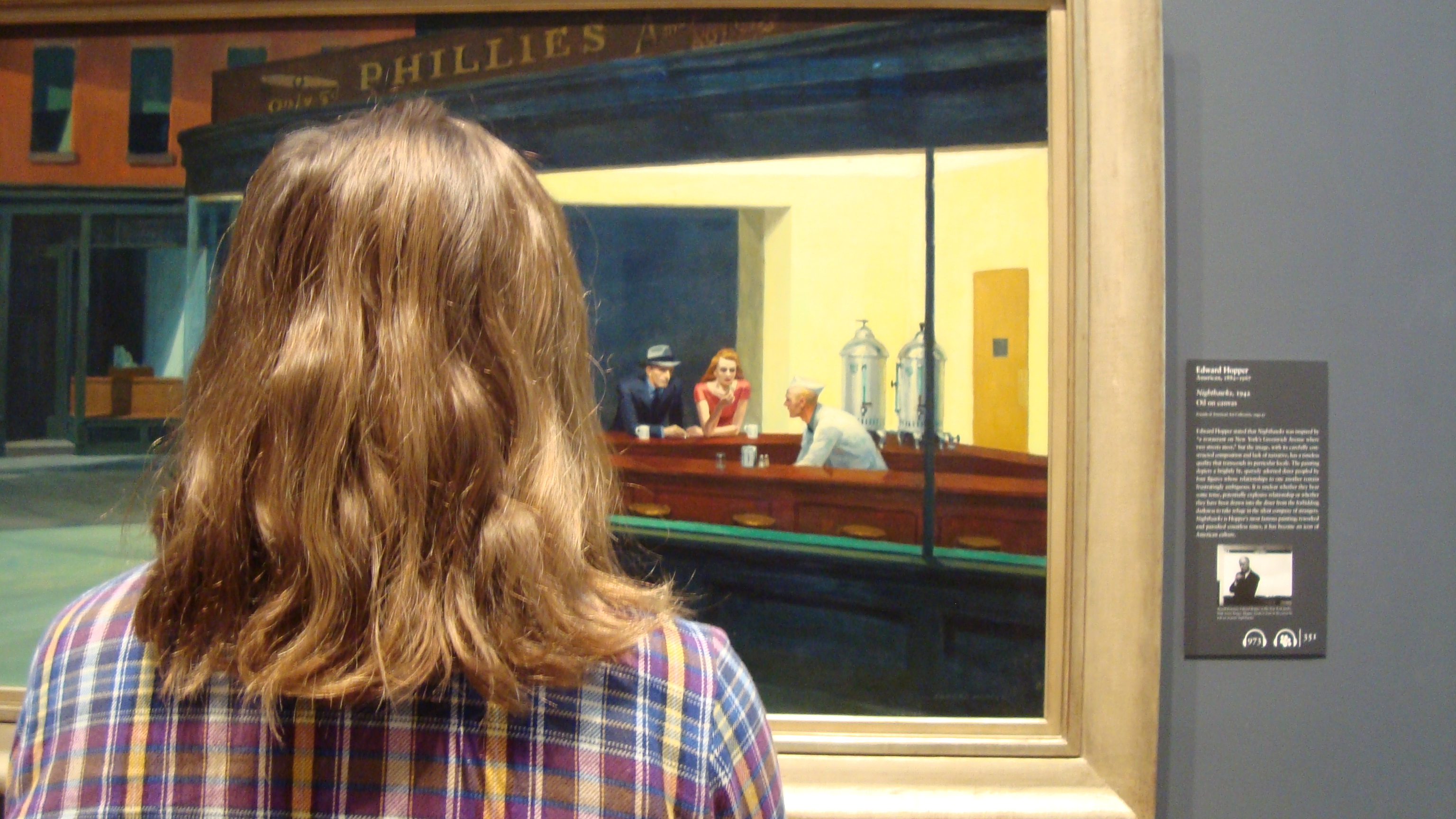 Nighthawks by Edward Hopper
Colleen and I had decided the night before that we wanted to have a museum day. So, we took the metro back to downtown and walked to The Chicago Institute of Arts. I love museums, especially when they’ve got some impressive collections. It wasn’t until I had the visitor guide that I realized how many famous pieces the museum houses. Some include, Georges Seurat’s A Sunday Afternoon on the Island of La Grande Jatte, Grant Wood’s American Gothic, Edward Hopper’s Nighthawks, Pablo Picasso’s The Old Guitarist, and a whole room of Georgia O’Keefe’s! Colleen and I had a bunch of fun exploring the different collections.
The next morning, we packed our bags and said goodbye to IHSP hostel. We were staying with my friend Allie that evening and she lives north of Chicago in Edgewater, which is right off of Lake Michigan. So, Colleen and I decided to make a day of it and hike up Lake Michigan’s Lakefront Trail.
 A lone guitarist playing a tune along the Lakefront Trail
We took the bus to Lincoln Park and started our 5-mile hike. Within the first mile, we found ourselves at Lincoln Park Zoo, which has free admission. The rhinos were definitely are favorite exhibit (though, similar to Minneapolis’ Como Zoo, I was sad about their living arrangements). After the zoo, we stopped by the Lincoln Park Conservatory and enjoyed a stroll through their horticulture collections.
After Lincoln Park, we found ourselves on a path directly bordering Lake Michigan and followed it for 3 miles. Listening to the water hit against the retaining wall and chatting with my sis made for a fun, relaxing hike. It wasn’t until we arrived at Montrose Harbour that the trail took a tight right turn and we found ourselves at the Montrose Point Bird Sanctuary. We decided to walk through the park and heard the chirps of migrating sparrows and even saw a juvenile red-tailed hawk hunt for prey. I was happy to find such a quiet place only a few miles from downtown! The best part though was the view of the Chicago skyline from the harbour.
 Exploring the Montrose Point Bird Sanctuary
 The Chicago Skyline
After our urban hike, we met up and got dinner with my good friend Allie. I had met Allie through couchsurfing.com, so most of the night was catching up, as well as reminiscing about our CS adventures. Thank you Aliie for hosting us!
We woke up bright and early to wish Allie a good day and then Colleen and I slowly meandered south, finding ourselves in a cool neighborhood called Andersonville. We ate breakfast at a quaint diner called Svea Restaurant and then explored the rest of the area. I think it was probably my favorite neighborhood we visited. Soon after, we took the bus south to stay our final night in Chicago at The Getaway Hostel. After dropping off our stuff, we had dinner at a burger joint called Spritz with a couple of Colleen’s old college friends. This place is known for making everything homemade. From ketchup to soda, they make it all. They even have a small jar of their picked vegetables as free appetizers. I also must say, I ordered the Poutine Burger and it was amazing.
When we took the bus back to the hostel, Colleen and I both agreed that we needed to walk off our burgers. While walking, I thought back about the week and how much fun I had with my twin sister. I didn’t mention before, but it was our birthday week, and as we maneuvered through residential streets, I was reminded how lucky I am to have such an awesome and adventurous sister. She’s a fantastic travel companion and friend. I wouldn’t of wanted to spend my birthday week any other way.
Well, the rest is history. <3
Much love,
-Molly
 Sister Love

Hello friends,
As I type, I am actually in Chicago: The Windy City! My sister Colleen had to go to the Chicago China Consulate to get her Chinese work-visa and I thought I might as well tag along. While Colleen gets her visa figured out, I’ll be exploring the city’s vibrant coffeehouses and freelance writing/photo editing for RootsRated. (It’s awesome being a freelancer; I can work from anywhere!).
But, I’ll have to tell you about Chicago another time. I bet some of you want to hear about my backcountry ski trip in Minnesota’s Iron Range.
Tettegouche State Park: Skiing, snowshoeing, and hiking around the Historic Tettegouche Camp.
In my last post, I mentioned I went ice climbing at Sandstone, MN’s Robinson Ice Quarry with a handful of my co-workers. Well, after spending a morning/afternoon climbing, we packed up our equipment and carpooled up to the North Shore. Since we climbed longer than expected, we picked up a parking and ski pass at a nearby State Park (because by the time we would get to Tettgouche, the park would’ve been closed. And it’s necessary to have those documents while in the park).
The drive went nice and easy. When we passed Duluth, it began to snow. It was a calming scene: watching snowflakes fall with frozen Lake Superior as the backdrop.
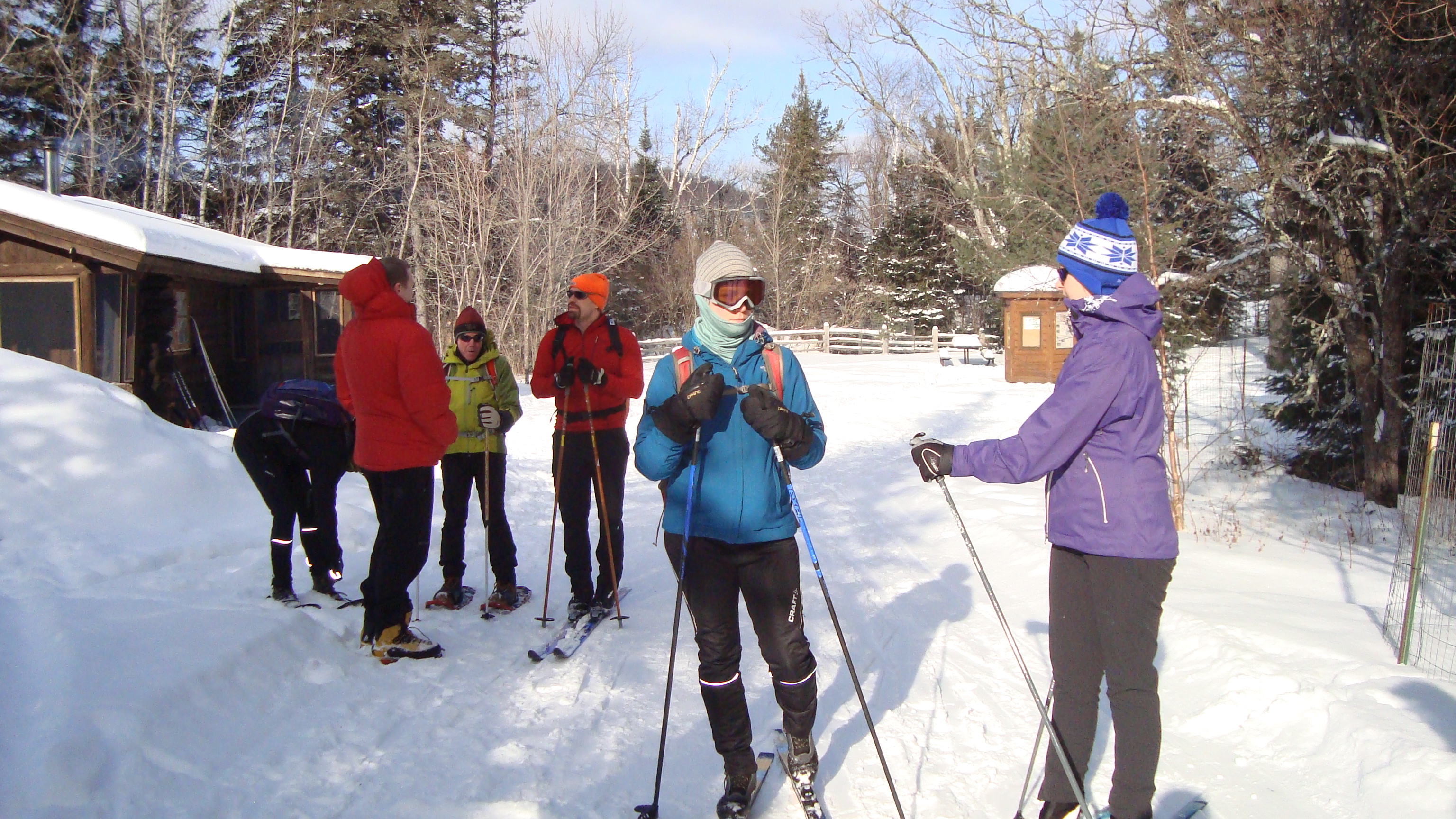
The sun had set by the time we parked at the West/Historic Camp Parking Area and it was a little chilly as we set off from the parking lot. Three of us were on skis (Sonia, Phil, and Kyra) and two of us were on foot (Ian and I). The first ¾ mile was a grueling climb, but once we reached the top, the rest was smooth sailing. The skiers flew ahead of us, while Ian and I enjoyed the quiet of the night. Ian and I split for a short while and I decided to turn off my headlamp. I realized the moon was quite bright and that I could see the trail just fine. For the rest of the hike, I enjoyed the quiet of the forest; the only sound made was by the crunching of the snow beneath my feet.
I reached the final bend and saw lights from the Historic Tettegouche Camp cabins. The skiers were already there and when Ian and I trudged in, they were just about to open our cabin door. When we walked in, I was very surprised by how much space we had! There was a lounge area/dining room, a kitchen, and a sleeping area. One of the first things I noticed was a wood stove, which would be keeping us warm the rest of the week (there was a back-up thermostat set at 40F).
I forgot to mention, there were two groups of us staying in Tettegouche for the weekend. The other group had already arrived and they had started making dinner. So, the rest of the evening was spent cooking, eating, and playing word games. When we went to bed, I decided to sleep in the lounge area, so that I could tend the fire and fall asleep to the sound of crackling wood.
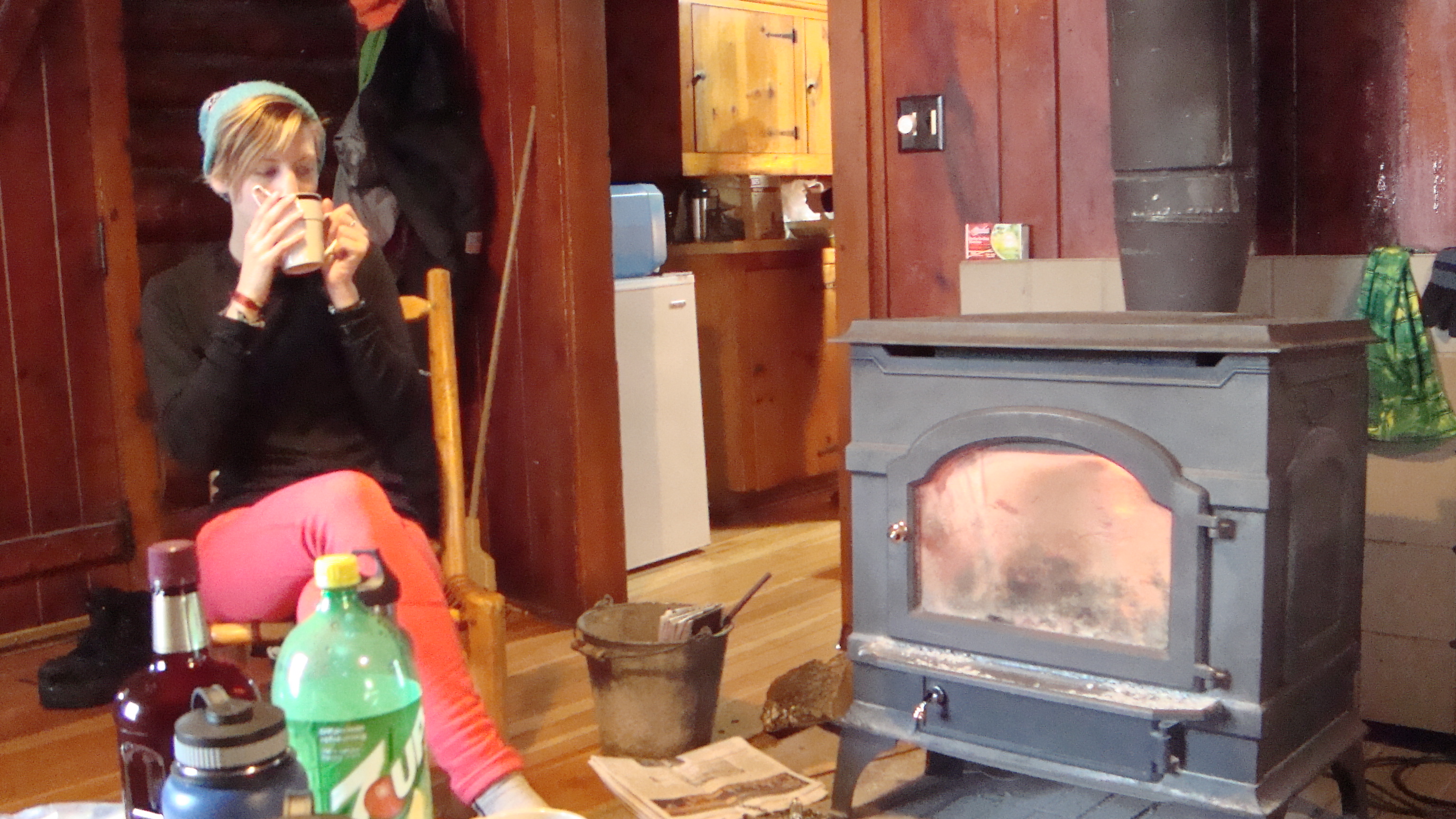 Sonia sipping coffee beside the wood stove
I woke up bright and early to a nearly dead fire. I tended it and spent the rest of the morning crocheting a hat. I also walked down to the lake to watch the sunrise over the horizon. When everyone was awake, we made coffee and pancakes. Yum!
Before getting on my skis, I first had to wax them. I had never done that before, so Phil taught a group of us before we set off. When I was ready, I put my ski boots on, grabbed my skis, and walked to the lakeshore. With some help from a friend, I got my skis on and carved my own path through Mic Mac Lake’s freshly fallen snow. (Oh, and if you hadn’t realized already, I’m not good at skiing. This was my third time on cross-country skis)
As I looked across the lake, I could see cliffs and steep hills etched in the horizon. To my left were pine trees that had a light coat of snow. I was grateful for the recent snowfall. It made the lake look untouched, almost like what to expect in the Northern Wood’s wilderness.
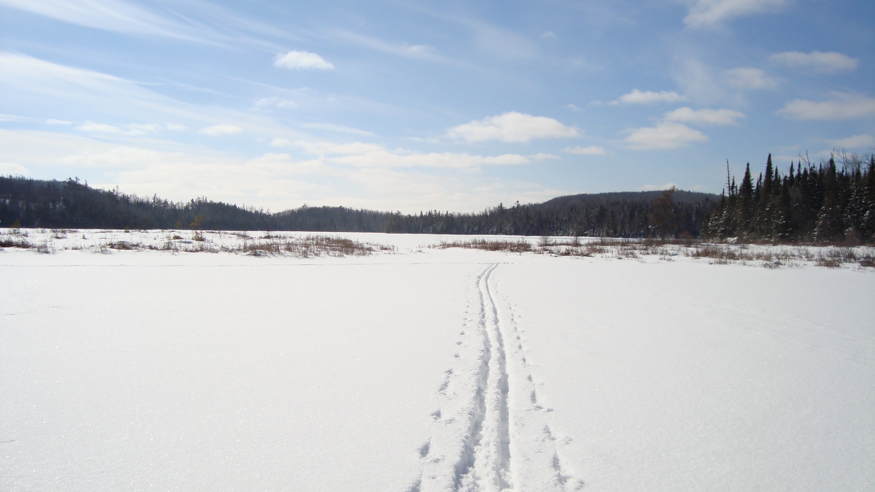 My own path
I spent the afternoon galavanting around the lake, even braving the actually trails Tettegouche offers its ski patrons. I think my favorite part was having the freedom to go wherever I pleased. On the lake, there were no trails, so if I thought something looked cool, there was nothing to stop me, I could just ski to it.
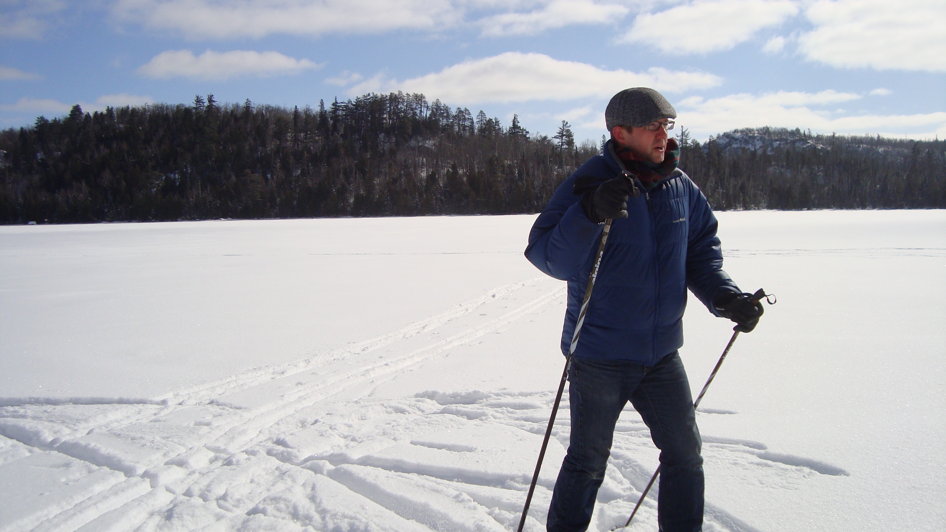 Judd showing me his ski techniques
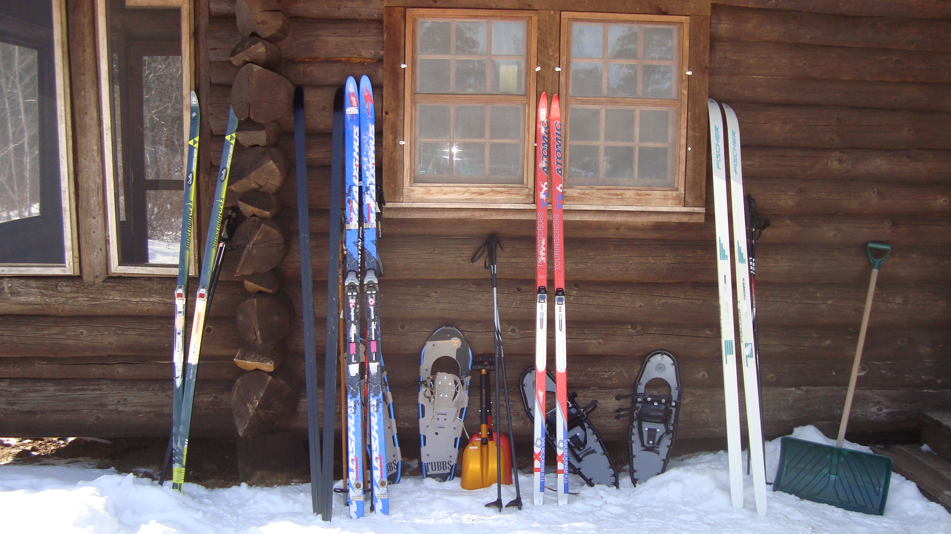 Our cabin and our equipment
I returned back to the cabin and added another log to the fire. I was feeling pretty tired and my foot pain was slightly flaring (from a previous injury), so I decided to rest my feet for the afternoon. As I was sitting and crocheting, lunch was made, as well as a plan. Almost all of the group decided to go on a ski/snowshoe hike to the nearby hill called Mt. Trudee. I wished them all good luck and promised I would start dinner by the time they got back.
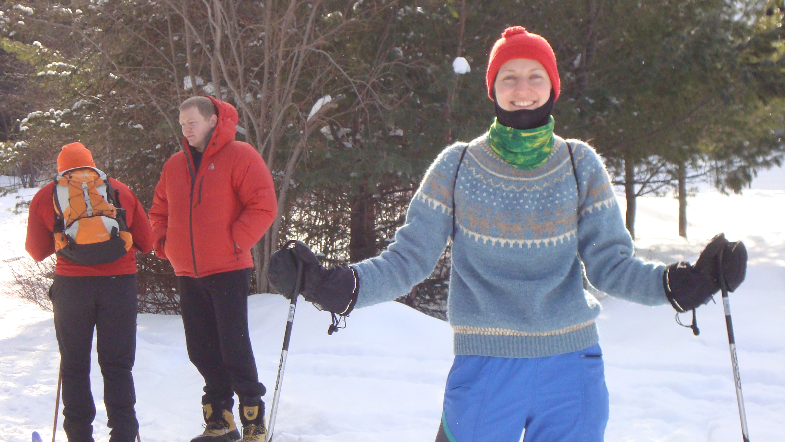 Sonia before the big hike/ski
 Preparation
When everyone had left, I had the whole cabin to myself. It felt great! Before getting all comfy cozy, I decided to get out on the lake one more time. It was now full circle, I had seen the lake at sunrise and now I saw the lake at sunset. Both were beautiful and peaceful. While skiing back to the cabins, I was chasing the shadows of the trees, trying to catch the last glimpses of sunlight for the day. When I got back to the cabin, I still had almost 2 hours until my friends got back. The rest of the time was spent by me tending the fire, crocheting my hat, and writing in my journal.
When everyone got back, dinner was cooking and people were voracious. When dinner was served, there was not one shred of lettuce left in the salad dish and no chile left in the bowl. When our appetites were met, we played a good ‘ol game of Cards Against Humanity. After that, we got into teams for a Wilderness Trivia Game. I knew a lot of the animal questions, but the guns/ammunition questions were definitely out of my league.
That night was our last night in the cabins, so when everyone went to sleep, I laid in the lounge and focused on the sound of fire crackling. I knew it would be awhile until I fall asleep next to a fire again. Within seconds, I drifted into a deep sleep.
The next morning, as Phil made breakfast, the rest of us cleaned up the cabin. It didn’t take all that long and the reward for cleaning the cabin was delicious bacon and egg sandwiches… yummmm…
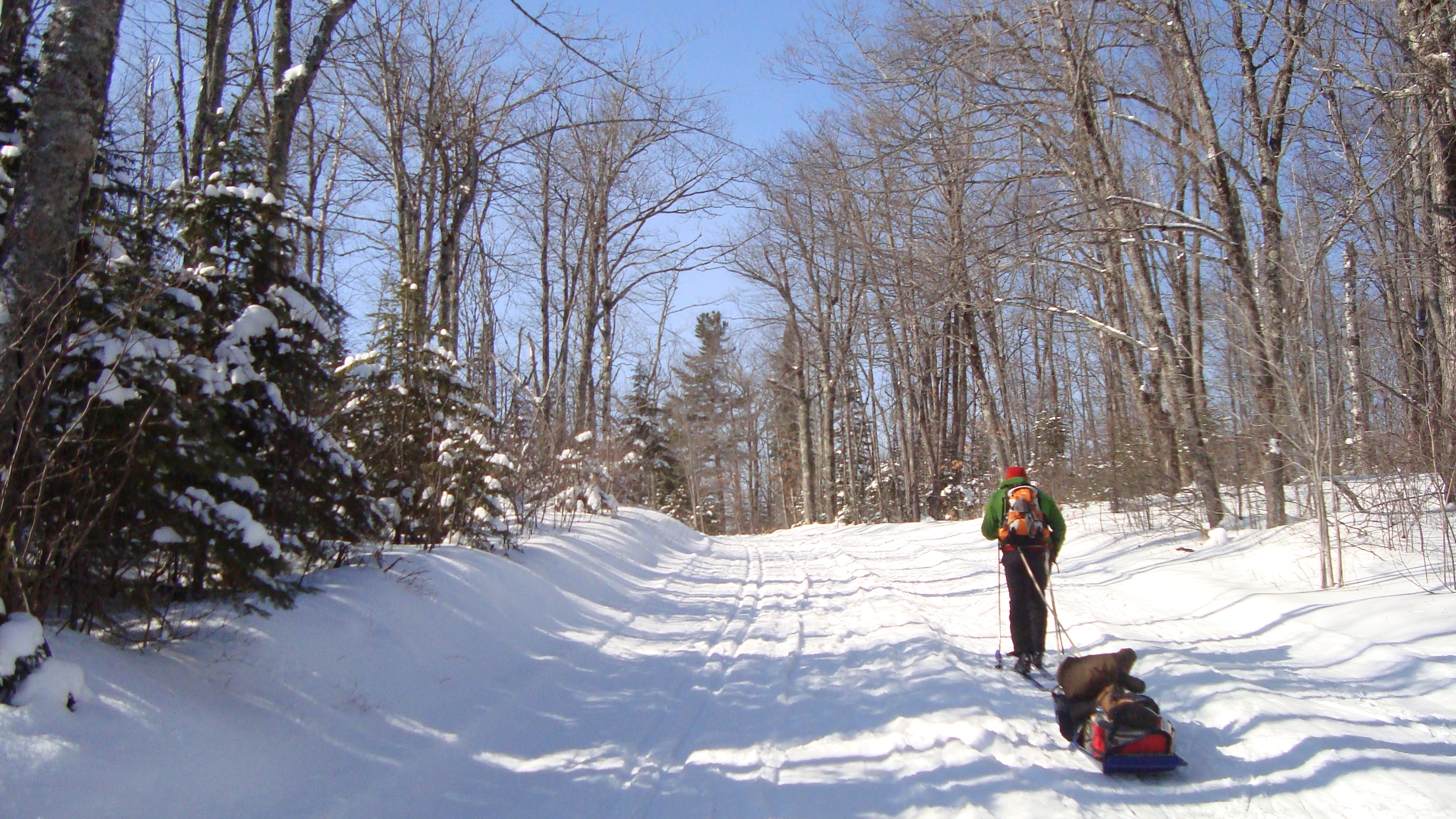 When everything was packed, we put on our packs and started our hike/ski out. Phil had a sled, which we piled with our extra food and heavier winter supplies. (For anyone wanting to stay at the Historic Camp, it’s a good idea to have a sled).
 Here is Phil ready to bomb a hill.
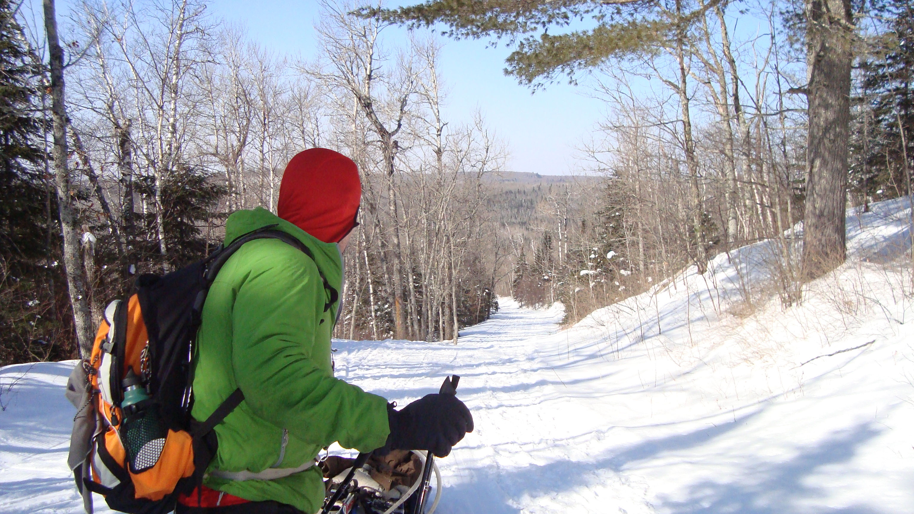
We were lucky the weather was so nice, we could see for miles. Before reaching the parking area, I made sure to soak in all the views.
As we drove south, back towards Minneapolis, I reminisced about my epic weekend. Ascending ice walls and gliding across frozen lakes is something not the average Minnesotan does over one weekend. I’m thankful to surround myself with such adventurous people and will always think fondly of my time ice climbing in the Robinson Quarry Ice Park and backcountry skiing at Tettegouche State Park.
Thanks for reading my unusually long post. In my next one, I’ll tell you about my time exploring Chicago.
Much Love,
-Molly
 The sun was so bright!

Hello Friends,
I have good news. RootsRated has published 11 more articles of mine, all of which you can find at the Minneapolis page. Some of the newer ones include: Perrot State Park, Temperance River State Park, and Vertical Endeavors – MSP. I also got paid to eat food, which you can read about in the Food & Drink section. (I only wrote 4 for the food section).

Photo credit: RR + Merrel
Also, big news for RootsRated. We’re updating the site (in a big way) and there is a giveaway going on for the people who sign up for the new site! If you’re interested, then follow this link.
Also, one more plug. I recently made an Instagram. My work asked me if I had one (which I didn’t – well kinda did, but only for work related stuff). After talking with my sis and some of my other artsy friends, I determined that it’s probably a good idea to join the bandwagon, especially since I’m working with photographers. So here’s a link to it or you can search for mollycoconnor. I’ll mostly be posting pictures of the hikes I go on, maybe even referencing them to my wordpress/RR articles. I also think I want to post some of my best shots from my travels 2 years back. To reminisce. : )
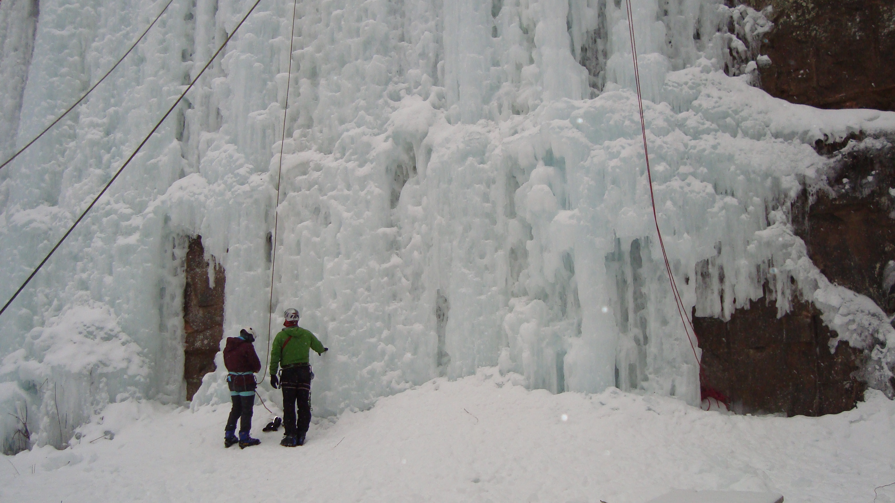
Okay. Now about my action filled weekend! You might’ve not known, but a handful of my co-workers and I went up north. Our boss rented two cabins for us at Tettegouche State Park, so we could enjoy a weekend in the snow. Well, I joined in and then another co-worker of mine brought up the idea of ice climbing at Sandstone, since it’s on the way to Tettegouche. I had always wanted to try ice climbing, so a few people and myself got together and carpooled to Sandstone, MN’s Robinson Quarry Ice Park!
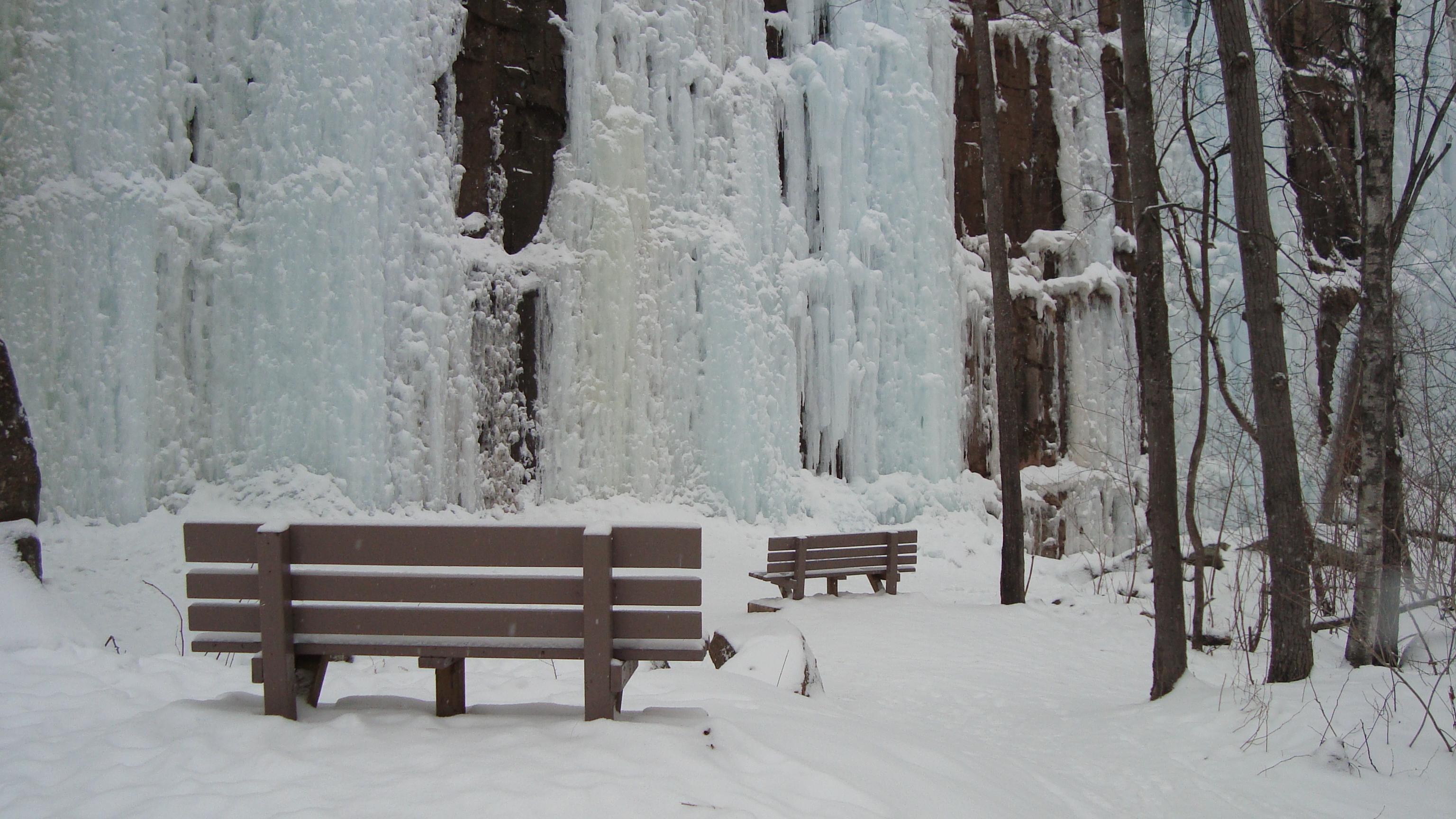 Sandstone, MN: Robinson Quarry Ice Park
On Friday, I woke up bright and early to prep for my weekend getaway. When I looked out the window, I saw it was snowing. It was a beautiful snowfall. It was reassurance that this weekend was going to awesome.
I didn’t mention before, but there are specific ice climbing boots you need. You also need crampons for the boots. The best place to get them is through the UoM’s Center for Outdoor Adventure (COA). It’s the cheapest option and you don’t have to be a student to use them! It’s a bit funny to get there, so I’d recommend calling in advance for directions. Also, call in advance to reserve equipment. Sometimes items reserve up quickly (even ice climbing boots and crampons!).
So, my car buddy (Kyra) and I had never ice climbed before, so while driving up to Sandstone, we were excited and anxious at the same time. When we turned into the Robinson Quarry Ice Park, we didn’t really have any idea where to go, so we followed these lone car tracks. In the end, they were our co-worker’s car, which was great because we found our way to the climbing walls. (For those who are curious. When you turn into the Robinson Quarry, follow the road down the hill. Take a slight left onto a small road. Follow it until you reach a fork (a loop). Take a left and park at the picnic tables. You’ll see the ice covered walls).
When we parked our car, Kyra and I gawked at the steep ice walls. They were magnificent. We realized we were alone, but knew that our friends were nearby because their car was there. We soon realized that they were walking along the upper ledge of the ice walls because they were setting up the anchors for the two routes we would climb for the day.
 Kyra tugging on the rope. Making sure the anchor is set.
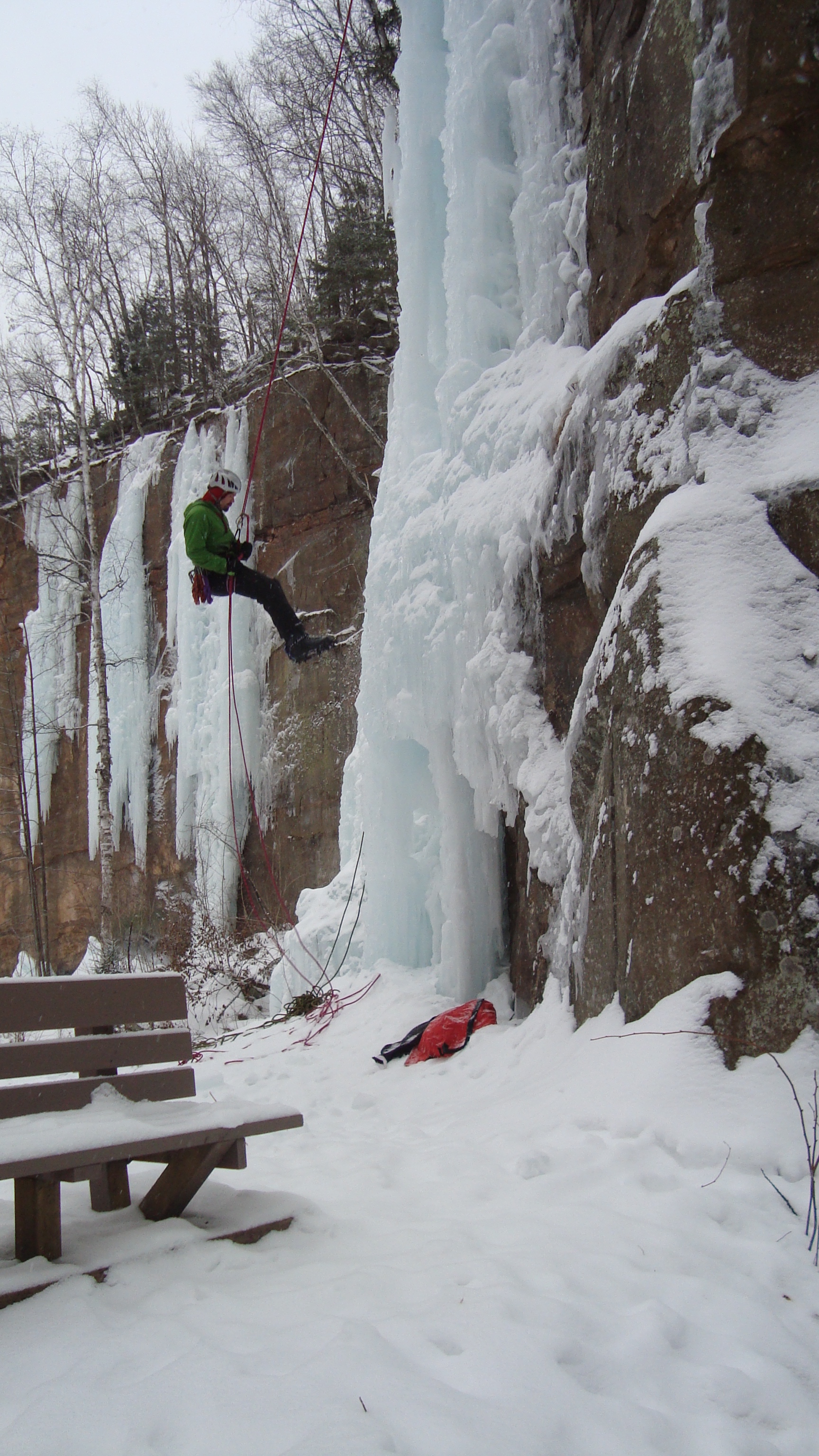 Phil repelling
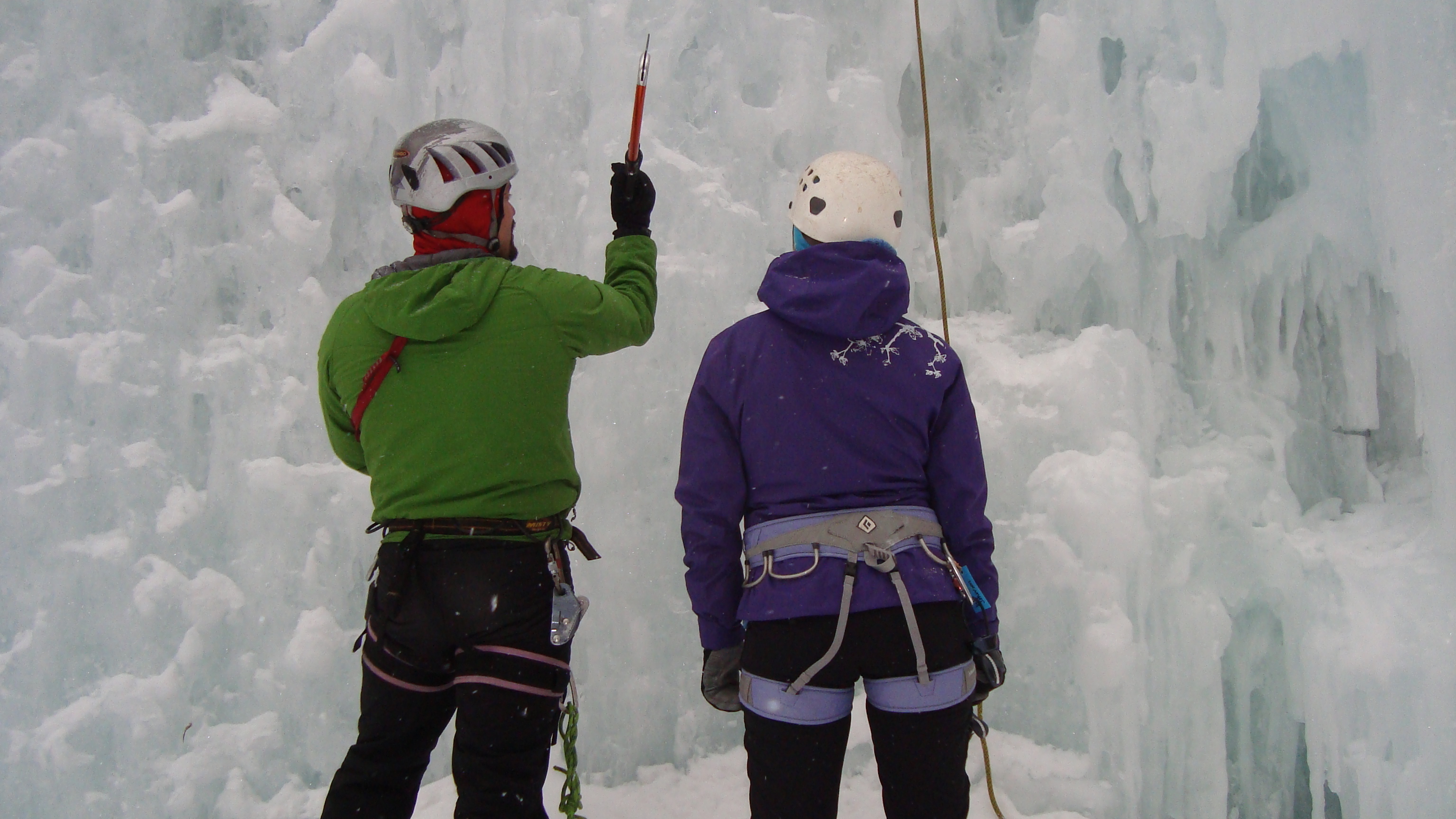
When all was set, our ice climbing guru, Phil, gave us new climbers some pointers. He showed us what ice axes we’d be using and how to use them. He also mentioned about the footwork necessary to get up the wall. It’s very similar to rock climbing technique, but since your arms are extended by sharp ice axes, it changes the way you hold yourself while climbing up the wall. What Phil told us is to keep your arms straight as much as possible. Meaning, let your skeleton take the brunt of the weight, not your muscles. It’s easier said than done, that’s for sure!
He also mentioned some terminology. “Hooking it” means you don’t pierce the ice, you only hook into a previous made hole or cranny. “Sticking it” means you pierce your axe into the ice, so to hold you up. It’s more efficient to hook than to stick, which I learned quite quickly.
 Here’s Phil giving Kyra some pointers
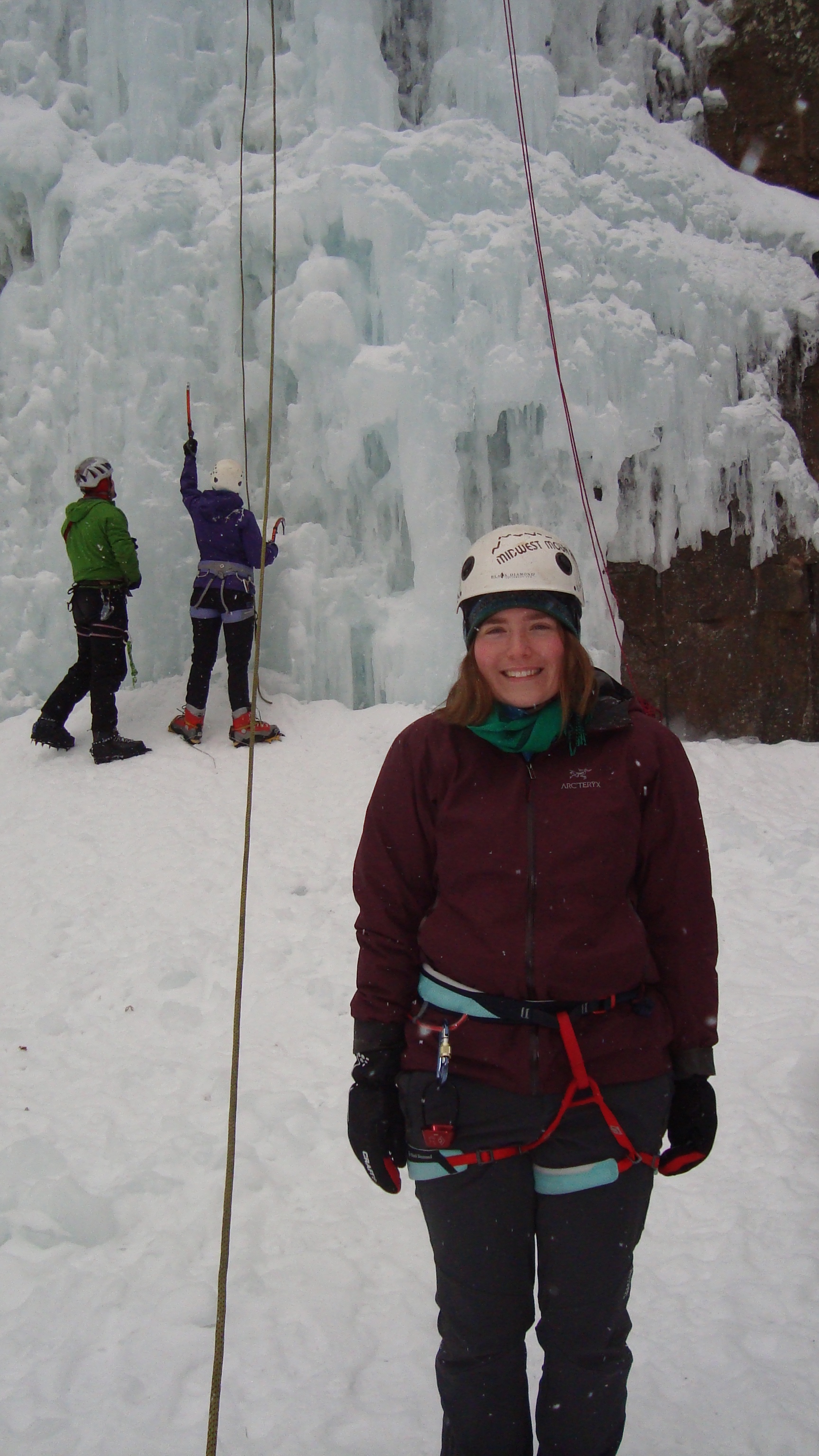
My feet were pretty cold (make sure to layer up in socks people!), so I let Sonia and Kyra climb first. I watched their first ascents and was impressed by how quickly they got up. Phil also tackled a route and made ice climbing look real easy. It was good to watch him because I recognized some of the technique that I would need to use.
 Ian is belaying Sonia’s first ascent. She nailed it!
 I’m ready to go. Here’s me nervous, but mostly excited!
 Soon enough, it was my turn to try it out. I put on my harness and tied myself in. Phil came over and reminded me to focus on straight arms and good footwork. I told him I would do my best.
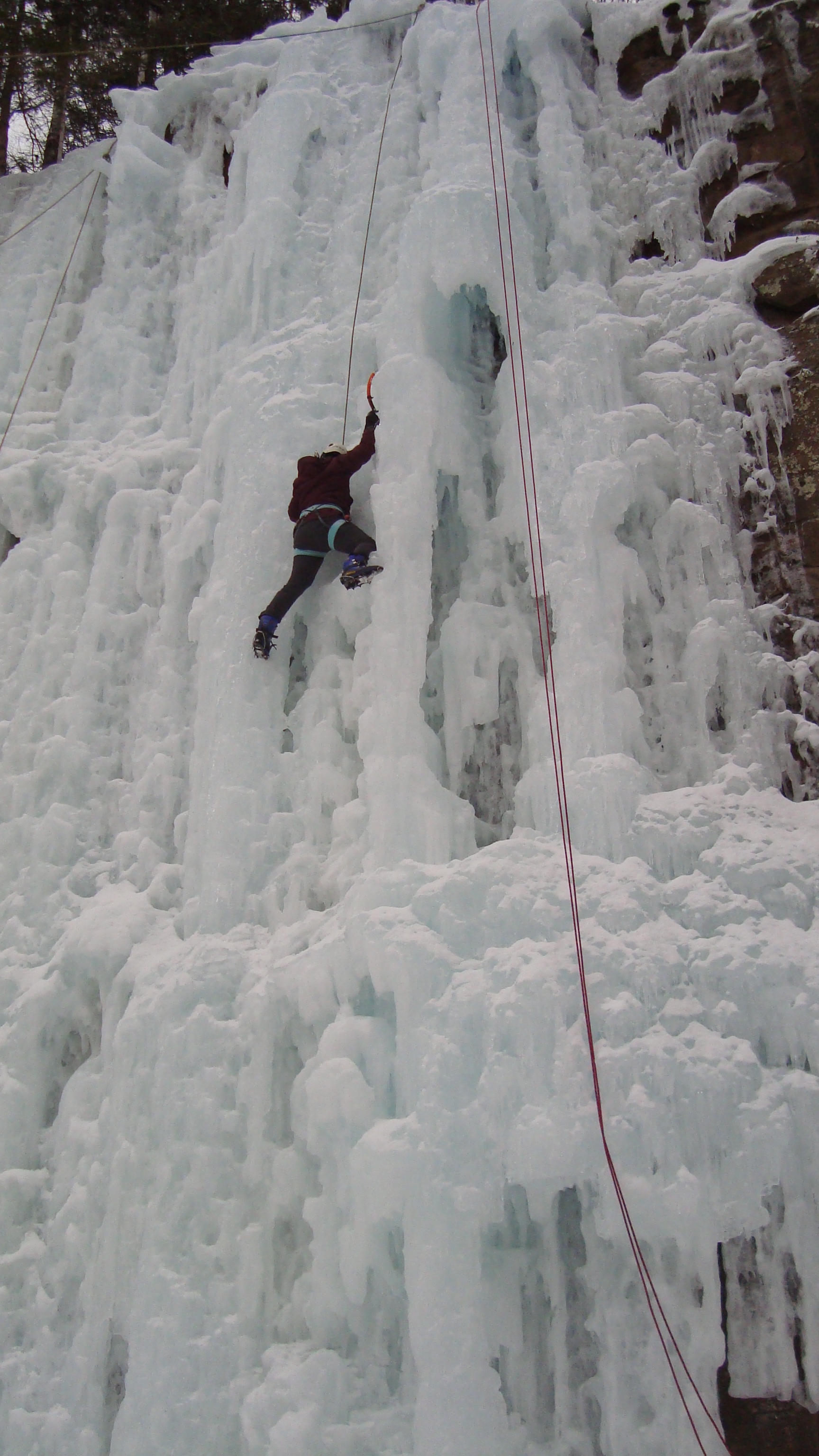
When I had the axes in my hands, I was surprised how light they were. It made me realize how nice it is to have outdoorsy friends who actually buy high-end carbon fiber ice axes! I took a few breaths and looked up the ice wall. I got my first hook-in and started my first ascent up the ice. I wish I could tell you that I nailed my first climb, but I totally only made it a short way up. If I remember correctly, my footing slipped. For anyone who has climbed before (rock climbing, I mean), would know that feeling that I felt while on that wall. Though I’ve been climbing for on-and-off 4-5 years, that first ascent reminded me of the first time I ever rock climbed. My mind went blank, almost like I had never climbed before. I forgot everything I had ever learned, all because I let the ice get the best of me. On my next try, I told myself I would make much better footwork and hooking-in decisions.
 My second ascent went much better!
On my second try, I did much better. My footwork was sound and I made it up the wall pretty quickly. I totally got the hang of it. The only thing I was missing was my gripping muscles. I hadn’t climbed in a couple months (due to my foot injury), so my climbing muscles were nothing. Which means, my arms got pretty tired! I tried my best to take breaks and regain my strength (and to not get the “Screaming Barfies,” which is when you keep your arms above your head for too long that when the blood rushes back to your arms, it hurts like hell! Causing one to scream in pain and then barf shortly after). Luckily, it wasn’t cold enough and I wasn’t good enough to get the screaming barfies, but my arms sure did get sore.
 Here’s me taking a break. I didn’t make it much further, but I was sure proud of myself anyway!
By the end of my second ascent, I was really happy with how it went. I made it up past halfway, all thanks to 2 ice axes and 2 crampons. It’s empowering to know that I’m able to climb a wall of ice.
I’m thankful for my friends for inviting me to join and to teach me how fun this winter sport is! Just another fun activity to put on my Minneapolis Winter List. I look forward to ice climbing again, when my foot is fully healed, so that I can actually finish a whole route!
Well, I’ll end here, but in my next post, I’ll tell you all about backpacking to Tettegouche State Park’s Historic Camp and skiing on the picturesque Mic Mac Lake.
Till then,
-Molly
P.S. I bumped into an old friend of mine named Andy. He is apart of a band called The Paper Days and they just released a super cool music video. Even City Pages recommended it. Check it out!

Hello friends,
As I type, I am comfy cozy on a couch, warm by the nearby fire, in the countryside of Wisconsin. Maybe you’re wondering why I’m not in Minneapolis? Well, for President’s/Valentine’s Day weekend, some girlfriends and I decided to escape the city and enjoy a quiet weekend in the woods. There is a no more romantic way to spend Valentine’s weekend than by snowshoeing across the lake, doodling, playing board games, eating chocolate, and watching French films.
 I went snowshoeing this weekend! This is me very excited to be outside. XD
In my last post, I told you about my adventures to Point Reyes National Seashore with a fellow Couchsurfer and my twin sister, Colleen. After we got back, the very next day, I woke up with my foot in terrible pain! It hurt to put pressure on the ball of my right foot. (Only recently did I go to the doctor and found out that I have a swollen metatarsal bone and slight tendinitis. Yikes! Told me to stay off it for 3 weeks…).
How did this happen? Well, after urban and trail hiking 30-40 miles in old keen sandals (and possibly playing ultimate frisbee in old cleats and whole other list of reasons), my feet decided that they had had enough! So, for 2 days, I lied low and relaxed with my sistas. I also met up with an old friend of mine named Kerry! In college, we went to Ecuador together for a study abroad and then we went on a camping trip along the Oregon Coast. I was so happy to see her and reminisce (we also went to a SketchFest NPR show called Ask Me Another.)
 My friend Kerry during our Oregon Coast camping trip. We spent a week hiking Oregon’s magical coastal trails. (2012)
 Half Moon Bay Diner. Our pre-hike meal.
On the third day, my foot felt a little better, so we rented a car through RelayRides and drove south along Highway 1. We decided to go on Highway 1 because Colleen had never been on it before and wanted to see what all the hype was about! Well, it was a beautiful drive. The ocean to our right and steep cliffs to our left, there was never a bad view. We even stopped in a small town and got breakfast at a diner (and picked up donuts from a nearby bakery…mmmm).
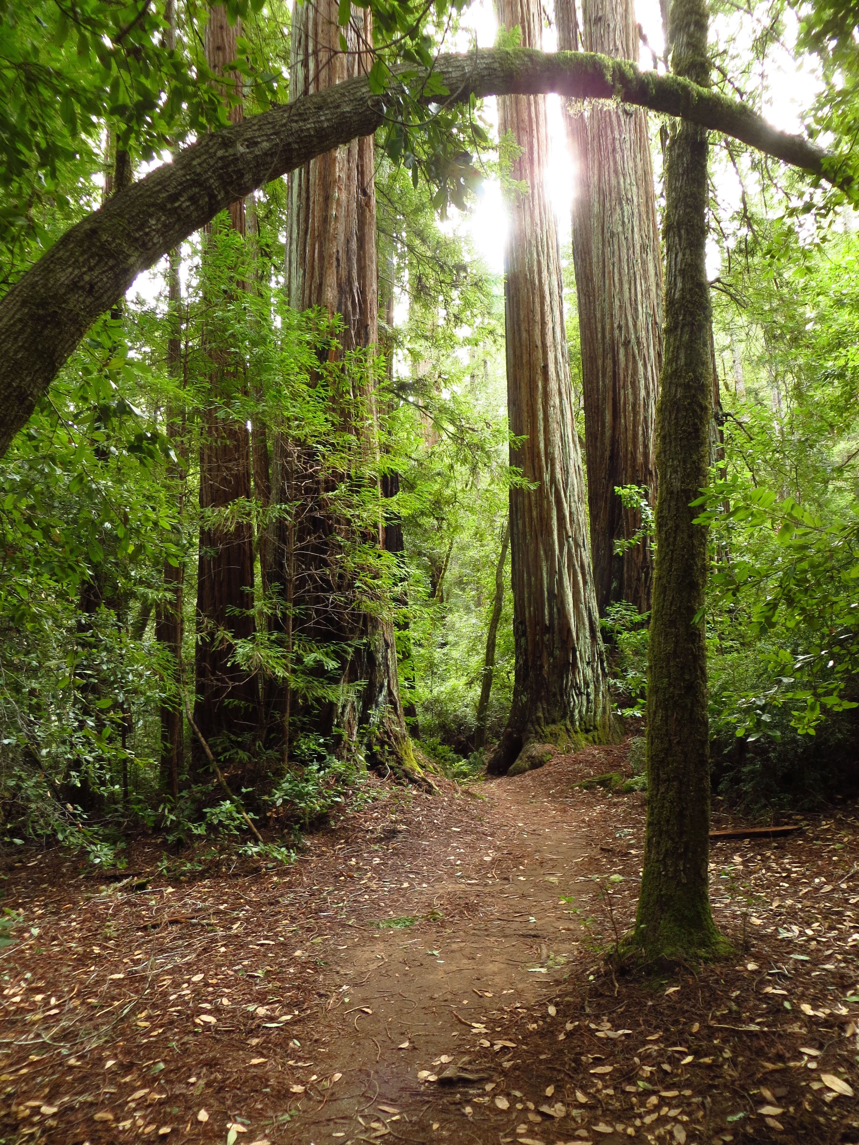
After eating brunch, we wound our way up to Big Basin and idled our time with improv games. We nearly crashed because I made Meghan laugh so hard. The higher up we went, the more evident it became that we were entering a redwood forest. The tree trunks became larger and the forest’s color changed from brown to a deep dark red. Though I’ve seen redwood trees several times in my life, seeing those magnificent red trunks just never gets old.
 On the trail in Big Basin. It was slow moving during our hike (due to my foot), but I tried my best to ignore the pain and appreciate the environment.
We spent 2 hours meandering through the forest. For most of the hike, I stayed behind my sistas, looking up to the tall redwoods or going a little off trail to touch the bark and identify different trees. It was a good time. Doing science-y things was fun, but being able to spend my last full day in San Francisco with my sistas was the best part.
 ze trees!!
 My sister, Meghan, and I holding hands. So adorable.
 My sistas! <3
And that is my 2 week San Francisco trip in a nutshell. I think 2 weeks was a good amount of time to spend in SF. It’s enough time to eat all the food you want and see all the people and places you want. Not to mention that it’s enough time to become comfortable in a new part of the city.
Well, I’ll have to update you later about my life. For now, it may be a while till I post again because RootsRated asked me to do a couple features (which I’ll post about no worries!). But, when I do write it’ll be about about my upcoming trip to Sandstone and Tettegouche State Park! I’ll be ice climbing and back country skiing! How fun. : )
Much Love,
-Molly
 We were pretty hungry after our Big Basin rendezvous. This is Colleen.

